
MyTopo
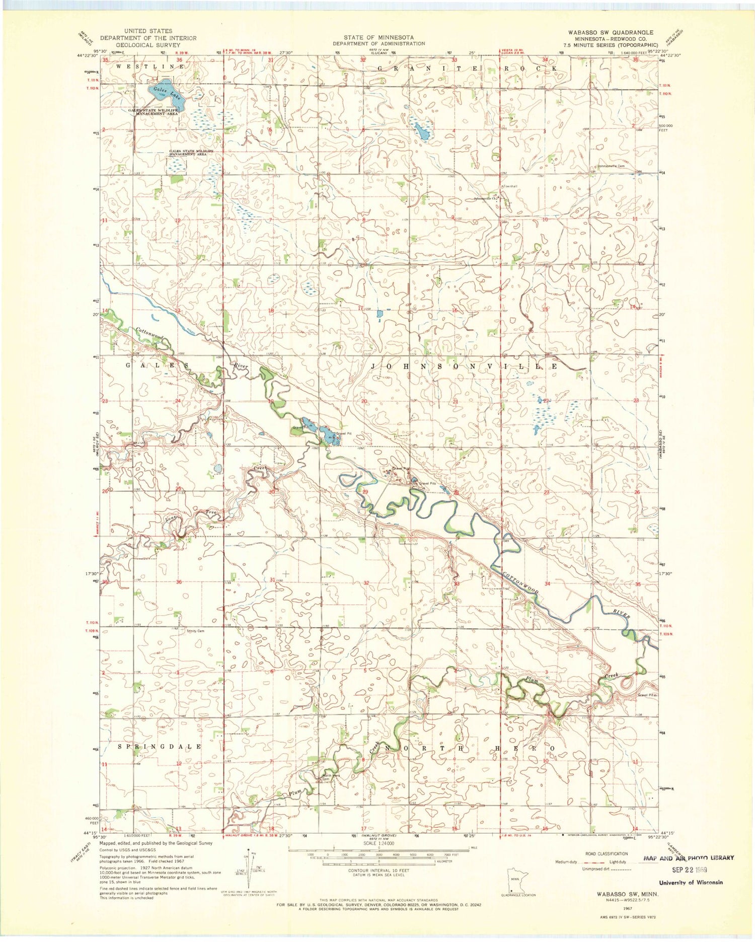
Classic USGS Wabasso SW Minnesota 7.5'x7.5' Topo Map
Couldn't load pickup availability
Historical USGS topographic quad map of Wabasso SW in the state of Minnesota. Map scale may vary for some years, but is generally around 1:24,000. Print size is approximately 24" x 27"
This quadrangle is in the following counties: Redwood.
The map contains contour lines, roads, rivers, towns, and lakes. Printed on high-quality waterproof paper with UV fade-resistant inks, and shipped rolled.
Contains the following named places: Arlen Knott Detention Dam, Duane Knott Retention Reservoir Dam, Gales Lake, Gales State Wildlife Management Area, Johnsonville Cemetery, Johnsonville Church, Johnsonville Township Cemetery, Lone Tree Creek, North Hero Cemetery, Plum Creek, Township of Johnsonville, Trinity Cemetery


