MyTopo
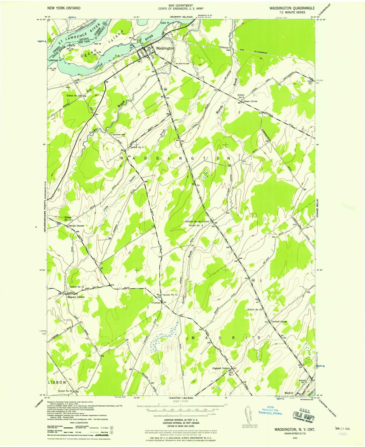
Classic USGS Waddington New York 7.5'x7.5' Topo Map
Couldn't load pickup availability
Historical USGS topographic quad map of Waddington in the state of New York. Map scale may vary for some years, but is generally around 1:24,000. Print size is approximately 24" x 27"
This quadrangle is in the following counties: St. Lawrence.
The map contains contour lines, roads, rivers, towns, and lakes. Printed on high-quality waterproof paper with UV fade-resistant inks, and shipped rolled.
Contains the following named places: Brandy View Farms, Brookside Cemetery, Chipman, Clark Point, Cogswell Corners, Drews Corner, First Congregational Church, Halfway House Corners, Hamilton Gardens Assisted Living Facility, Harmony Farm, Harvest Dairy Farm, Henrys Corners, Leishman Point, Little River, Little Sucker Brook, Madrid, Madrid-Waddington High School, Ogden Island, Old Saint Marys Cemetery, Saint Marys Cemetery, School Number 11, School Number 12, School Number 13, School Number 2, School Number 31, School Number 4, School Number 6, School Number 8, School Number 9, Scotch Cemetery, Scotch Presbyterian Church, Sucker Brook, Town of Madrid, Town of Madrid Highway Department, Town of Waddington, Turnbull Corner, Twin Brooks Golf Course, Village of Waddington, Waddington, Waddington Beach, Waddington Hepburn Library, Waddington Post Office, Waddington Rescue Squad, Waddington Village Wastewater Treatment Facility, Wagners Corners, ZIP Codes: 13660, 13694