MyTopo
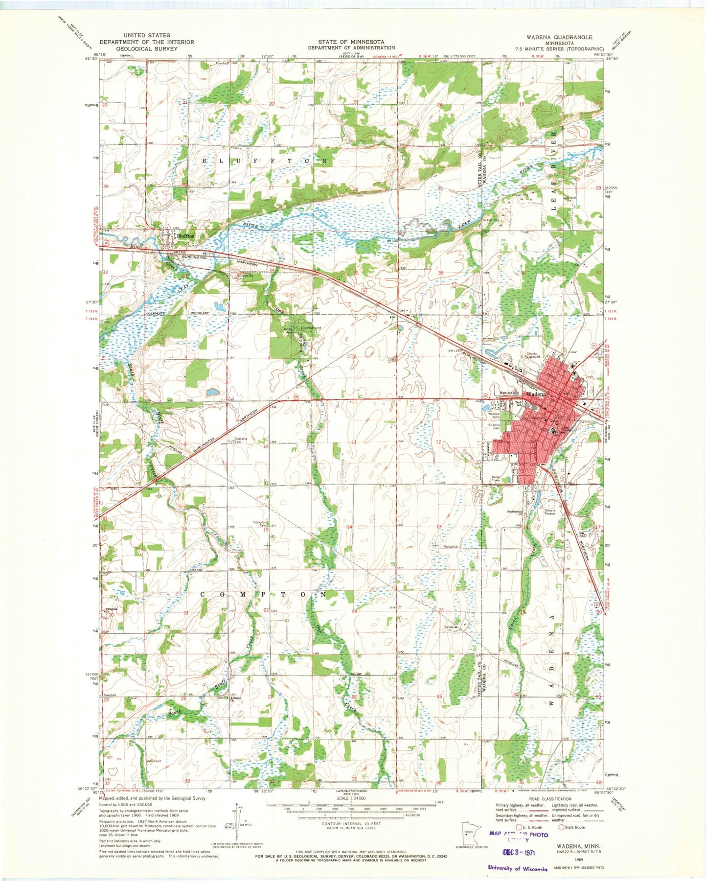
Classic USGS Wadena Minnesota 7.5'x7.5' Topo Map
Couldn't load pickup availability
Historical USGS topographic quad map of Wadena in the state of Minnesota. Map scale may vary for some years, but is generally around 1:24,000. Print size is approximately 24" x 27"
This quadrangle is in the following counties: Otter Tail, Wadena.
The map contains contour lines, roads, rivers, towns, and lakes. Printed on high-quality waterproof paper with UV fade-resistant inks, and shipped rolled.
Contains the following named places: Alliance Church, Bluff Creek, Bluffton, Bluffton Fire Department, Bluffton Post Office, City of Bluffton, City of Wadena, Compton Cemetery, Compton Church, Gustafva Cemetery, Oak Creek, Saint Ann' Cemetery, Saint Anns School, Saint John's Catholic Church, Saint John's Catholic Church Cemetery, Sonrise Christian School, Southbrook Church, Township of Compton, Tri - County Health Care Hospital, Tri-County Heliport, Wadena, Wadena Cemetery, Wadena County Jail, Wadena County Sheriff's Office, Wadena Fire Department, Wadena Municipal Airport, Wadena Police Department, Wadena Post Office, West Wind Estates, ZIP Code: 56482