MyTopo
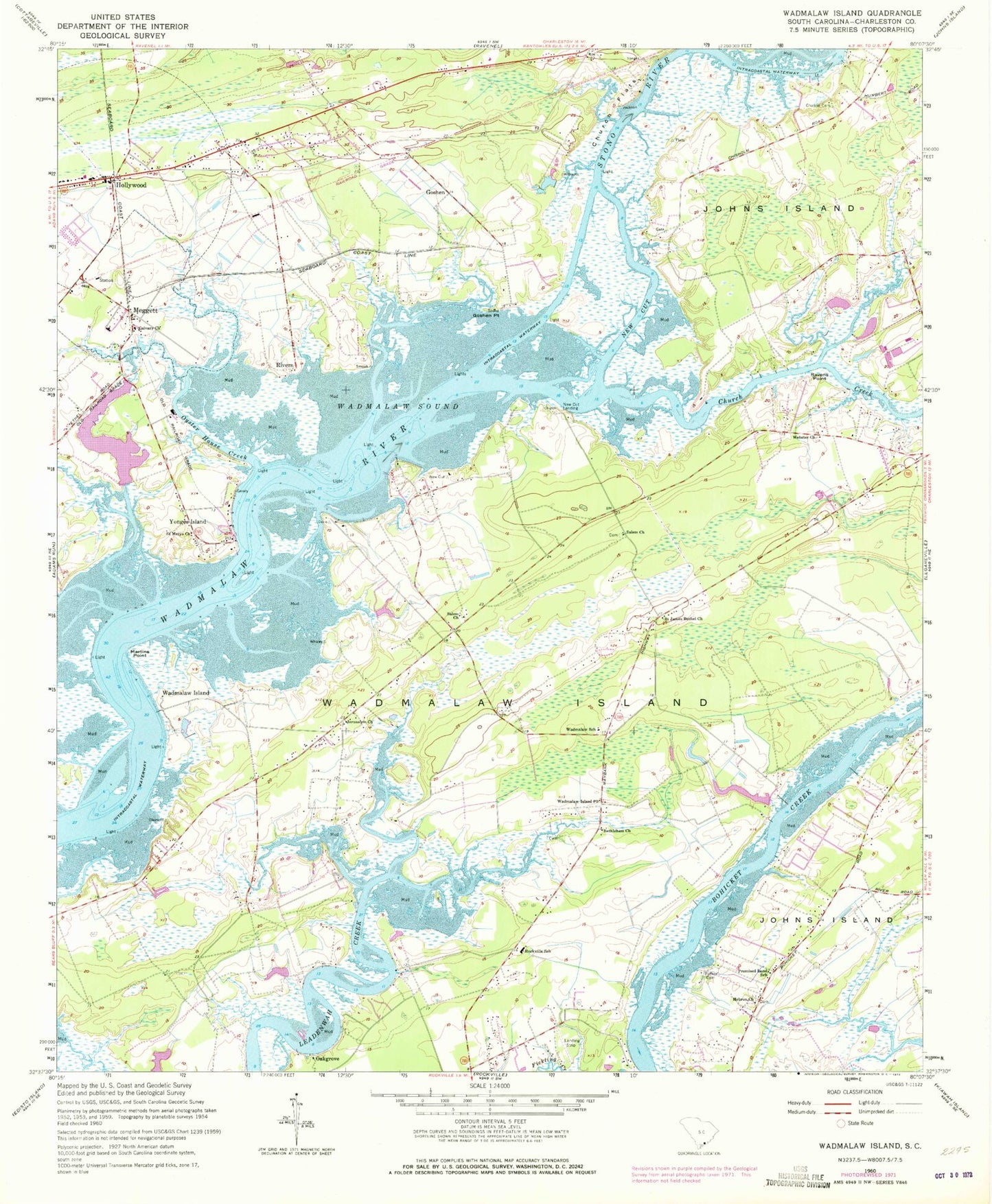
Classic USGS Wadmalaw Island South Carolina 7.5'x7.5' Topo Map
Couldn't load pickup availability
Historical USGS topographic quad map of Wadmalaw Island in the state of South Carolina. Typical map scale is 1:24,000, but may vary for certain years, if available. Print size: 24" x 27"
This quadrangle is in the following counties: Charleston.
The map contains contour lines, roads, rivers, towns, and lakes. Printed on high-quality waterproof paper with UV fade-resistant inks, and shipped rolled.
Contains the following named places: Bethlehem Church, Calvary Church, Chaplin Cemetery, Church Creek, Church Flats, Goshen Point, Jerusalem Church, Martins Point, New Cut, Oyster House Creek, Parker Cemetery, Promised Land School, Ravens Point, Rivers, Saint James Bethel Church, Saint Marys Church, Salem Church, Salem Church, Wadmalaw Island, Wadmalaw School, Wadmalaw Sound, Webster Church, Goshen, Hollywood, Meggett, New Cut Landing, Oakgrove, Wadmalaw Island, Yonges Island, Yonges Island Airport (historical), Hebron Church, Edith L Frierson Elementary School, Wadmalaw Island Post Office, Anchorage Plantation, Bears Bluff School (historical), Church Flats Bluff, Clementia (historical), Cottage Plantation, Dixie Plantation, Meggett School, New Cut Plantation, Nine Mile Fork School (historical), Promised Land Church, Sellkirk Plantation, Yonges Island, Yonges Island Post Office (historical), Wadmalaw Island Division, Saint Johns Fire District Station 3, Hollywood Post Office, Charleston County Public Library Saint Pauls Branch, Town of Wadmalaw