MyTopo
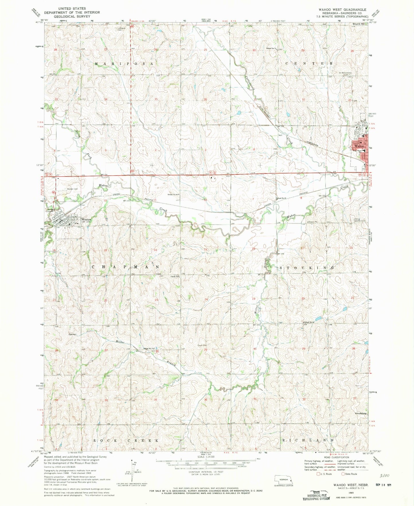
Classic USGS Wahoo West Nebraska 7.5'x7.5' Topo Map
Couldn't load pickup availability
Historical USGS topographic quad map of Wahoo West in the state of Nebraska. Map scale may vary for some years, but is generally around 1:24,000. Print size is approximately 24" x 27"
This quadrangle is in the following counties: Saunders.
The map contains contour lines, roads, rivers, towns, and lakes. Printed on high-quality waterproof paper with UV fade-resistant inks, and shipped rolled.
Contains the following named places: Chapek Dam, Chapek Reservoir, Cottonwood Creek, Cottonwood Creek Dam 23-A, Cottonwood Creek Reservoir 23-A, Czech Cemetery, Czech Church, Dunlap Creek, Edensburg Lutheran Cemetery, First Presbyterian Church, Hackberry Park, Haven House, Hilltop Country Club, John F Kennedy College, Kavan Dam 1, Kavan Dam 2, Kavan Reservoir 1, Kavan Reservoir 2, Miller Branch, North Fork Wahoo Creek, Our Reddemer Lutheran Church, Roberts Dam, Roberts Reservoir, Saint John Elementary School, Saint John Nepomucene Catholic Church, Saint Wenceslaus Cemetery, Saunders County, Saunders County Care Center, Saunders Medical Center, School Number 44, School Number 62, School Number 7, School Number 87, South Center Public School, Swedeburg Dam 2B-2F, Swedeburg Reservoir 2B-2F, Thorston Dam B-2, Thorston Dam B-2A, Thorston Reservoir B-2, Thorston Reservoir B-2A, Township of Chapman, Triangle Park, Village of Weston, Wahoo High School, Wahoo Medical Clinic, Wahoo Middle School, Wahoo Physicians Clinic, West Ward Elementary School, Weston, Weston Cemetery, Weston Fire and Rescue, Weston Post Office, Weston Public School, ZIP Code: 68066