MyTopo
Classic USGS Wahpenayo Peak Washington 7.5'x7.5' Topo Map
Couldn't load pickup availability
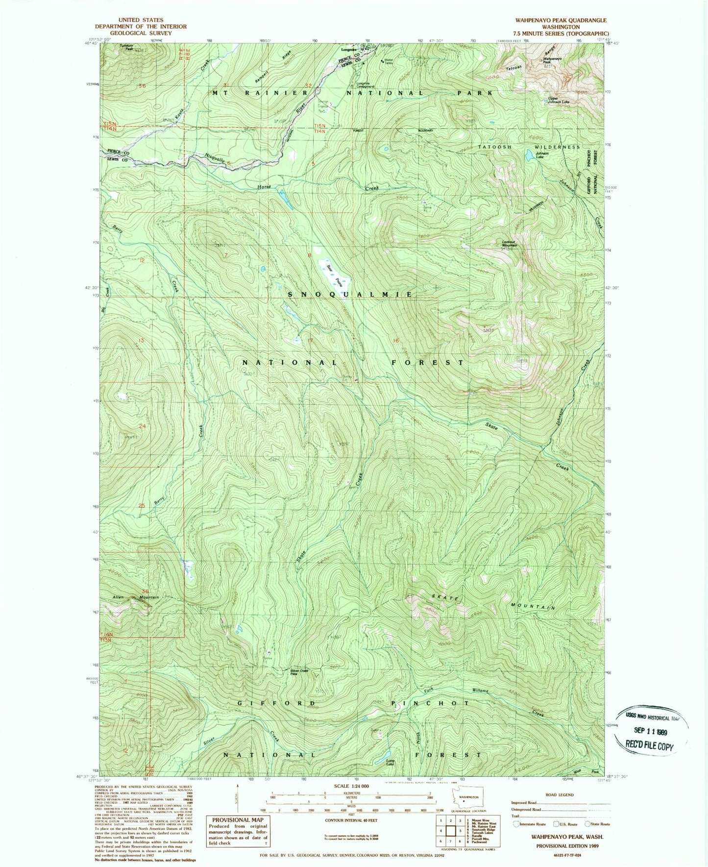
Historical USGS topographic quad map of Wahpenayo Peak in the state of Washington. Map scale may vary for some years, but is generally around 1:24,000. Print size is approximately 24" x 27"
This quadrangle is in the following counties: Lewis, Pierce.
The map contains contour lines, roads, rivers, towns, and lakes. Printed on high-quality waterproof paper with UV fade-resistant inks, and shipped rolled.
Contains the following named places: Allen Mountain, Bear Prairie, Horse Creek, Johnson Creek, Johnson Lake, Kautz Creek, Lake Fizrenken, Long Lake, Longmire, Longmire Campground, Longmire Post Office, Lookout Mountain, North Fork Willame Creek, Silver Creek Pass, Silver Creek Trail, Skate Mountain, Tumtum Peak, Upper Johnson Lake, Wahpenayo Peak