MyTopo
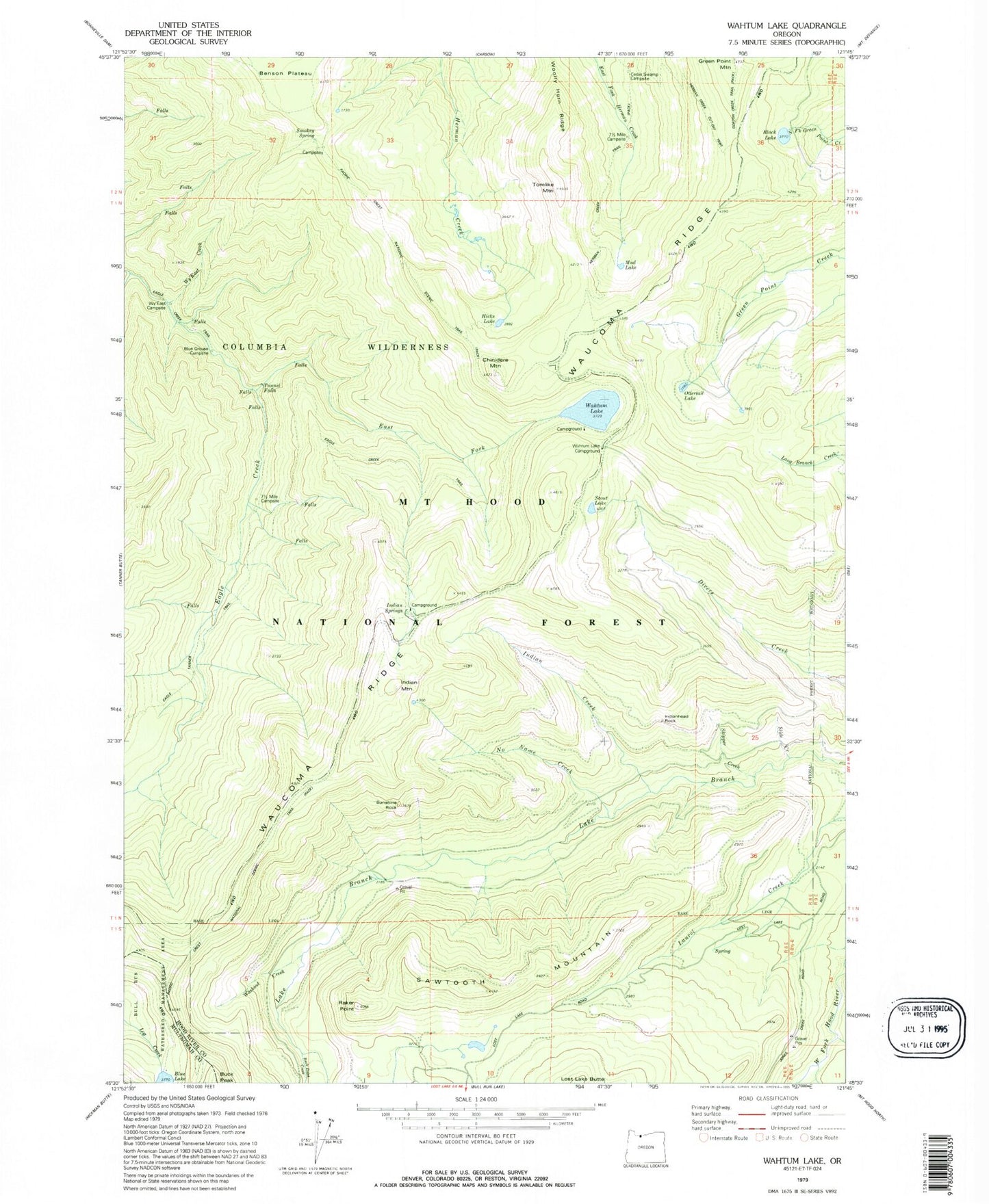
Classic USGS Wahtum Lake Oregon 7.5'x7.5' Topo Map
Couldn't load pickup availability
Historical USGS topographic quad map of Wahtum Lake in the state of Oregon. Typical map scale is 1:24,000, but may vary for certain years, if available. Print size: 24" x 27"
This quadrangle is in the following counties: Hood River, Multnomah.
The map contains contour lines, roads, rivers, towns, and lakes. Printed on high-quality waterproof paper with UV fade-resistant inks, and shipped rolled.
Contains the following named places: Black Lake, Chinidere Mountain, Eagle Creek Trail, East Fork Eagle Creek, Green Point Mountain, Hicks Lake, Indian Creek, Indian Mountain, Indian Springs, Marco Creek, Mud Lake, No Name Creek, Opal Creek, Ottertail Lake, Raker Point, Sawtooth Mountain, Scout Lake, Skipper Creek, Tomlike Mountain, Tumbledown Creek, Tunnel Falls, Wahtum Lake, Washout Creek, Waucoma Ridge, Woolly Horn Ridge, Wahtum Lake Recreation Site, Simmons Creek, Midget Creek, Indianhead Rock, Seven-and-a-Half Mile Campsite (historical), Cedar Swamp Campsite (historical), Buck Point Creek, Sunshine Rock, Blue Grouse Campsite, Wy'East Camp, Smokey Spring, Seven-and-a-Half Mile Camp (historical), Wahtum Lake Guard Station (historical), Indian Springs Campground (historical), Mark O Hatfield Wilderness