MyTopo
Classic USGS Waitsburg Washington 7.5'x7.5' Topo Map
Couldn't load pickup availability
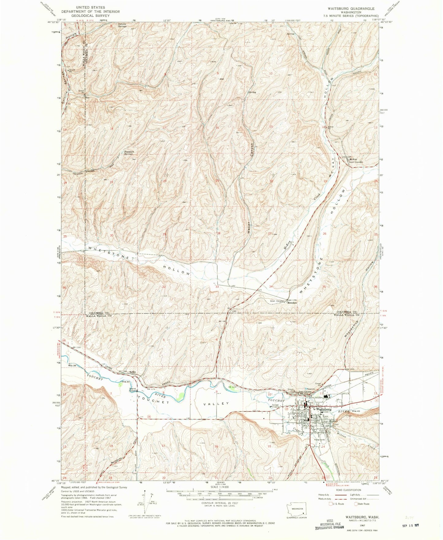
Historical USGS topographic quad map of Waitsburg in the state of Washington. Map scale may vary for some years, but is generally around 1:24,000. Print size is approximately 24" x 27"
This quadrangle is in the following counties: Columbia, Walla Walla.
The map contains contour lines, roads, rivers, towns, and lakes. Printed on high-quality waterproof paper with UV fade-resistant inks, and shipped rolled.
Contains the following named places: Bolles, Bruce Memorial Museum, City of Waitsburg, Coppei Creek, Fountain Springs, Independent Order of Odd Fellows Cemetery, McKay, McKay Hollow, Menoken, Preston Park, Waitsburg, Waitsburg Ambulance Service, Waitsburg Elementary School, Waitsburg Fire Department, Waitsburg High School, Waitsburg Junction, Waitsburg Post Office, Waitsburg Upper Elementary School, Weller Canyon, Weller Canyon Airport, Whoopemup Hollow, Wilson Creek