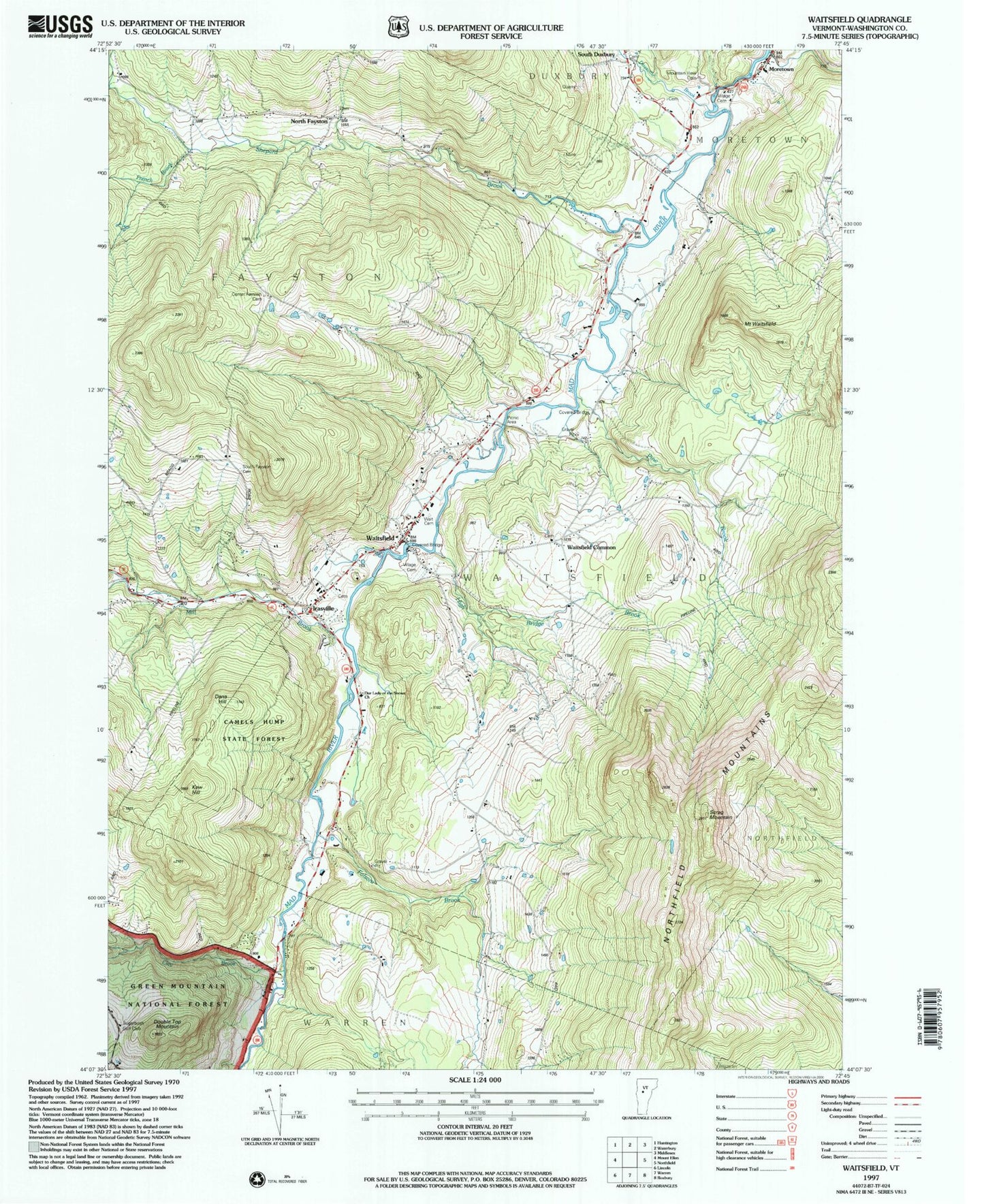
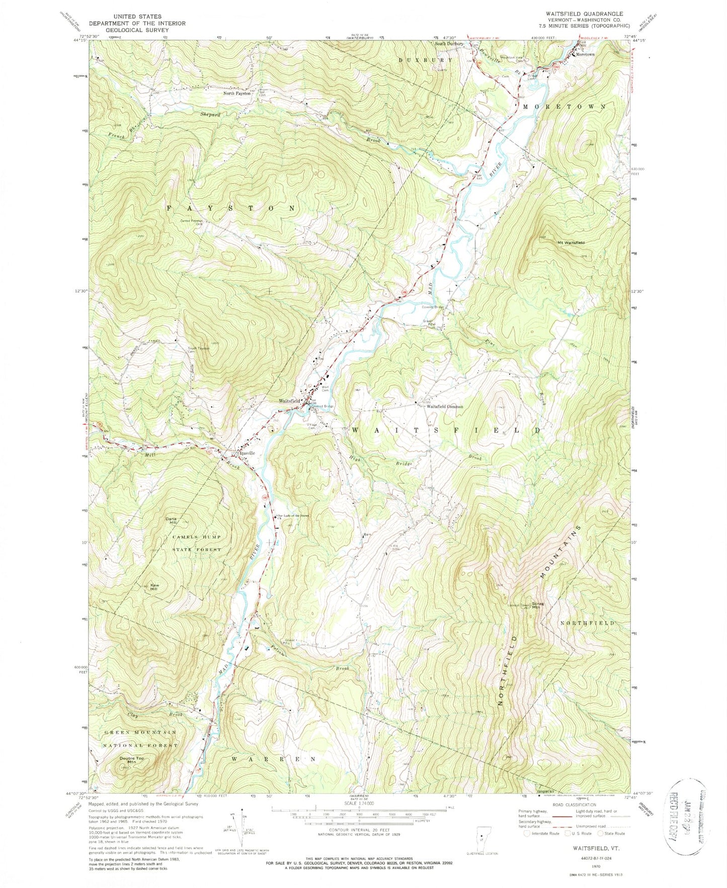
MyTopo
Classic USGS Waitsfield Vermont 7.5'x7.5' Topo Map
Couldn't load pickup availability
Historical USGS topographic quad map of Waitsfield in the state of Vermont. Typical map scale is 1:24,000, but may vary for certain years, if available. Print size: 24" x 27"
This quadrangle is in the following counties: Washington.
The map contains contour lines, roads, rivers, towns, and lakes. Printed on high-quality waterproof paper with UV fade-resistant inks, and shipped rolled.
Contains the following named places: Center Fayston Cemetery, Chase Brook, Clay Brook, Dana Hill, Deer Brook, Double Top Mountain, Dowsville Brook, Folsom Brook, French Brook, Green Mountains, High Bridge Brook, Irasville, Kew Hill, Mill Brook, Mountain View Cemetery, North Fayston, Northfield Mountains, Our Lady of the Snows Church, Pine Brook, Scrag Mountain, Shepard Brook, South Duxbury, South Fayston Cemetery, Village Cemetery, Wait Cemetery, Waitsfield, Waitsfield Common, Mount Waitsfield, Village Cemetery, Mad River Fly-In Airport (historical), Ketcham Landing Area, Angus Airways Airport (historical), Town of Fayston, Town of Waitsfield, Belding Cemetery, Federated Church, Great Eddy Covered Bridge, Irasville Cemetery, Joslin Memorial Library, Mad River Valley Alliance Church, Moretown Elementary School, Moretown United Methodist CHurch, North Fayston Cemetery, Pine Brook Covered Bridge, Tucker Hill Ski Center, Waitsfield Elementary School, Waitsfield Post Office, Waitsfield Village Historic District, Waitsfield Fayston Fire Department, Moretown Volunteer Fire Department, Sunrise School, Green Mountain Valley School, Spring Hill School, Waitsfield Children's Center, Mad River Valley Ambulance Service, Waitsfield Census Designated Place