MyTopo
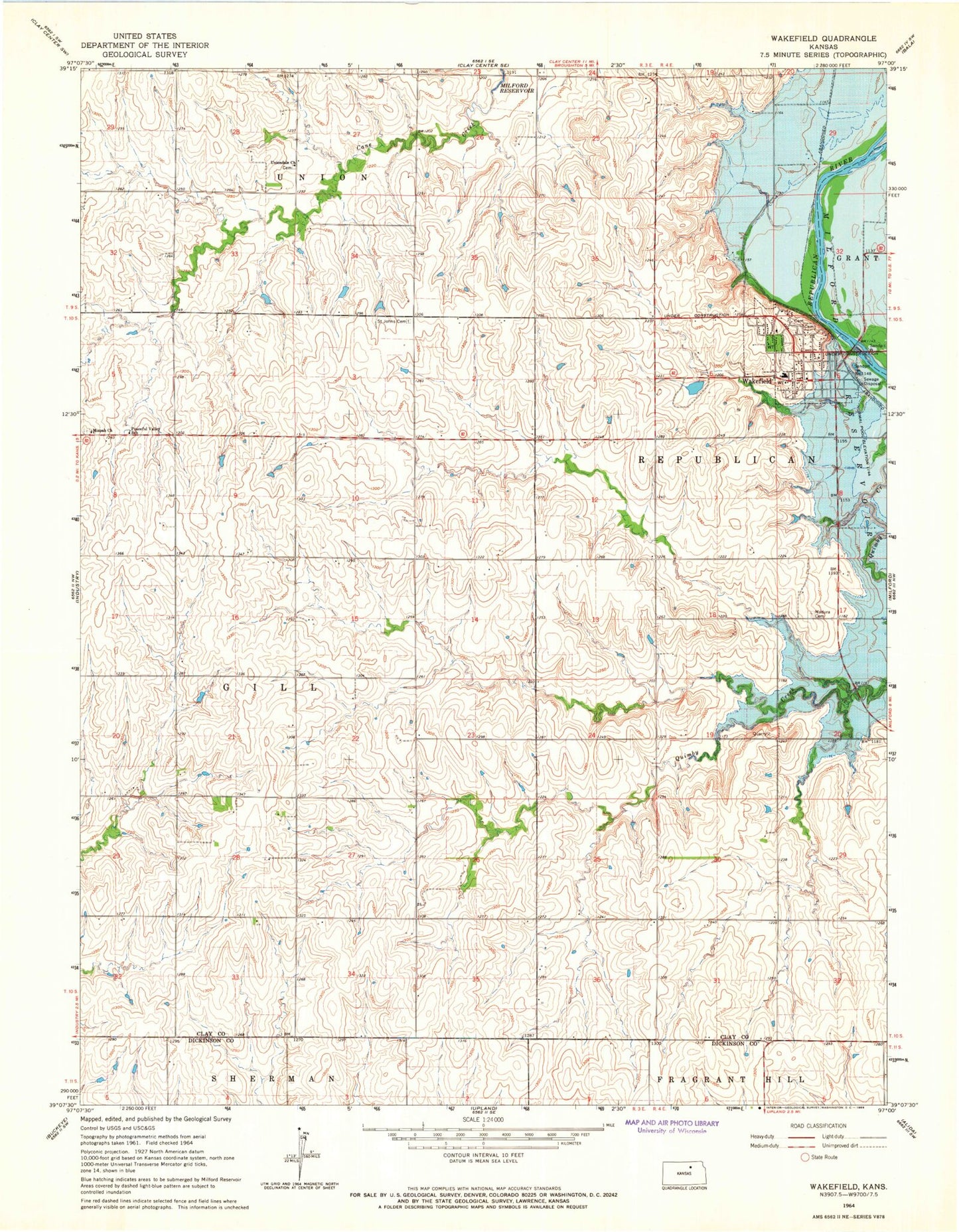
Classic USGS Wakefield Kansas 7.5'x7.5' Topo Map
Couldn't load pickup availability
Historical USGS topographic quad map of Wakefield in the state of Kansas. Map scale may vary for some years, but is generally around 1:24,000. Print size is approximately 24" x 27"
This quadrangle is in the following counties: Clay, Dickinson.
The map contains contour lines, roads, rivers, towns, and lakes. Printed on high-quality waterproof paper with UV fade-resistant inks, and shipped rolled.
Contains the following named places: Bateham, City of Wakefield, Clay County Lake, Clay County Lake Dam, Highland Cemetery, Kansas Arboretum, Madura Cemetery, Madura Congregational Church, Mizpah Cemetery, Mizpah United Methodist Church, Peaceful Valley School, Saint John's Episcopal Cemetery, Stitt, Township of Gill, Township of Republican, Uniondale Church, Wakefield, Wakefield Elementary School, Wakefield Farmers Co - Operative Association Grain Elevator Number 1, Wakefield Fire Department, Wakefield K - 12 School, Wakefield Municipal Airstrip, Wakefield Museum, Wakefield Police Department, Wakefield Post Office, Wakefield Public Library, Wakefield United Methodist Church, Wakefield Wastewater Plant, ZIP Code: 67487