MyTopo
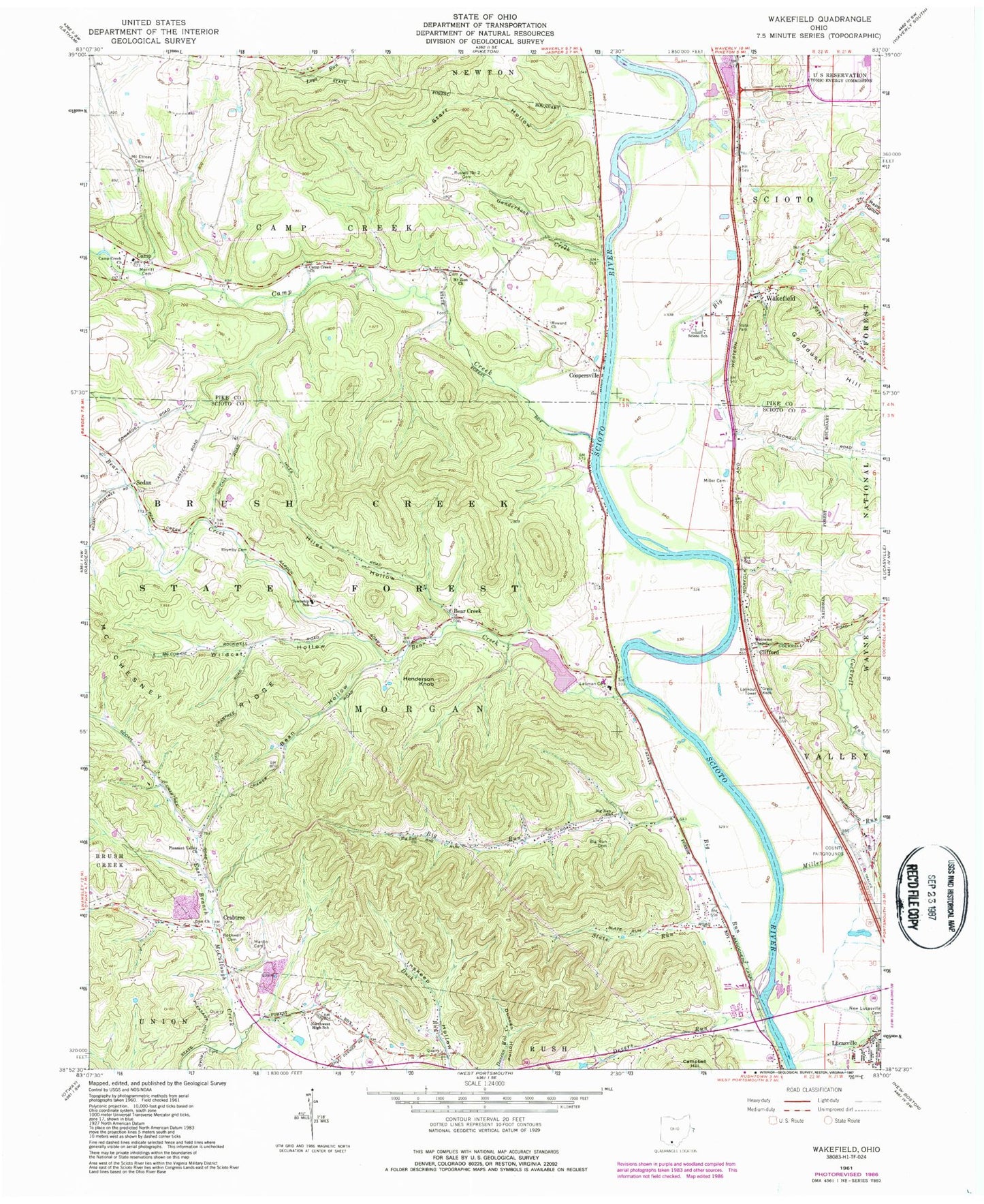
Classic USGS Wakefield Ohio 7.5'x7.5' Topo Map
Couldn't load pickup availability
Historical USGS topographic quad map of Wakefield in the state of Ohio. Map scale may vary for some years, but is generally around 1:24,000. Print size is approximately 24" x 27"
This quadrangle is in the following counties: Pike, Scioto.
The map contains contour lines, roads, rivers, towns, and lakes. Printed on high-quality waterproof paper with UV fade-resistant inks, and shipped rolled.
Contains the following named places: Bean Hollow, Bear Creek, Bear Creek School, Bearcreek Post Office, Big Run, Big Run Cemetery, Big Run Church, Bonds Trailer Court, Camp, Camp Creek, Camp Creek Church, Camp Creek Township Volunteer Fire Department, Camp Post Office, Clifford, Clifford Post Office, Coopersville, Coopersville Post Office, Crabtree, Crabtree Post Office, Dawsons Mobile Home Park, Devers Run, Doll School, Ganderhook Creek, Goldust Hill, Henderson Knob, Hidden Quarry Airport, Hiles Hollow, Howard Number 2 Cemetery, Howard United Methodist Church, Lake Frasure, Lake Frasure Dam, Lauman Cemetery, Lower Bear Creek School, Lucasville Census Designated Place, Martin Cemetery, McChesney Ridge, Merritt Cemetery, Miller Cemetery, Miller Run, Morgan Elementary School, Morgan Township Volunteer Fire Department, Mount Ettney Cemetery, Mount Zion Number 3 Cemetery, Northwest High School, Pleasant Valley Church, Pleasant Valley School, Rapp Hollow, Rhymby Cemetery, Rockwell Cemetery, Rocky Fork, Russell Number 2 Cemetery, Salt Creek, School Number 6, Scioto Ambulance District, Scioto County Fairgrounds, Scioto School, Sedan, Sedan Post Office, Slate Run, Starr Hollow, Township of Morgan, Wakefield, Wakefield Post Office, Welcome Chapel, Wetmore, Wetmore Post Office, Wheeler Hollow, Wildcat Hollow, Zion Church, ZIP Code: 45648