MyTopo
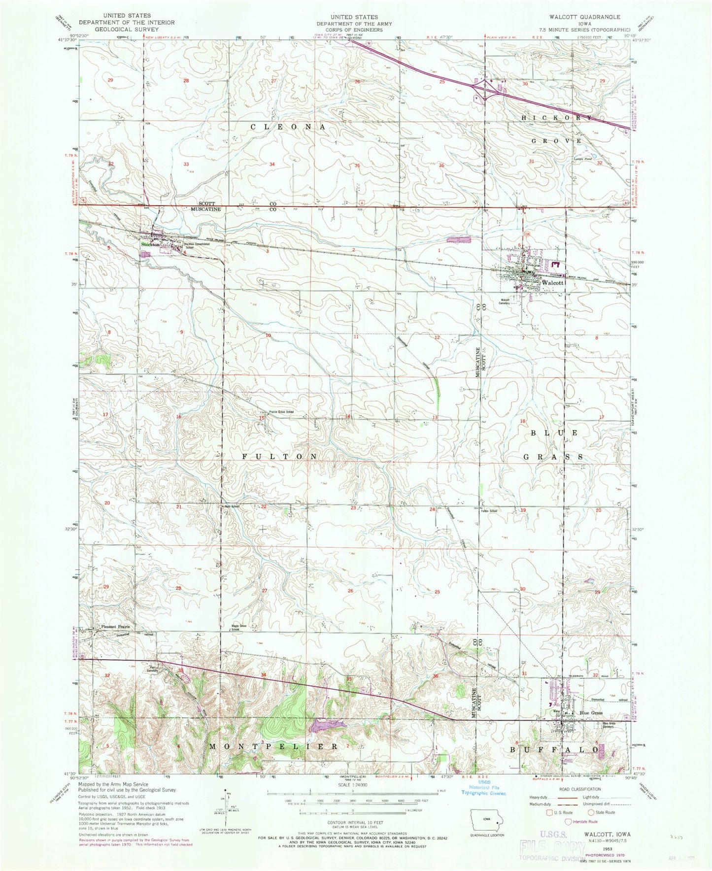
Classic USGS Walcott Iowa 7.5'x7.5' Topo Map
Couldn't load pickup availability
Historical USGS topographic quad map of Walcott in the state of Iowa. Map scale may vary for some years, but is generally around 1:24,000. Print size is approximately 24" x 27"
This quadrangle is in the following counties: Muscatine, Scott.
The map contains contour lines, roads, rivers, towns, and lakes. Printed on high-quality waterproof paper with UV fade-resistant inks, and shipped rolled.
Contains the following named places: Blue Grass, Blue Grass Cemetery, Blue Grass City Hall, Blue Grass Elementary School, Blue Grass Family Medical Center, Blue Grass Library, Blue Grass Police Department, Blue Grass Post Office, Blue Grass Presbyterian Church, Blue Grass Volunteer Fire Department, Calvary United Methodist Church, City of Blue Grass, City of Stockton, City of Walcott, Community Church, Fulton School, Lamps Pond, Maple Grove School, Medic Emergency Medical Services, Nolo School, Parr Cemetery, Petersburg, Pleasant Prairie, Pleasant Prairie Post Office, Prairie Grove School, Saint Andrew Church, Scott County Library, Spirit of God Baptist Church, Stockton, Stockton Baptist Church, Stockton Consolidated School, Stockton Post Office, Township of Fulton, Victory Life Church, Victory Park, Walcott, Walcott Cemetery, Walcott Elementary / Intermediate School, Walcott Eststes, Walcott Fire Department, Walcott Intermediate School, Walcott Post Office, Walcott Town Hall, Westcott Park, Workman Airfield, ZIP Codes: 52769, 52773