
MyTopo
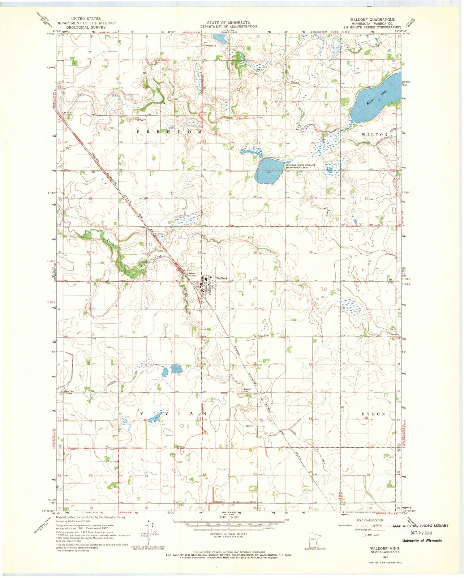
Classic USGS Waldorf Minnesota 7.5'x7.5' Topo Map
Couldn't load pickup availability
Historical USGS topographic quad map of Waldorf in the state of Minnesota. Map scale may vary for some years, but is generally around 1:24,000. Print size is approximately 24" x 27"
This quadrangle is in the following counties: Waseca.
The map contains contour lines, roads, rivers, towns, and lakes. Printed on high-quality waterproof paper with UV fade-resistant inks, and shipped rolled.
Contains the following named places: City of Waldorf, County Ditch Number Forty, First Lutheran Church, First Lutheran Church Cemetery, Freedom Cemetery, Freedom Lutheran Church Cemetery, Hendrickson Cemetery, Immanuel Church, Mueller State Wildlife Management Area, Radloff Cemetery, Saint Joseph's Church, Silver Lake, Silver Lake Dam, Township of Freedom, Township of Vivian, Vivian Cemetery, Waldorf, Waldorf City Hall, Waldorf Fire Department, Waldorf High School, Waldorf Post Office, Waldorf Public Library, Zoars Cemetery, ZIP Code: 56091


