MyTopo
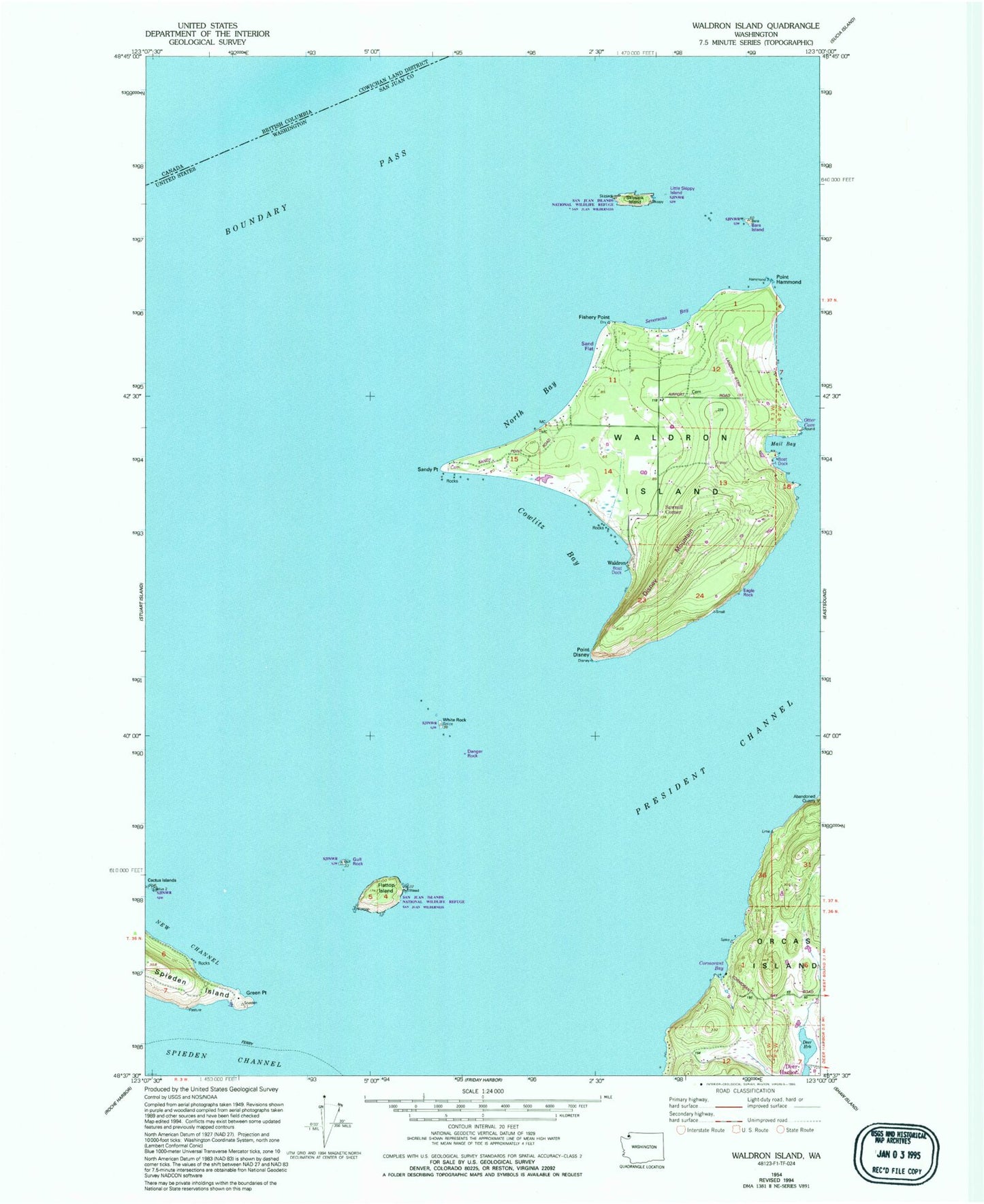
Classic USGS Waldron Island Washington 7.5'x7.5' Topo Map
Couldn't load pickup availability
Historical USGS topographic quad map of Waldron Island in the state of Washington. Map scale may vary for some years, but is generally around 1:24,000. Print size is approximately 24" x 27"
This quadrangle is in the following counties: San Juan.
The map contains contour lines, roads, rivers, towns, and lakes. Printed on high-quality waterproof paper with UV fade-resistant inks, and shipped rolled.
Contains the following named places: Adolphus Island, Bare Island, Boundary Pass, Cowlitz Bay, Danger Rock, Fishery Point, Flattop Island, Gordon Island, Green Point, Gull Rock, Lehman Pond, Lehman Pond Dam, Lindbery Point, Mail Bay, Mouatt Reef, Mount Cement, North Bay, Point Disney, Point Hammond, President Channel, San Juan County Fire District 2 / Orcas Island Fire and Rescue Station 24 Deer Harbor / Spring Point, Sandy Point, Seversons Bay, Skipjack Island, Waldron, Waldron Cemetery, Waldron Island, Waldron Island School, Waldronaire Airport, White Rock, ZIP Code: 98297