MyTopo
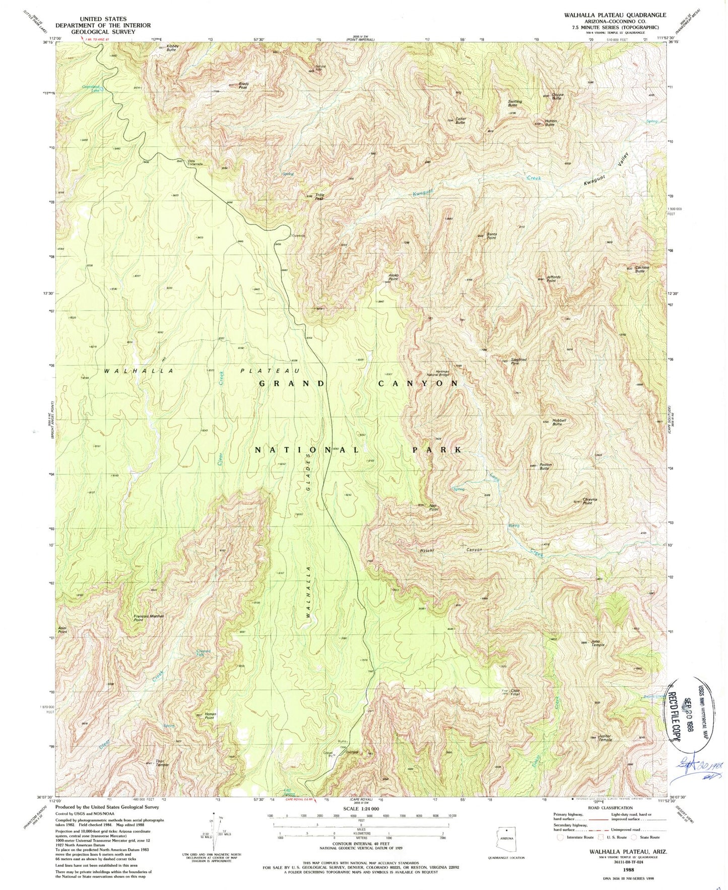
Classic USGS Walhalla Plateau Arizona 7.5'x7.5' Topo Map
Couldn't load pickup availability
Historical USGS topographic quad map of Walhalla Plateau in the state of Arizona. Typical map scale is 1:24,000, but may vary for certain years, if available. Print size: 24" x 27"
This quadrangle is in the following counties: Coconino.
The map contains contour lines, roads, rivers, towns, and lakes. Printed on high-quality waterproof paper with UV fade-resistant inks, and shipped rolled.
Contains the following named places: Atoko Point, Banta Point, Brady Peak, Cape Final, Cheyava Falls, Chiavria Point, Cliff Spring, Cochise Butte, Colter Butte, Duppa Butte, Francois Matthes Point, Greenland Lake, Honan Point, Hubbell Butte, Hutton Butte, Jeffords Point, Juno Temple, Jupiter Temple, Kibbey Butte, Naji Point, Natch Canyon, Poston Butte, Siegfried Pyre, Swilling Butte, Thor Temple, Tritle Peak, Walhalla Glades, Walhalla Plateau, Vista Encantada, Hartman Natural Bridge, Roosevelt Point, Butchart Butte