
MyTopo
Classic USGS Walhonding Ohio 7.5'x7.5' Topo Map
Couldn't load pickup availability
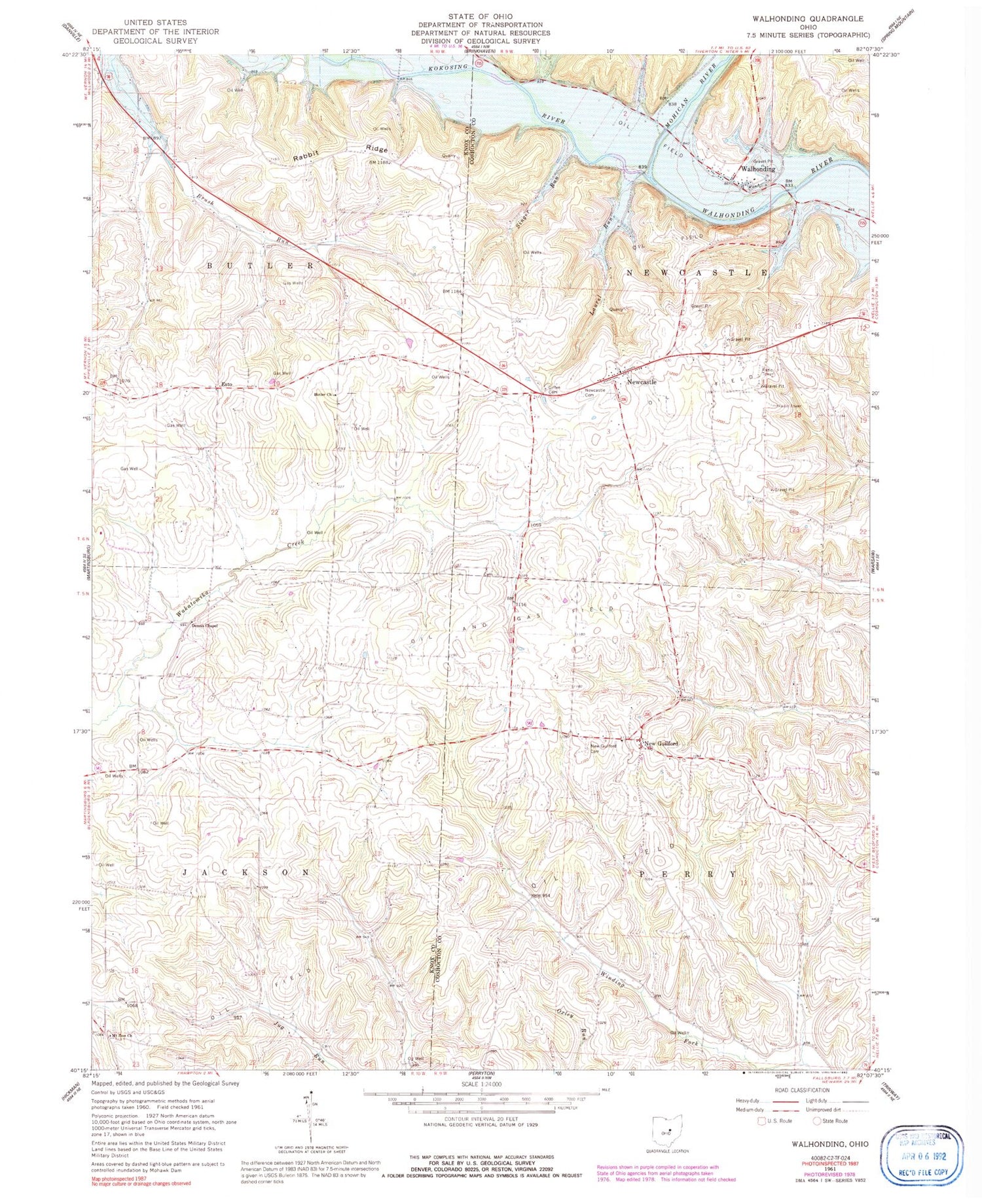
Historical USGS topographic quad map of Walhonding in the state of Ohio. Typical map scale is 1:24,000, but may vary for certain years, if available. Print size: 24" x 27"
This quadrangle is in the following counties: Coshocton, Knox.
The map contains contour lines, roads, rivers, towns, and lakes. Printed on high-quality waterproof paper with UV fade-resistant inks, and shipped rolled.
Contains the following named places: Butler Church, Dennis Chapel, Giffen Cemetery, Laurel Run, Mount Zion Church, New Guilford Cemetery, Newcastle Cemetery, Rabbit Ridge, Singer Run, Walhonding, Winding Fork School (historical), Jug Run School (historical), Wood School (historical), Brush Run School (historical), Rabbit Ridge School (historical), Kokosing River, New Castle Methodist Church, New Guilford Methodist Church, Esto, New Guilford, Newcastle, Mohican River, Owls Town (historical), Stricker School (historical), Dry Run, Jug Run, South Run, California Farm (historical), School Number 4 (historical), School Number 5 (historical), Township of Newcastle, Township of Perry, Township of Butler, Township of Jackson, Butler Baptist Cemetery, Dennis Cemetery, Mount Zion Cemetery, Walhonding Post Office, Flint Cemetery, Saint Matthews Episcopal Cemetery, Scott Cemetery, Walhonding Cemetery, Winding Fork Evangelical Cemetery, New Guilford Post Office (historical), Esto Post Office (historical), Farmers Orchards, Maverick Farms, Widows Point Farms


