MyTopo
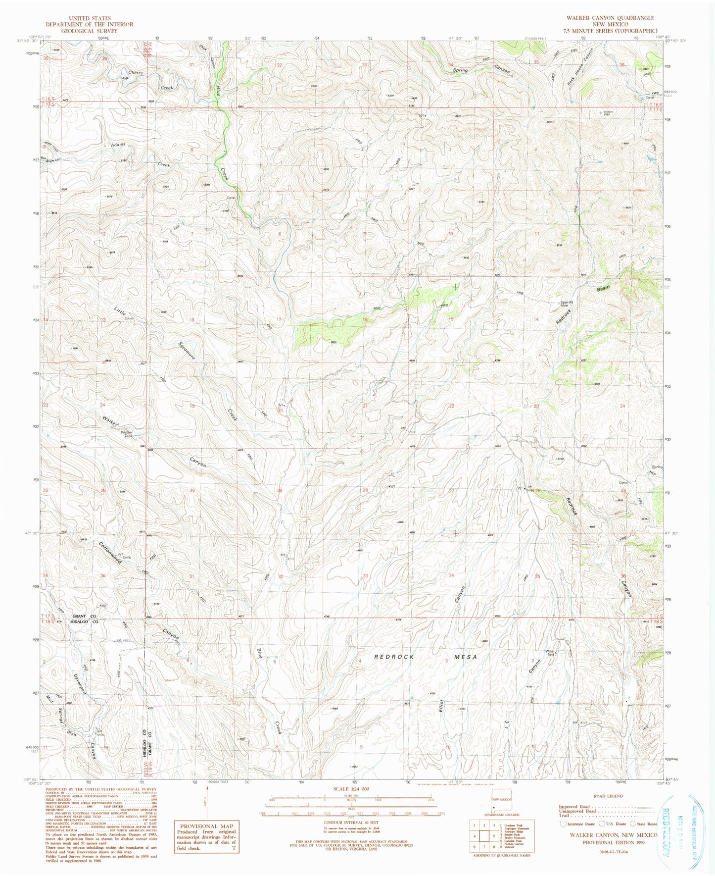
Classic USGS Walker Canyon New Mexico 7.5'x7.5' Topo Map
Couldn't load pickup availability
Historical USGS topographic quad map of Walker Canyon in the state of New Mexico. Map scale may vary for some years, but is generally around 1:24,000. Print size is approximately 24" x 27"
This quadrangle is in the following counties: Grant, Hidalgo.
The map contains contour lines, roads, rivers, towns, and lakes. Printed on high-quality waterproof paper with UV fade-resistant inks, and shipped rolled.
Contains the following named places: Adams Creek, Anderson Ranch, Blakely, Blakey Ranch, Blakey Windmill, Bud Wright Canyon, Cherry Creek, Chick Canyon, Cottonwood Canyon, Dutch John Windmill, Gunn Place, Kemp Creek, Little Sycamore Creek, Martin Ranch, Matthew Place, Mouth of Cottonwood Windmill, Mud Springs Draw, Mud Springs Ranch, Redrock Basin, Redrock Mesa, Walker Canyon, Walker Tank