MyTopo
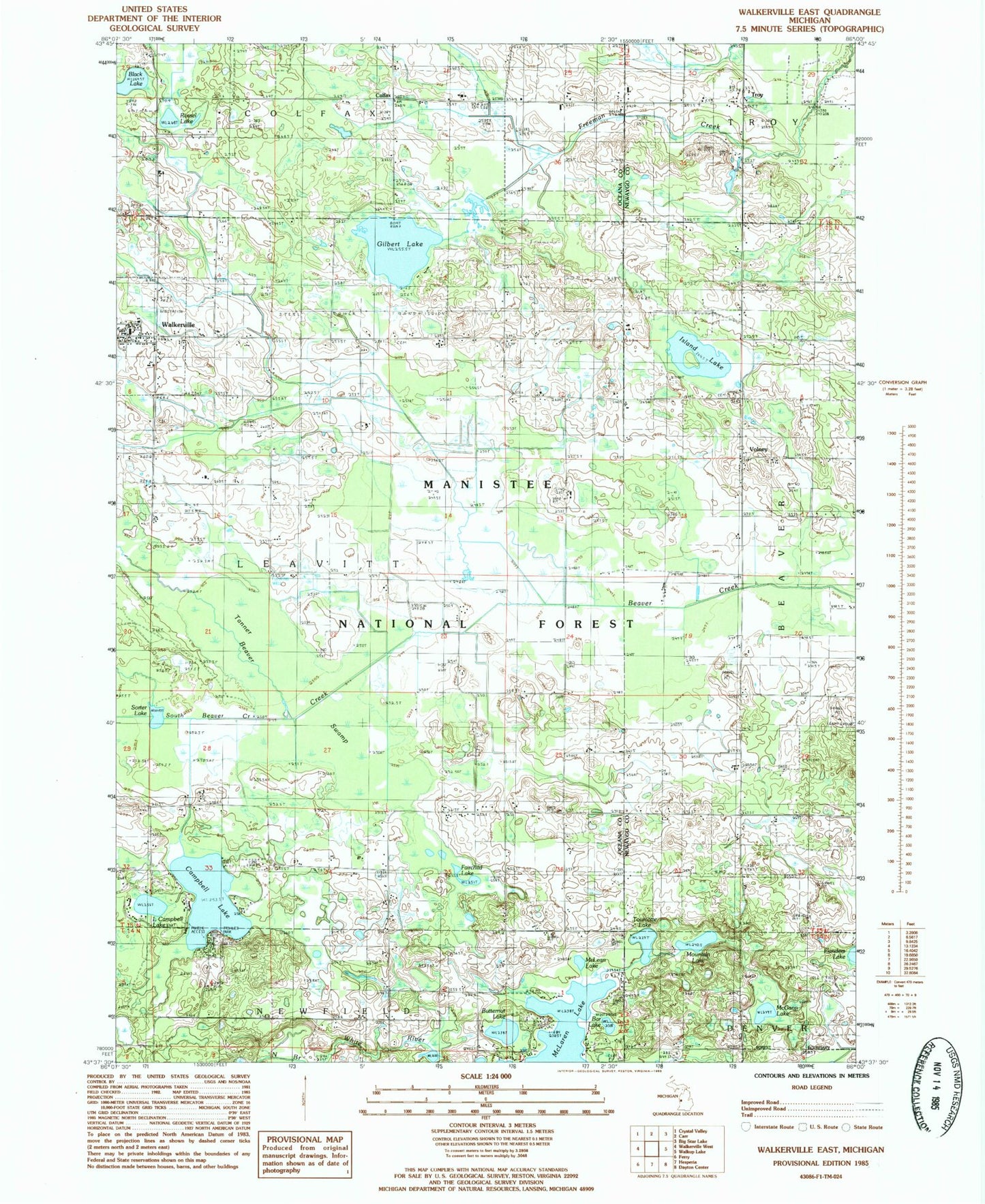
Classic USGS Walkerville East Michigan 7.5'x7.5' Topo Map
Couldn't load pickup availability
Historical USGS topographic quad map of Walkerville East in the state of Michigan. Map scale may vary for some years, but is generally around 1:24,000. Print size is approximately 24" x 27"
This quadrangle is in the following counties: Newaygo, Oceana.
The map contains contour lines, roads, rivers, towns, and lakes. Printed on high-quality waterproof paper with UV fade-resistant inks, and shipped rolled.
Contains the following named places: Abson Cemetery, Bar Lake, Beaver Post Office, Bird Post Office, Black Lake, Butternut Lake, Campbell Lake, Colfax, Fairchild Lake, Gilbert Lake, Gilbert Lake Oil Field, Huber Oil Field, Island Lake, Klondike Post Office, Little Campbell Lake, McGann Lake, McLaren Lake, McLeam Lake, Mountain Lake, Rossel Lake, Sorter Lake, South Beaver Creek, Tanner Swamp, Tourcotte Lake, Township of Leavitt, Troy, Troy Cemetery, Volney, Volney Bible Church, Volney Cemetery, Volney Post Office, Volney School, Walkerville, Walkerville Area Fire and Rescue, Walkerville Elementary School, Walkerville High School, Walkerville Police Department, Walkerville Post Office, Walkerville Station, Walkerville United Methodist Church, Walkerville Wesleyan Church, ZIP Code: 49459