
MyTopo
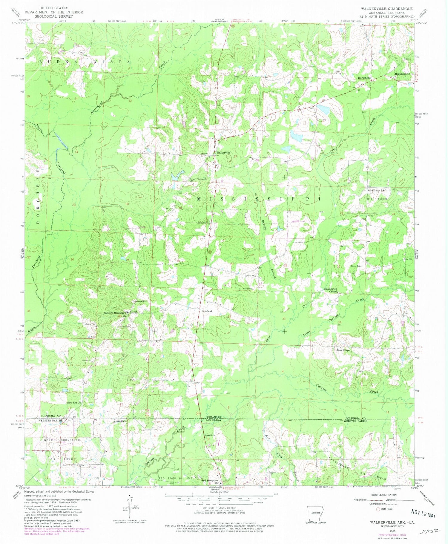
Classic USGS Walkerville Arkansas 7.5'x7.5' Topo Map
Couldn't load pickup availability
Historical USGS topographic quad map of Walkerville in the states of Arkansas, Louisiana. Map scale may vary for some years, but is generally around 1:24,000. Print size is approximately 24" x 27"
This quadrangle is in the following counties: Columbia, Webster.
The map contains contour lines, roads, rivers, towns, and lakes. Printed on high-quality waterproof paper with UV fade-resistant inks, and shipped rolled.
Contains the following named places: Antioch Church, Brushy Branch, Byrd Lake, Byrd Lake Dam, Center Point School, Courtneys Ford, Doss Chapel, Glover Cemetery, Green School, Hephzibah Church, Horsehead, Horsehead Creek, Horsehead School, Lecroys Ford, Leonard Branch, Little Cypress Creek, Maloch Lake, Maloch Lake Dam, New Era United Methodist Church, New Hope Church, New Prospect Church, North Shongaloo Oil and Gas Field, Old Shongaloo Church, Otter Creek, Plainfield, Red Rock Branch, Stewart - Walkerville Cemetery, Taylor Branch, Township of Mississippi, Vaughns Chapel, Walkerville, Walkerville Volunteer Fire Department, Washington Chapel, Western, Western Baptist Church Cemetery, Western Missionary Church, White Oak Creek


