MyTopo
Classic USGS Wallingford Vermont 7.5'x7.5' Topo Map
Couldn't load pickup availability
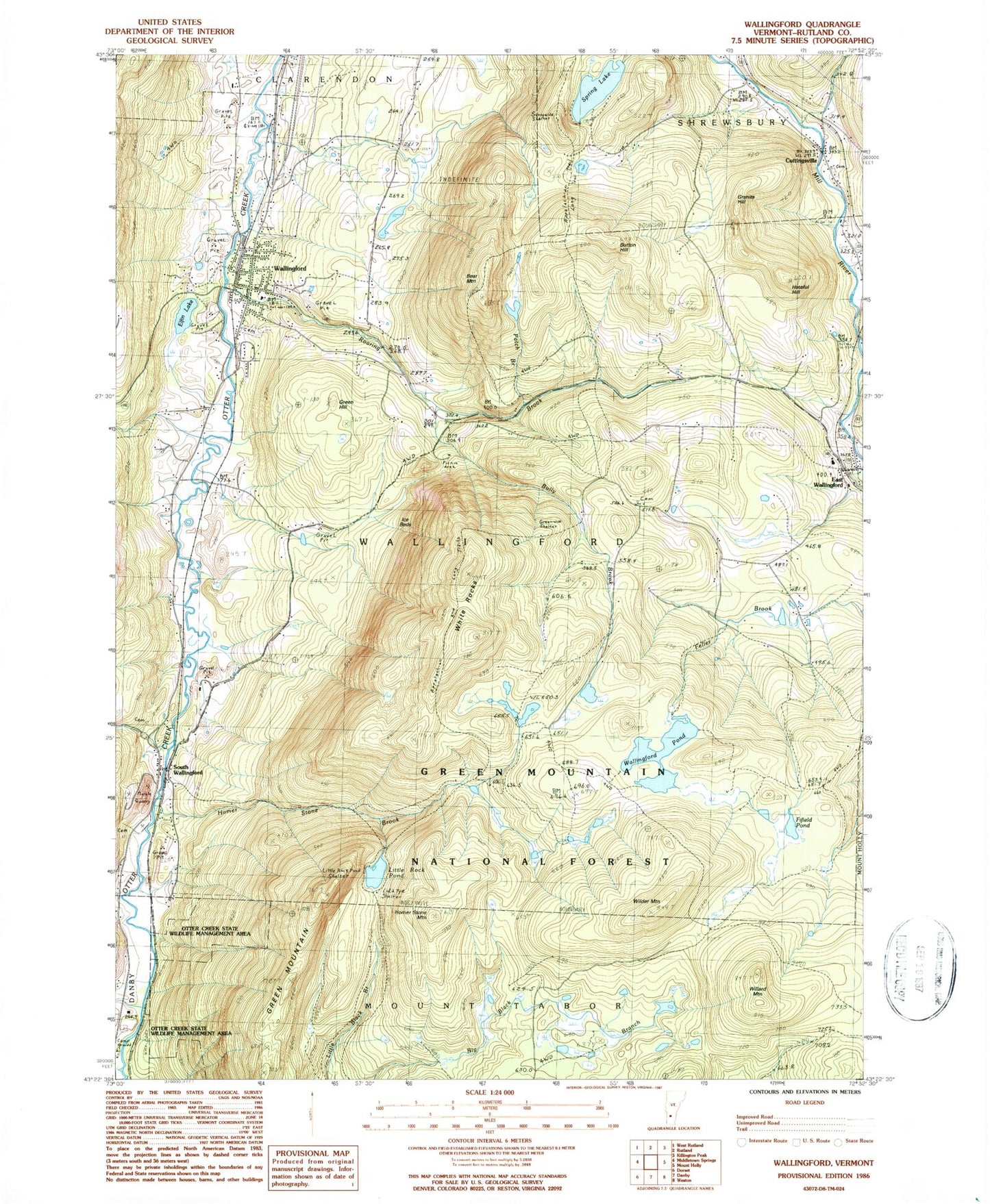
Historical USGS topographic quad map of Wallingford in the state of Vermont. Typical map scale is 1:24,000, but may vary for certain years, if available. Print size: 24" x 27"
This quadrangle is in the following counties: Rutland.
The map contains contour lines, roads, rivers, towns, and lakes. Printed on high-quality waterproof paper with UV fade-resistant inks, and shipped rolled.
Contains the following named places: Baker Brook, Bear Mountain, Button Hill, Cuttingsville, East Wallingford, Elfin Lake, Fifield Pond, Freeman Brook, Granite Hill, Green Hill, Green Mountain, Hateful Hill, Homer Stone Brook, Homer Stone Mountain, Laurel Glen Cemetery, Little Rock Pond, Roaring Brook, South Wallingford, Spring Lake, Wallingford, Wallingford Pond, White Rocks, Wilder Mountain, Willard Mountain, Feller Brook, Otter Creek State Wildlife Management Area, White Rocks National Recreation Area, Green Mountain Trail, Homer Stone Trail, Little Rock Pond Shelter, Lula Tye Shelter, White Rocks Picnic Grounds, Greenwall Shelter, Ice Beds, Keewaydin Trail, Bully Brook, Sunnyside Shelter, Patch Brook, Town of Wallingford, Saint Patrick Cemetery, Cuttingsville Post Office, Doty Cemetery, East Wallingford Baptist Church, East Wallingford Post Office, First Baptist Church, Green Hill Cemetery, Hill-Roberts Cemetery, Otter Creek Campground, Pelsue-Jarvary Cemetery, Saint Patricks Church, Stafford Cemetery, Sugar Hill Cemetery, Timber Hill Estates, Wallingford Congregational Church, Wallingford Village School, Wallingford Main Street Historic District, Wallingford Municipal Forest, Wallingford Post Office, Wallingford Town Hall, Wallingford Fire Department Station 2, Wallingford Volunteer Fire Department, Shrewsbury Volunteer Fire Department Station 1, East Wallingford Fire Department, Wallingford Census Designated Place, South Wallingford Limestone Quarry