MyTopo
Classic USGS Wallula Washington 7.5'x7.5' Topo Map
Couldn't load pickup availability
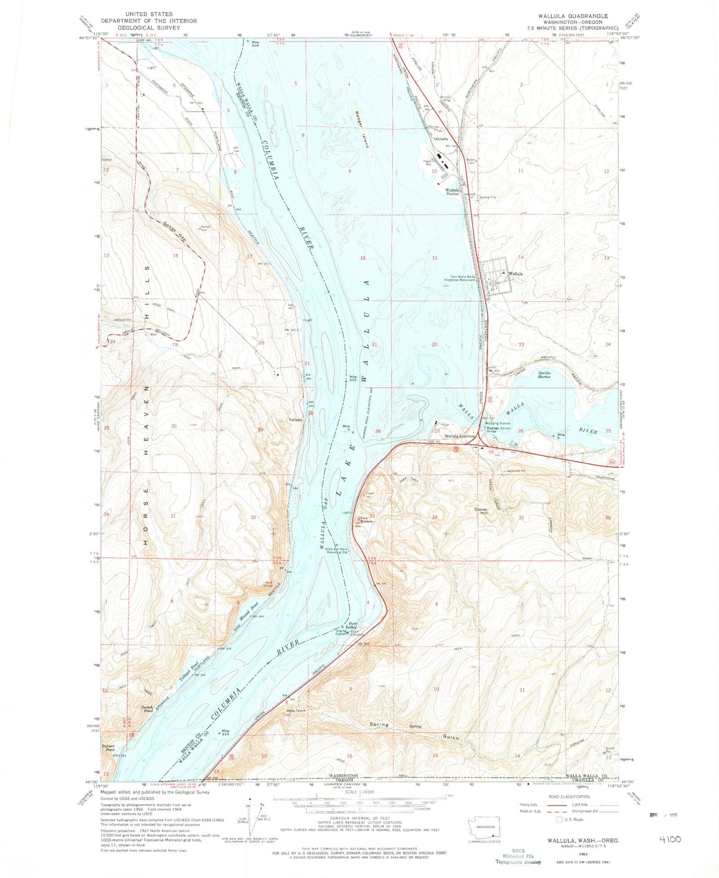
Historical USGS topographic quad map of Wallula in the state of Washington. Map scale may vary for some years, but is generally around 1:24,000. Print size is approximately 24" x 27"
This quadrangle is in the following counties: Benton, Umatilla, Walla Walla.
The map contains contour lines, roads, rivers, towns, and lakes. Printed on high-quality waterproof paper with UV fade-resistant inks, and shipped rolled.
Contains the following named places: Attalia, Badger Island, Broetge Orchards, Clover Hill, Crescent Island, Fort Walla Walla Historical Monument, Goose Gap, Hover, Hover Park, Hunt, Lake Wallula, Lasts Island, Madame Dorion Bridge, Madame Dorion Memorial Park, McNary National Wildlife Refuge, Mound Pond, Palmer Pond, Port Kelley, Port of Walla Walla, Smiths Harbor, Spring Gulch, Switch Pond, Twin Sisters, Walla Walla County Fire District 5 Station 52, Walla Walla River, Wallula, Wallula Census Designated Place, Wallula Gap, Wallula Junction, Wallula Post Office, Wallula State Park, Wallula Station, Yellepit, Yellepit Pond, ZIP Code: 99363