MyTopo
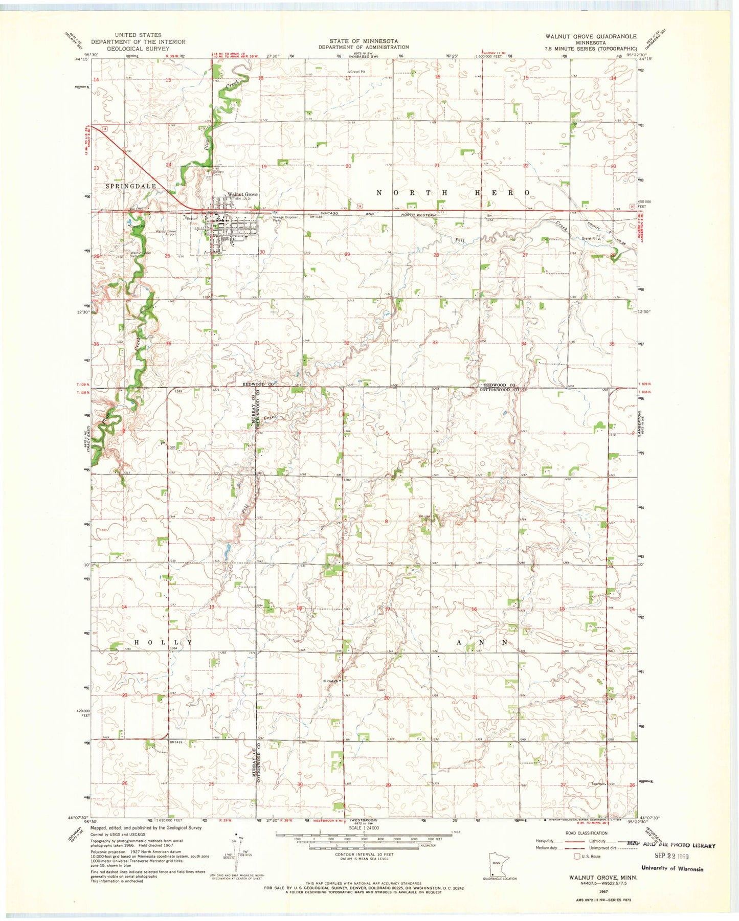
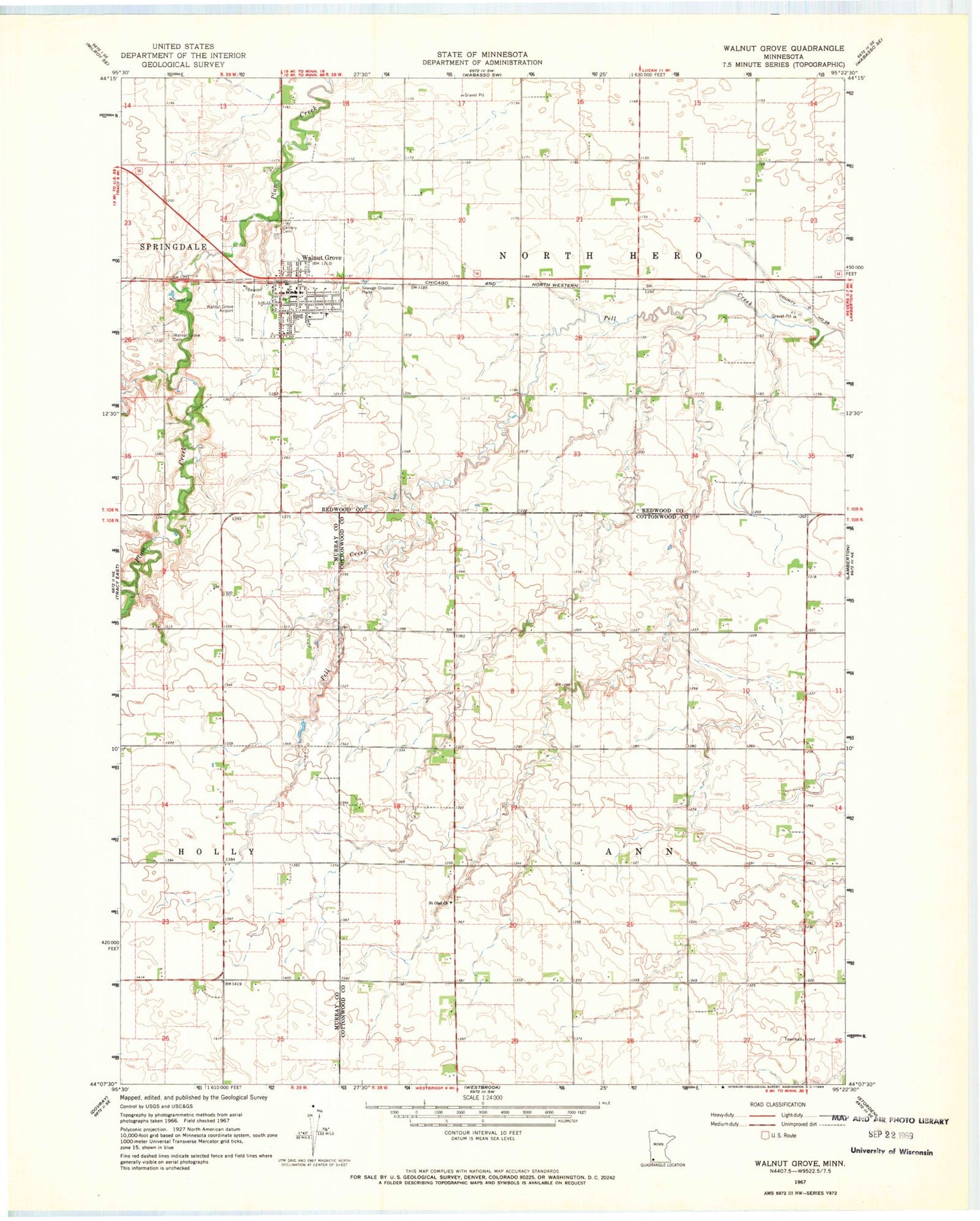
Classic USGS Walnut Grove Minnesota 7.5'x7.5' Topo Map
Couldn't load pickup availability
Historical USGS topographic quad map of Walnut Grove in the state of Minnesota. Map scale may vary for some years, but is generally around 1:24,000. Print size is approximately 24" x 27"
This quadrangle is in the following counties: Cottonwood, Murray, Redwood.
The map contains contour lines, roads, rivers, towns, and lakes. Printed on high-quality waterproof paper with UV fade-resistant inks, and shipped rolled.
Contains the following named places: Calvary Cemetery, City of Walnut Grove, County Ditch Number Twentyeight, English Lutheran Church, Heritage Baptist Bible Church, Methodist Church, Plum Creek Lake, Saint Olaf Cemetery, Saint Olaf Church, Saint Paul Parish, Township of Ann, Township of North Hero, Trinity Lutheran Church, Walnut Grove, Walnut Grove Cemetery, Walnut Grove City Hall, Walnut Grove Clinic, Walnut Grove Elementary School, Walnut Grove Fire Department, Walnut Grove Police Department, Walnut Grove Post Office, Walnut Grove Reservoir Dam, Wilder Museum, ZIP Codes: 56166, 56180