MyTopo
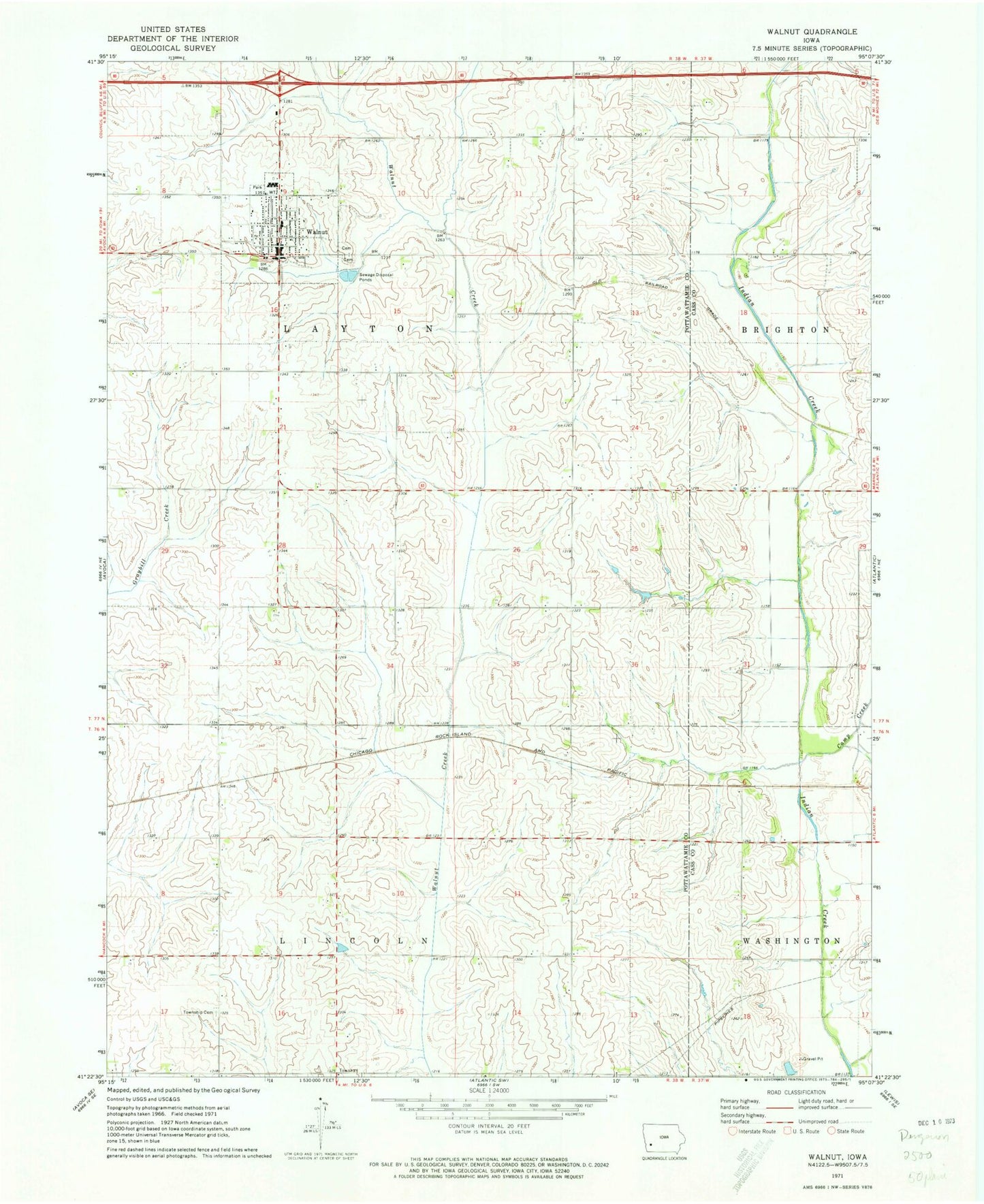
Classic USGS Walnut Iowa 7.5'x7.5' Topo Map
Couldn't load pickup availability
Historical USGS topographic quad map of Walnut in the state of Iowa. Map scale may vary for some years, but is generally around 1:24,000. Print size is approximately 24" x 27"
This quadrangle is in the following counties: Cass, Pottawattamie.
The map contains contour lines, roads, rivers, towns, and lakes. Printed on high-quality waterproof paper with UV fade-resistant inks, and shipped rolled.
Contains the following named places: Calvary Baptist Church, Camp Creek, City of Walnut, First Presbyterian Church, Layton Township Cemetery, Lincoln Township Cemetery, Monroe Methodist Church, Morton Post Office, Our Saviours Lutheran Church, Peace Haven Retirement Home, Peace United Church of Christ, Saint Patricks Catholic Cemetery, Township of Layton, Township of Lincoln, Walnut, Walnut Catholic Church, Walnut County Opera House, Walnut Creek Historical Museum, Walnut Elementary School, Walnut Elevator, Walnut High School, Walnut Medical Center, Walnut Middle School, Walnut Post Office, Walnut Public Library, Walnut Volunteer Fire Department, Walnut Welcome Center, ZIP Code: 51577