MyTopo
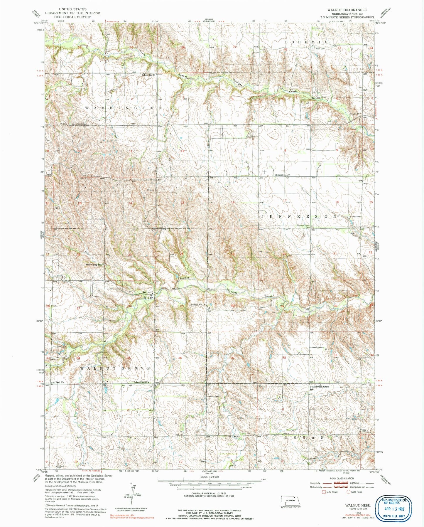
Classic USGS Walnut Nebraska 7.5'x7.5' Topo Map
Couldn't load pickup availability
Historical USGS topographic quad map of Walnut in the state of Nebraska. Map scale may vary for some years, but is generally around 1:24,000. Print size is approximately 24" x 27"
This quadrangle is in the following counties: Knox.
The map contains contour lines, roads, rivers, towns, and lakes. Printed on high-quality waterproof paper with UV fade-resistant inks, and shipped rolled.
Contains the following named places: Cottonwood Grove School, Greenvale State Wildlife Management Area, Jelen Cemetery, Oak Valley School, Pleasant Valley Cemetery, Saint Paul Church, School Number 18, School Number 47, School Number 61, School Number 62, Sukup Dam, Sukup Dam-1 Dam, Sukup Reservoir, Township of Jefferson, Township of Walnut Grove, Walnut, Walnut Post Office, ZIP Code: 68783