MyTopo
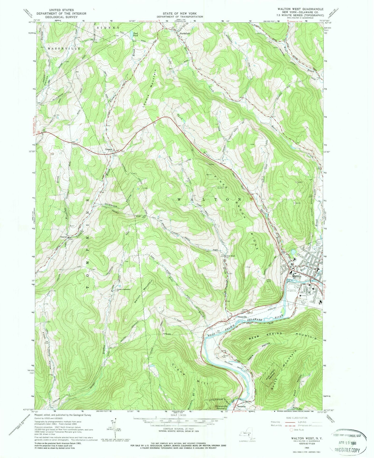
Classic USGS Walton West New York 7.5'x7.5' Topo Map
Couldn't load pickup availability
Historical USGS topographic quad map of Walton West in the state of New York. Map scale may vary for some years, but is generally around 1:24,000. Print size is approximately 24" x 27"
This quadrangle is in the following counties: Delaware.
The map contains contour lines, roads, rivers, towns, and lakes. Printed on high-quality waterproof paper with UV fade-resistant inks, and shipped rolled.
Contains the following named places: Austin Lincoln Park, Ballards Mobile Home Park, Beers Brook, Beerston, Bobs Brook, Cable Hollow, Chipmunk Hollow, Christ Episcopal Church, Church of Saint John the Baptist, Cleaver, Constable Quarry, Country Meadows Mobile Home Park, Crane Hill, Dryden Community Church, East Brook, Finch Hollow, First Baptist Church, First Congregational Church, First Methodist Episcopal Church, Free Methodist Church, Freer Hollow, Gospel Tabernacle Church, Loomis, Loomis Mountain, Miller Avenue School, More Park, Northfield, Northfield Community Church Cemetery, Ogden Free Library, Park Terrace Adult Home, Pines Brook, Pines Brook Church, Pines Brook Ridge, Pinesville, Plow Hollow, Reformed Presbyterian Church, Riverside Alliance Church, Sheffields Pond, South Mountain, Springhill Farm, Stevens Hospital, Teed Pond, Third Brook, Town of Walton, Townsend Elementary School, Townsend Hose Company Number 4, UHS Delaware Valley Hospital, United Presbyterian Church, Village of Walton, Walton, Walton Airport, Walton Cemetery, Walton Fire Department, Walton Grange, Walton High School, Walton Junior-Senior High School, Walton Mountain, Walton Municipal Building, Walton Post Office, West Brook, Windfall Brook, Windfall Cemetery, ZIP Code: 13856