MyTopo
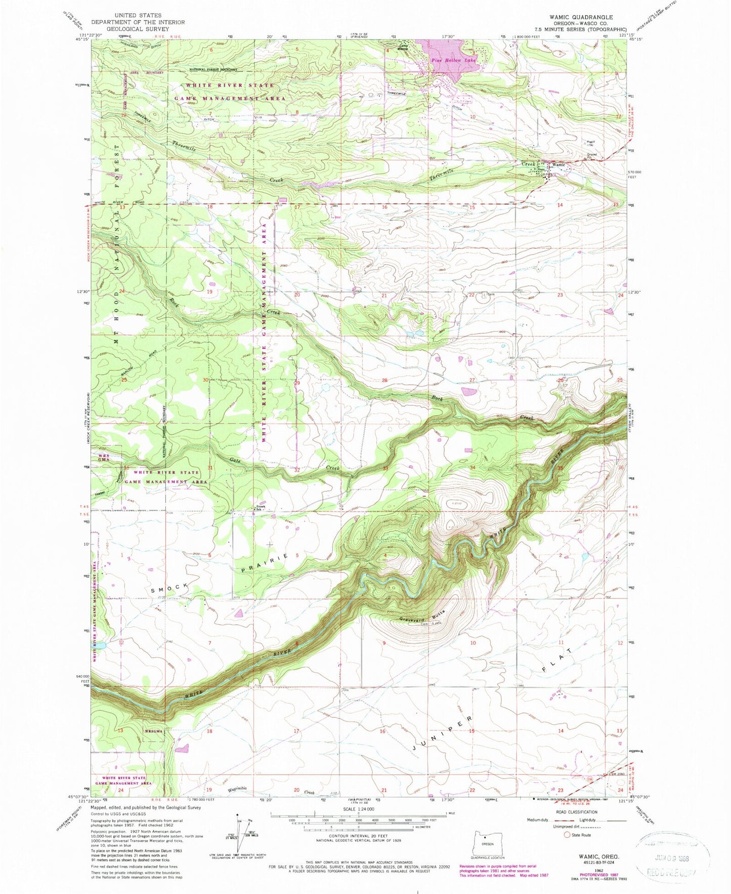
Classic USGS Wamic Oregon 7.5'x7.5' Topo Map
Couldn't load pickup availability
Historical USGS topographic quad map of Wamic in the state of Oregon. Map scale may vary for some years, but is generally around 1:24,000. Print size is approximately 24" x 27"
This quadrangle is in the following counties: Wasco.
The map contains contour lines, roads, rivers, towns, and lakes. Printed on high-quality waterproof paper with UV fade-resistant inks, and shipped rolled.
Contains the following named places: Batty School, Camp Morrow, Cody Ponds, Gate Creek, Graveyard Butte, Graveyard Butte Cemetery, Hazel Hollow, Hill Bench, Juniper Flat Rural Fire Protection District, Miller Dam, Pine Hollow, Pine Hollow Census Designated Place, Pine Hollow Dam, Pine Hollow Reservoir, Pine Hollow Reservoir Boat Ramp South, Pine Hollow Reservoir Lakeside Resort Boat Ramp, Pine Hollow Volunteer Fire Department Station 1, Rock Creek Ditch, Smock Post Office, Smock Prairie, Smock School, Threemile Ditch, Wamic, Wamic Cemetery, Wamic Census Designated Place, Wamic Post Office, Wamic Water and Sewer Authority, ZIP Code: 97063