
MyTopo
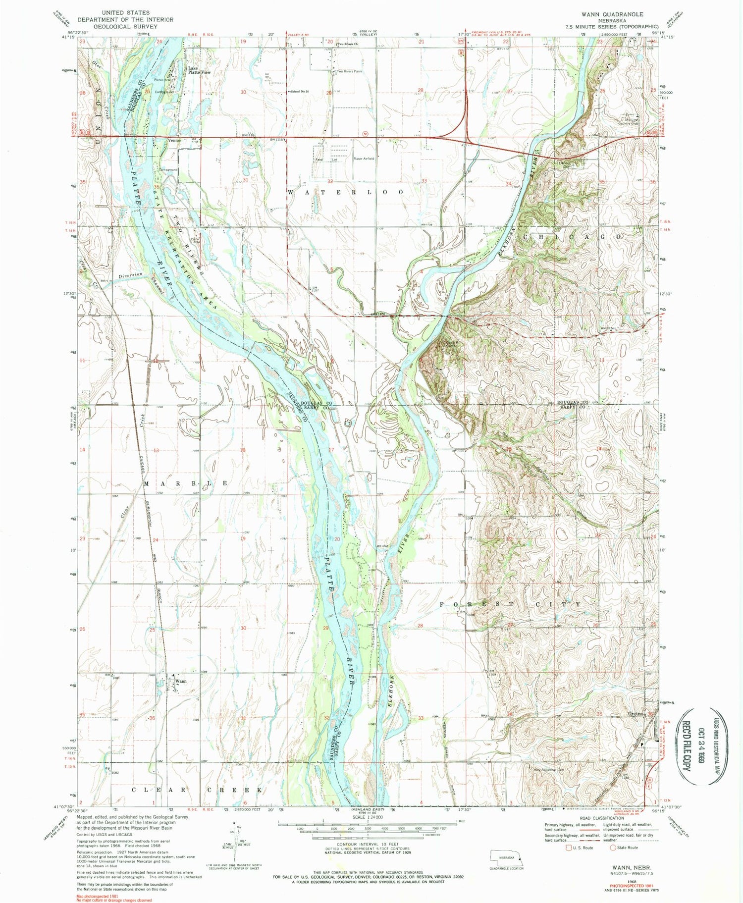
Classic USGS Wann Nebraska 7.5'x7.5' Topo Map
Couldn't load pickup availability
Historical USGS topographic quad map of Wann in the state of Nebraska. Map scale may vary for some years, but is generally around 1:24,000. Print size is approximately 24" x 27"
This quadrangle is in the following counties: Douglas, Sarpy, Saunders.
The map contains contour lines, roads, rivers, towns, and lakes. Printed on high-quality waterproof paper with UV fade-resistant inks, and shipped rolled.
Contains the following named places: Big Sandy Lake, Caboose Park, Circle R Camp, Cottonwood Campground, Diversion Channel, Elkhorn Cemetery, Fawn Meadows Campground, Goldenrod Campground, Gretna Middle School, Holy Sepulcher Cemetery, KPQC-TV (Omaha), Lake Platte View, Oak Grove Campground, Oto Indians Historical Marker, Otoe Creek, Riverside Campground, Skyline Woods Country Club, Township of Forest City, Trout Lake, Two Rivers Church, Two Rivers Farm, Two Rivers School, Two Rivers State Recreation Area, Venice, Venice Census Designated Place, Wann, Wann Census Designated Place, Wann Post Office, Woods Landing Campground and RV Park, ZIP Code: 68069


