MyTopo
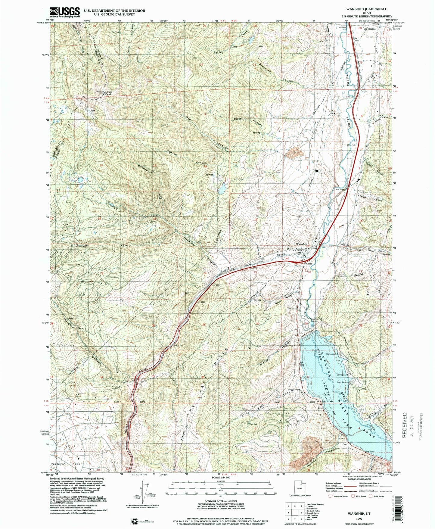
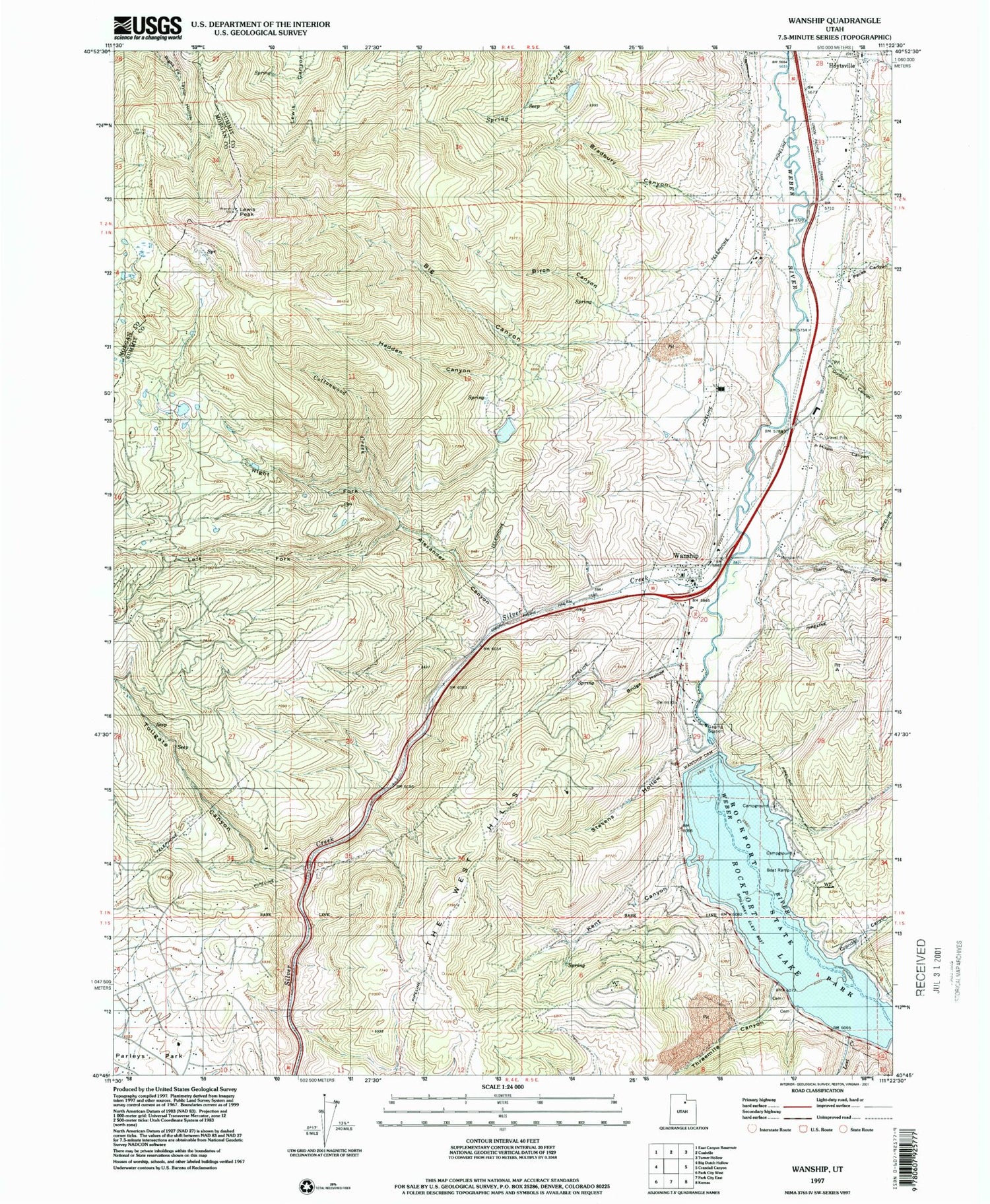
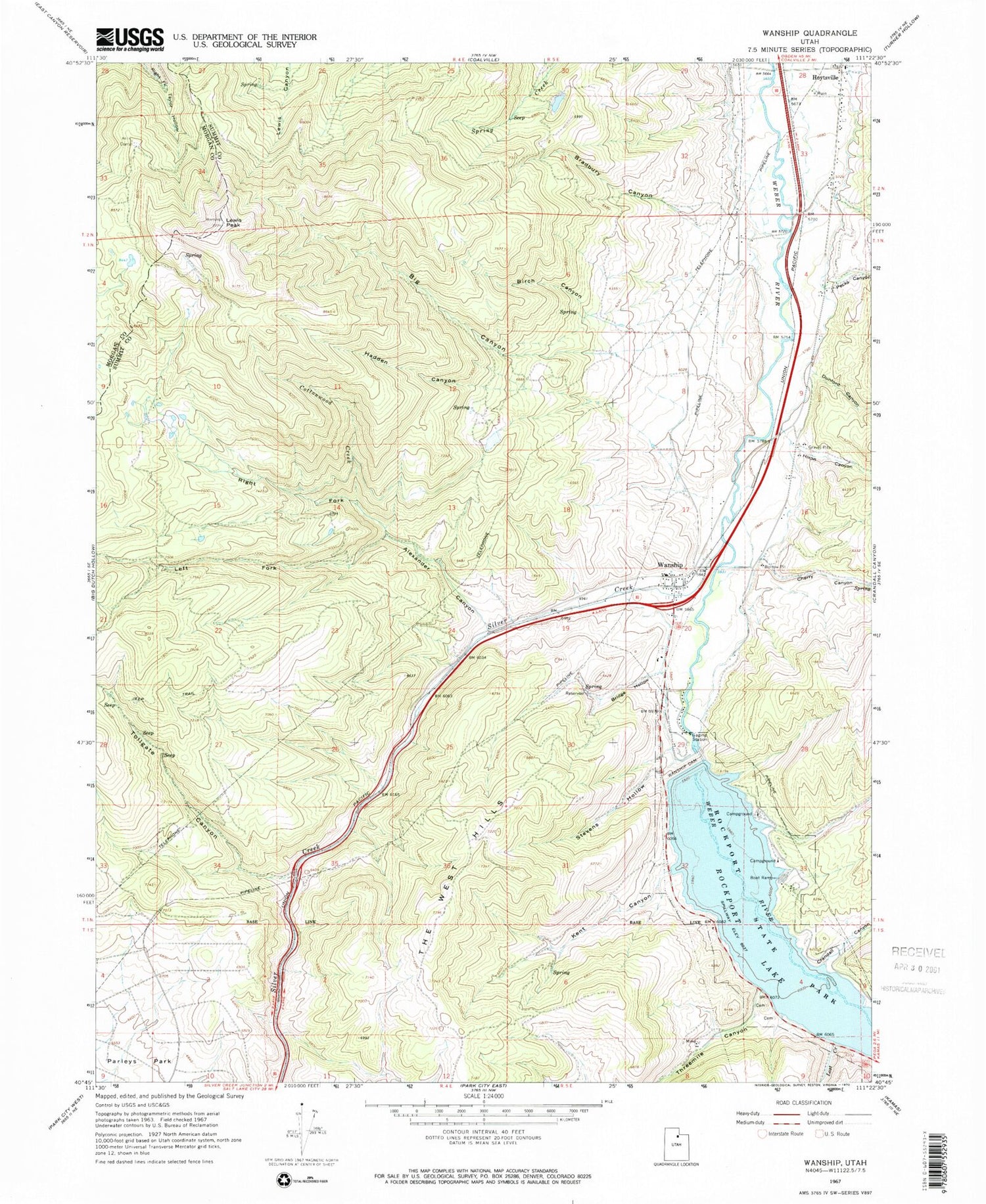
Classic USGS Wanship Utah 7.5'x7.5' Topo Map
Couldn't load pickup availability
Historical USGS topographic quad map of Wanship in the state of Utah. Map scale may vary for some years, but is generally around 1:24,000. Print size is approximately 24" x 27"
This quadrangle is in the following counties: Morgan, Summit.
The map contains contour lines, roads, rivers, towns, and lakes. Printed on high-quality waterproof paper with UV fade-resistant inks, and shipped rolled.
Contains the following named places: Alexander Canyon, Area A Recreation Site, Area B Recreation Site, Area D Recreation Site, Big Canyon, Birch Canyon, Bradbury Canyon, Bridge Hollow, Cherry Canyon, Cooper - Hughes - Vickory Cemetery, Cottonwood Canyon, Cottonwood Creek, Crandall Canyon, Dunford Canyon, Hadden Canyon, Hixon Canyon, Hoytsville, Kent Canyon, Left Fork Alexander Canyon, Lewis Peak, Lost Creek, North Summit EMS Ambulance, North Summit Fire District Station 23 Wanship, Pecks Canyon, Pine Creek, Right Fork Alexander Canyon, Rockport Campground, Rockport Cemetery, Rockport Lake, Rockport State Park, Seymour / Davis Cemetery, Silver Creek, Stevens Hollow, The Church of Jesus Christ of Latter Day Saints, Threemile Canyon, Tollgate Canyon, Union Pacific Rail Trail, Wanship, Wanship Cemetery, Wanship Census Designated Place, Wanship Dam