MyTopo
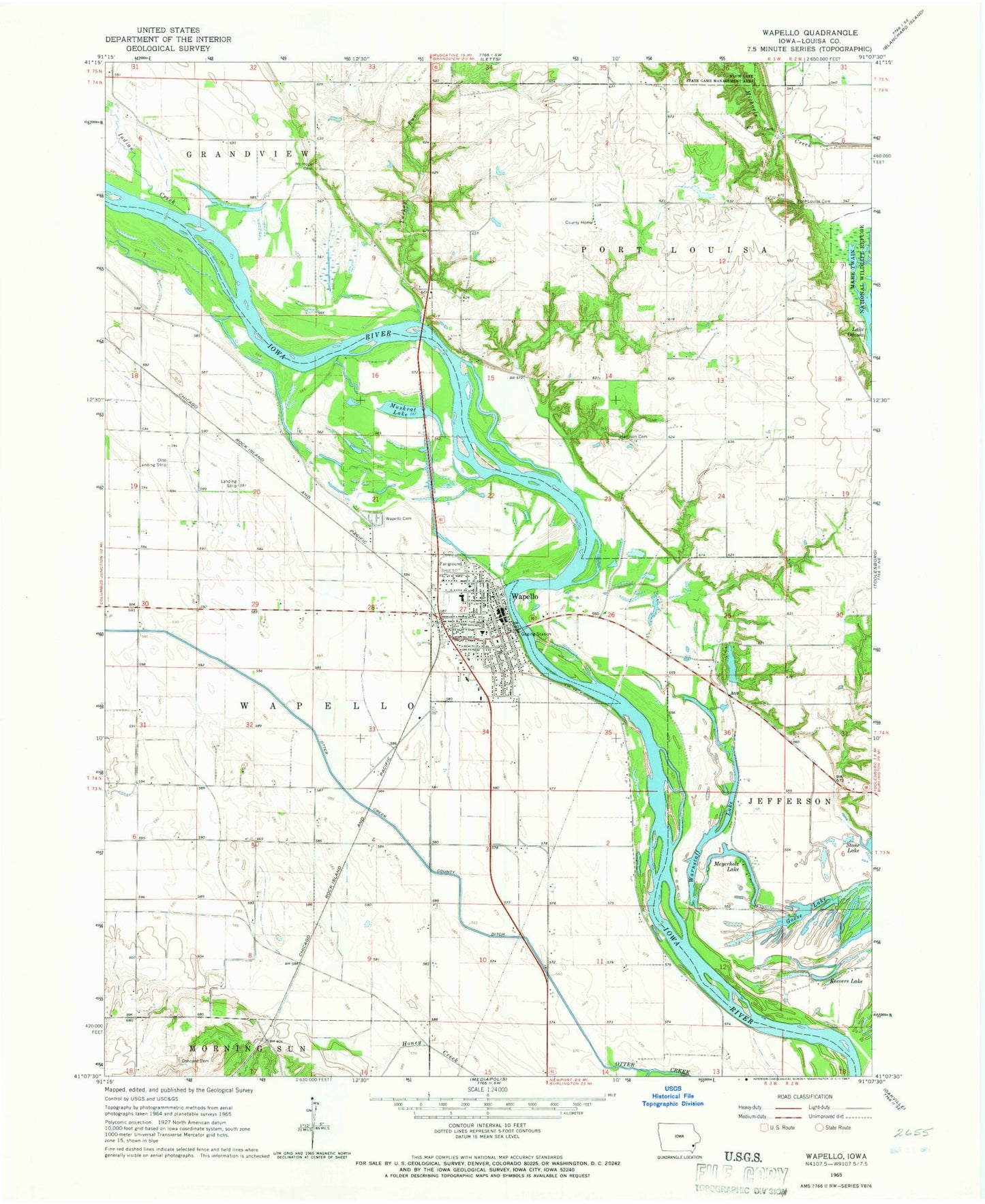
Classic USGS Wapello Iowa 7.5'x7.5' Topo Map
Couldn't load pickup availability
Historical USGS topographic quad map of Wapello in the state of Iowa. Map scale may vary for some years, but is generally around 1:24,000. Print size is approximately 24" x 27"
This quadrangle is in the following counties: Louisa.
The map contains contour lines, roads, rivers, towns, and lakes. Printed on high-quality waterproof paper with UV fade-resistant inks, and shipped rolled.
Contains the following named places: Briggs Civic Center, Church of the Nazarene, City of Wapello, Concord Cemetery, First Presbyterian Church, Fred T Schwob Access, Hardman Cemetery, Harrison, Harrison Cemetery, Harrison Post Office, Highway 61 Access, Honey Creek, Indian Creek, Indian Slough Wildlife Area, Kingdom Hall of Jehovahs Witnesses, Louisa County Courthouse, Louisa County Farm Cemetery, Louisa County Historical Museum, Louisa County Home, Louisa County Sheriff's Office, Maple Lane RV Campground, Meyerholz Lake, Mount Hope Cemetery, Muskrat Lake, Otter Creek County Ditch, Otto Landing Strip, Pleasant View country School, Port Louisa, Port Louisa Cemetery, Port Louisa Post Office, Saint Marys Catholic Church, Saint Paul Lutheran Church, Solid Rock Baptist Church, Stone Lake, Township of Wapello, Turkey Run, United Methodist Church, Wapello, Wapello Cemetery, Wapello Chiropractic Center, Wapello City Hall, Wapello Community Ambulance, Wapello Dental Health Care Center, Wapello Elementary School, Wapello Junior / Senior High School, Wapello Junior High School, Wapello Medical Clinic, Wapello Nursing and Care Center, Wapello Post Office, Wapello Public Library, Wapello Volunteer Fire and Rescue, Warnstaff Lake, Wilson Farm Cemetery, Woodland Mobile Home Park, ZIP Code: 52653