MyTopo
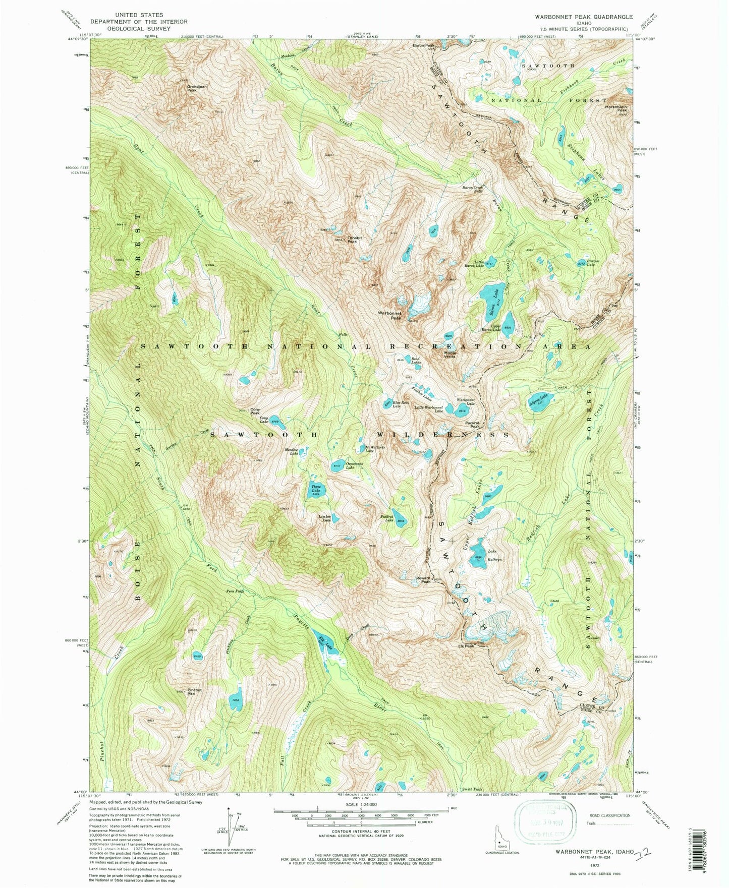
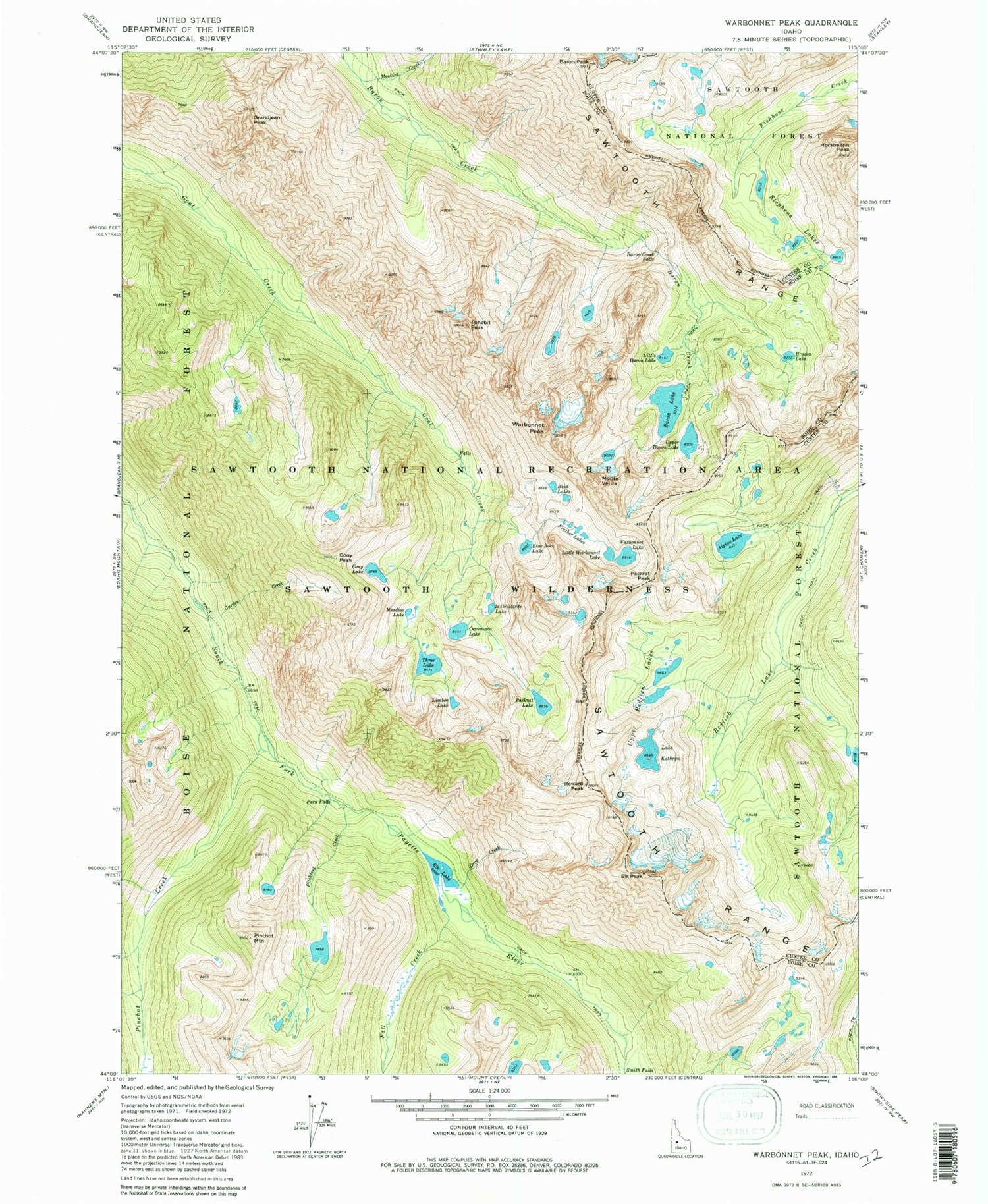
USGS Classic Warbonnet Peak Idaho 7.5'x7.5' Topo Map
Couldn't load pickup availability
Historical USGS topographic quad map of Warbonnet Peak in the state of Idaho. Scale: 1:24000. Print size: 24" x 27"
This quadrangle is in the following counties: Boise, Custer.
The map contains contour lines, roads, rivers, towns, lakes, and grids including latitude / longitude and UTM / MGRS. Printed on high-quality waterproof paper with UV fade-resistant inks.
Contains the following named places: Baron Creek Falls, Baron Lake, Baron Peak, Bead Lakes, Blue Rock Lake, Braxon Lake, Cony Lake, Cony Peak, Drop Creek, Elk Lake, Fall Creek, Feather Lakes, Fern Falls, Garden Creek, Grandjean Peak, Horstmann Peak, Lake Kathryn, Limber Lake, Little Baron Lake, McWillards Lake, Meadow Lake, Moolack Creek, Packrat Lake, Pinchot Creek, Pinchot Mountain, Reward Peak, Smith Falls, Stevens Lakes, Three Lake, Tohobit Peak, Upper Baron Lake, Upper Redfish Lakes, Warbonnet Lake, Monte Verita, Alpine Lake, Oreamnos Lake, Packrat Peak, Pitchfork Creek, Warbonnet Peak, Baron Lakes, Elk Peak, Sawtooth Wilderness