MyTopo
Classic USGS Warbonnet Ranch Nebraska 7.5'x7.5' Topo Map
Couldn't load pickup availability
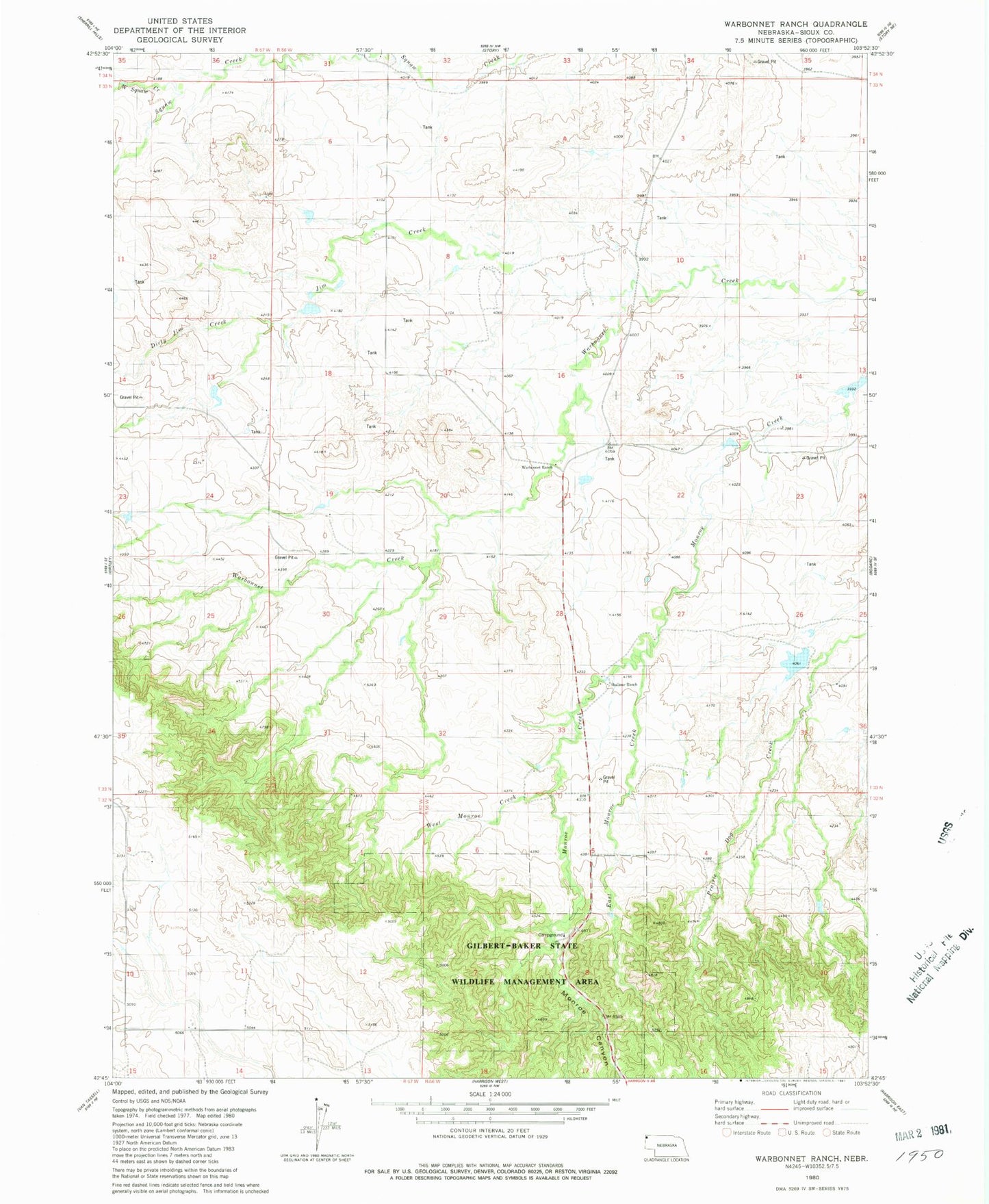
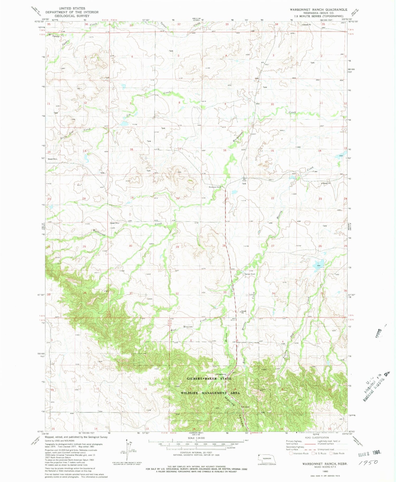
Historical USGS topographic quad map of Warbonnet Ranch in the state of Nebraska. Map scale may vary for some years, but is generally around 1:24,000. Print size is approximately 24" x 27"
This quadrangle is in the following counties: Sioux.
The map contains contour lines, roads, rivers, towns, and lakes. Printed on high-quality waterproof paper with UV fade-resistant inks, and shipped rolled.
Contains the following named places: Caladonia Dam, Caladonia Reservoir, Dirty Jim Creek, Dout Dam Number 1, Dout Reservoir Number 1, East Monroe Creek, Gilbert-Baker Campground, Gilbert-Baker Wildlife Area, Jim Creek, Jordan Reservoir, Little Red Reservoir, Monroe Canyon, Parsons Dam Number 1, Shepherd Dam, Shepherd Reservoir, Snyder Dam, Snyder Reservoir, Wasserburger Dam Number 1, Wasserburger Reservoir Number 1, West Monroe Creek, West Squaw Creek