
MyTopo
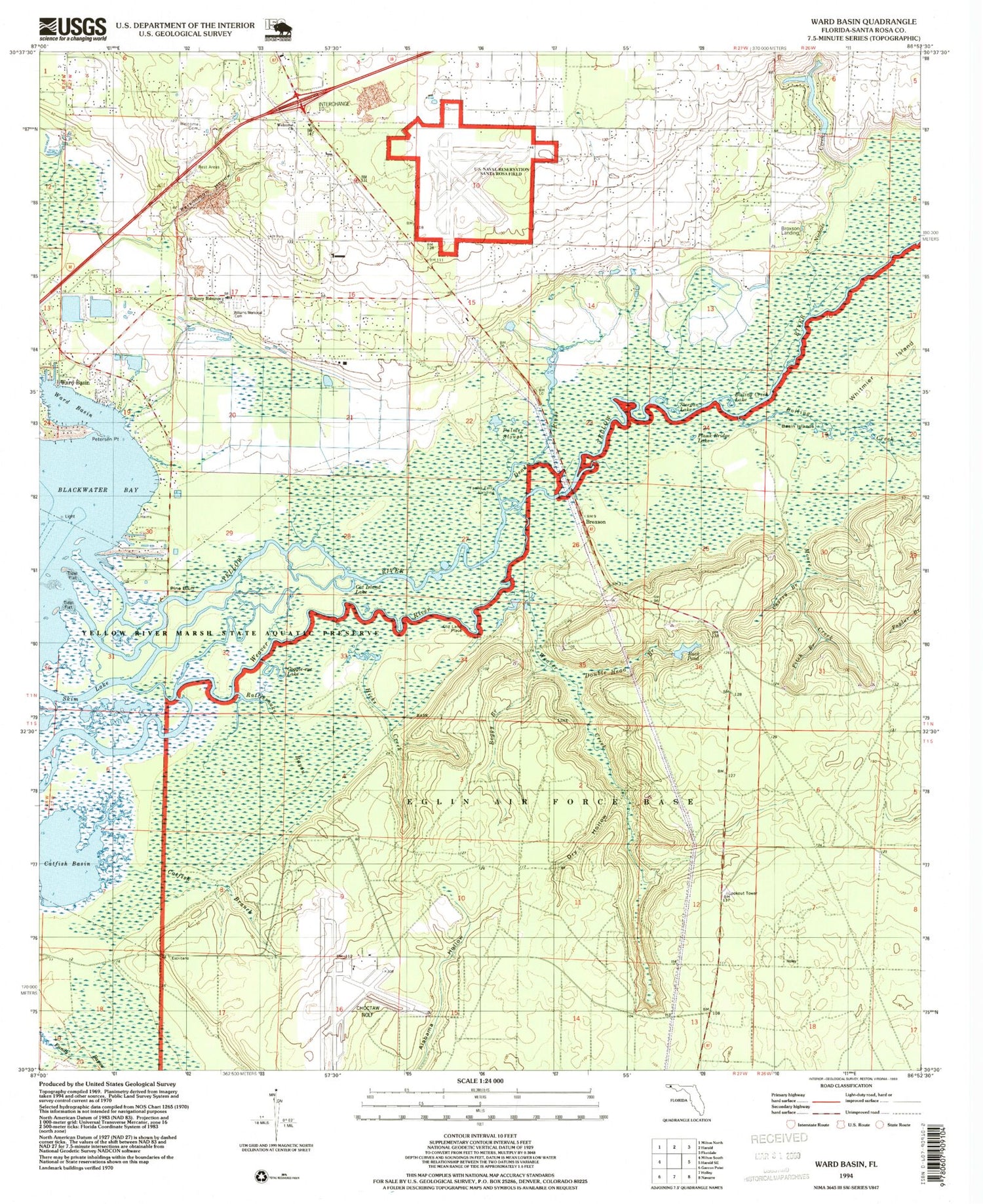
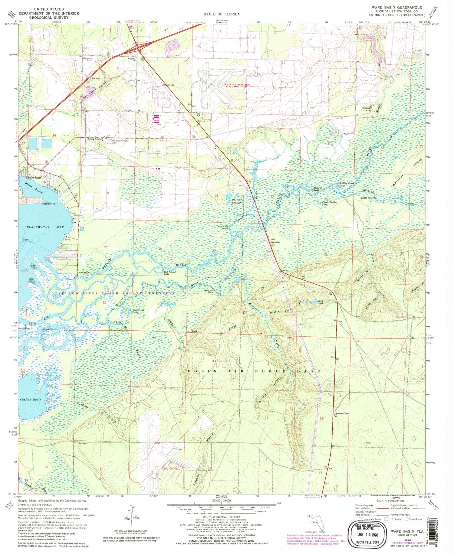
Classic USGS Ward Basin Florida 7.5'x7.5' Topo Map
Couldn't load pickup availability
Historical USGS topographic quad map of Ward Basin in the state of Florida. Typical map scale is 1:24,000, but may vary for certain years, if available. Print size: 24" x 27"
This quadrangle is in the following counties: Santa Rosa.
The map contains contour lines, roads, rivers, towns, and lakes. Printed on high-quality waterproof paper with UV fade-resistant inks, and shipped rolled.
Contains the following named places: Yellow River, Basin Island, Boggy Branch, Boiling Creek, Boiling Creek Lake, Buck Pond, Cat Island Lake, Catfish Basin, Catfish Branch, Cherry Branch, Dead River, Double Head Branch, Dry Hollow, Fitch Branch, Goggle-Eye Lake, Hickory Hammock Church, Hicks Creek, Moore Creek, Palmer Slough, Persimmon Hollow, Petersen Point, Plank Bridge Lake, Rattlesnake Bayou, Skim Lake, Stergan Lake, Ward Basin, Weaver Creek, Welcome Cemetery, Welcome Church, Lewis Williams Memorial Cemetery, Weaver Creek Lookout Tower, Broxson, Faulks Ferry Landing, Old Land Place, Pine Bluff, Ward Basin, Friendship Cemetery, Gulf Breeze-Harold Division, East Milton Census Designated Place, East Milton Volunteer Fire Department Station 2, East Milton Division, Choctaw Naval Outlying Field, Santa Rosa Naval Outlying Field


