
MyTopo
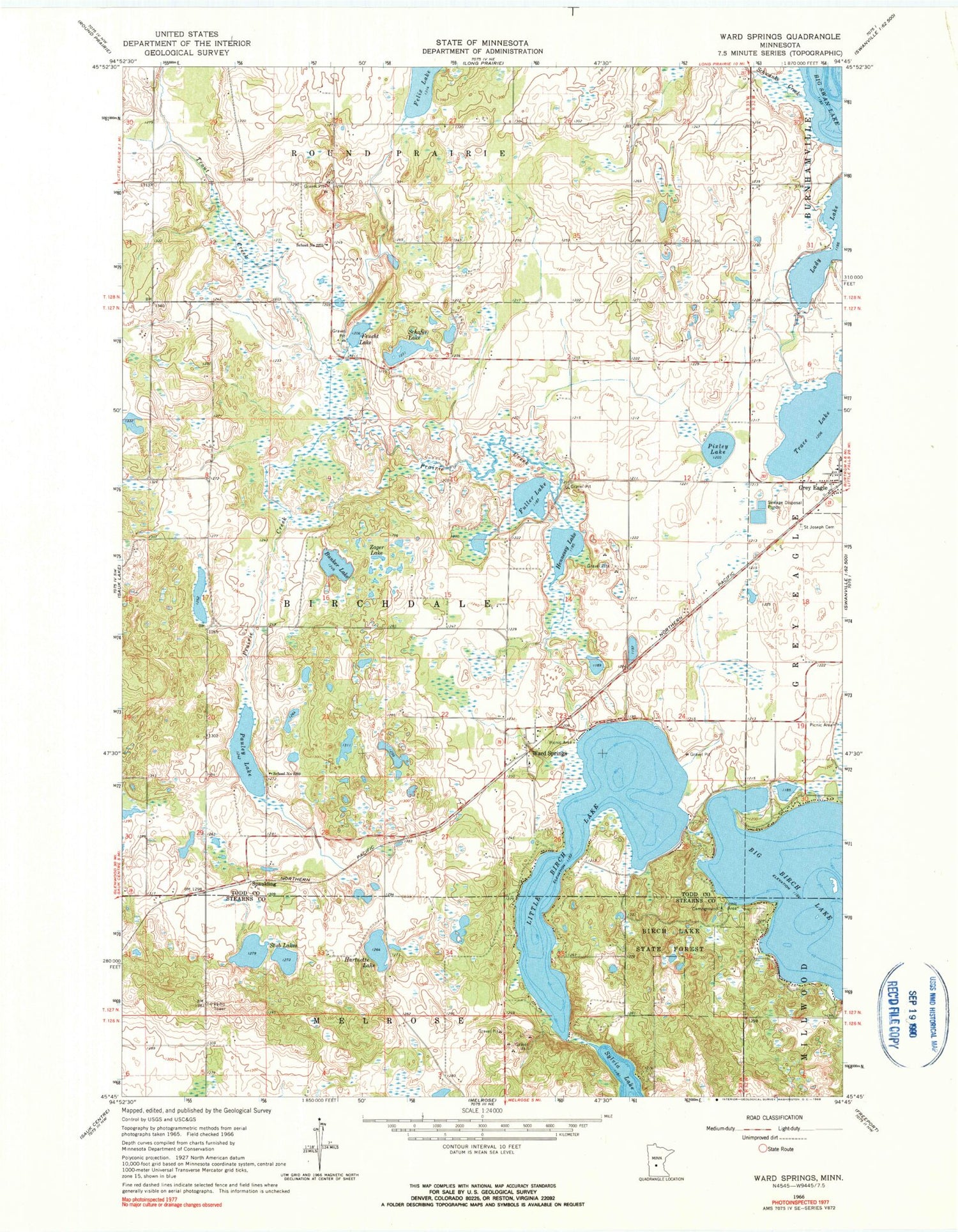
Classic USGS Ward Springs Minnesota 7.5'x7.5' Topo Map
Couldn't load pickup availability
Historical USGS topographic quad map of Ward Springs in the state of Minnesota. Map scale may vary for some years, but is generally around 1:24,000. Print size is approximately 24" x 27"
This quadrangle is in the following counties: Stearns, Todd.
The map contains contour lines, roads, rivers, towns, and lakes. Printed on high-quality waterproof paper with UV fade-resistant inks, and shipped rolled.
Contains the following named places: Big Birch Lake, Big Birch Lake Dam, Birch Lakes State Forest, Bunker Lake, D Peschel Pond, D Peschel Pond Dam, Feucht Lake, Fuller Lake, Grey Eagle, Hartnette Lake, Hennessy Lake, Little Birch Lake, Pauley Lake, Pixley Lake, Prairie Creek, Saint Joseph Cemetery, Saint Joseph's Catholic Church, Schafer Lake, School Number 2260, School Number 2269, School Number 2275, Schwanke Creek, Spaulding, Stub Lakes, Sylvia Lake, Township of Birchdale, Trace Lake, Trout Creek, Ward Springs, Ward Springs Post Office, Zager Lake, ZIP Code: 56336


