
MyTopo
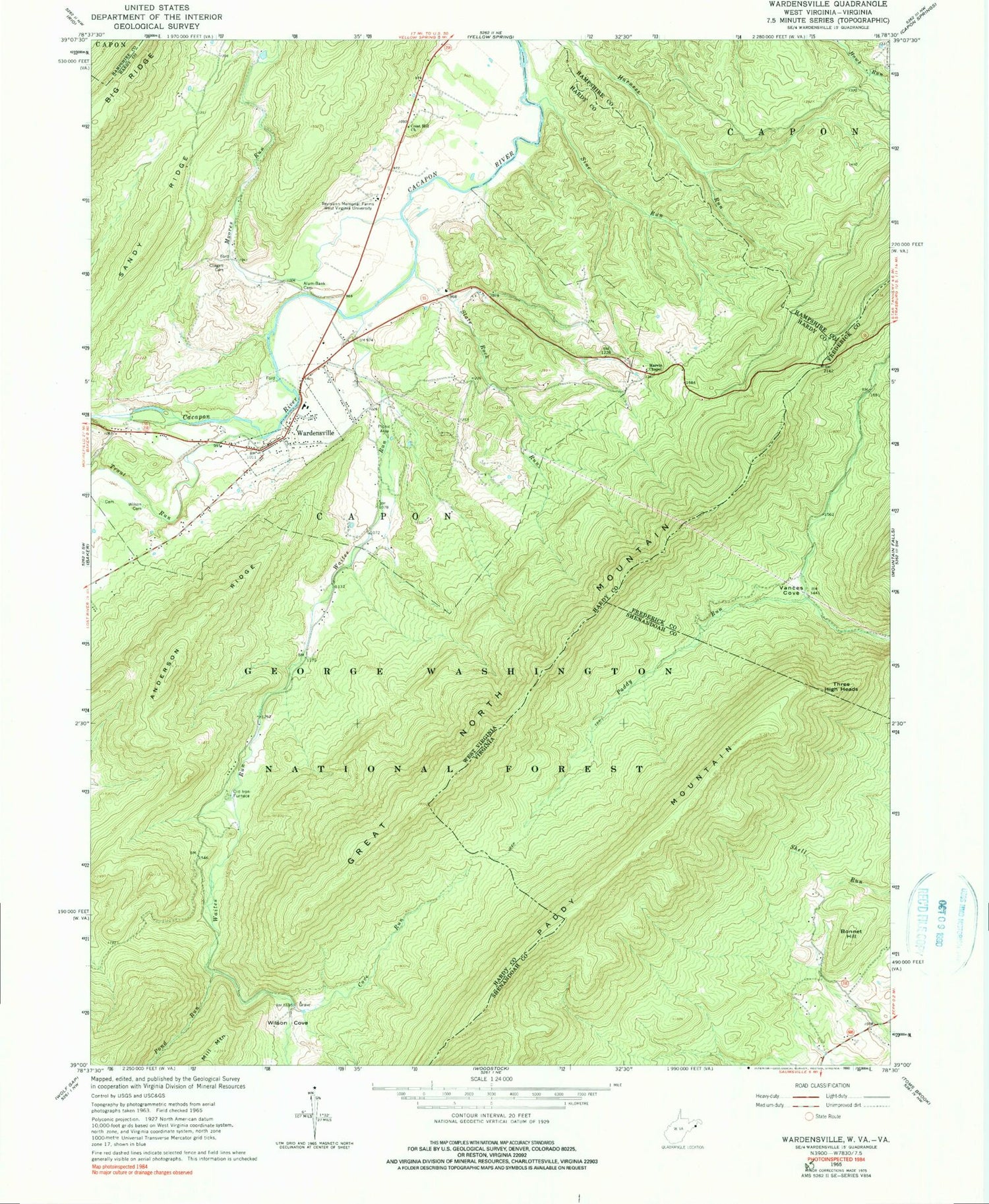
Classic USGS Wardensville West Virginia 7.5'x7.5' Topo Map
Couldn't load pickup availability
Historical USGS topographic quad map of Wardensville in the states of West Virginia, Virginia. Typical map scale is 1:24,000, but may vary for certain years, if available. Print size: 24" x 27"
This quadrangle is in the following counties: Frederick, Hampshire, Hardy, Shenandoah.
The map contains contour lines, roads, rivers, towns, and lakes. Printed on high-quality waterproof paper with UV fade-resistant inks, and shipped rolled.
Contains the following named places: Alum - Bank Cemetery, Anderson Ridge, Big Ridge, Clagett Cemetery, Cove Run, Crest Hill Church, Marvin Chapel, Moores Run, Pond Run, Reymann Memorial Farms West Virginia University, Sine Run, Slate Rock Run, Trout Run, Waites Run, Wardensville, Wilson Cemetery, Wilson Cove, Furnace (historical), North Mountain School (historical), Slate Rock School (historical), Capon Furnace, Upper State Farm Spring, Richard Farm Spring, Cold Spring, Wardensville Spring, Peewee Spring, Boiling Spring, Lower State Farm Spring, Capon Iron Works (historical), Wardensville High School (historical), Wardensville Post Office, Town of Wardensville, Capon Valley Volunteer Fire Department, Wardensville Volunteer Rescue Squad, Wardensville Police Department, Bonnet Hill, Great North Mountain, Paddy Mountain, Three High Heads, Vances Cove, Paul Gerhart Shelter, Rocky Run, Fowlers Spring


