MyTopo
Classic USGS Warfield Creek Wyoming 7.5'x7.5' Topo Map
Regular price
$16.95
Regular price
Sale price
$16.95
Unit price
per
Couldn't load pickup availability
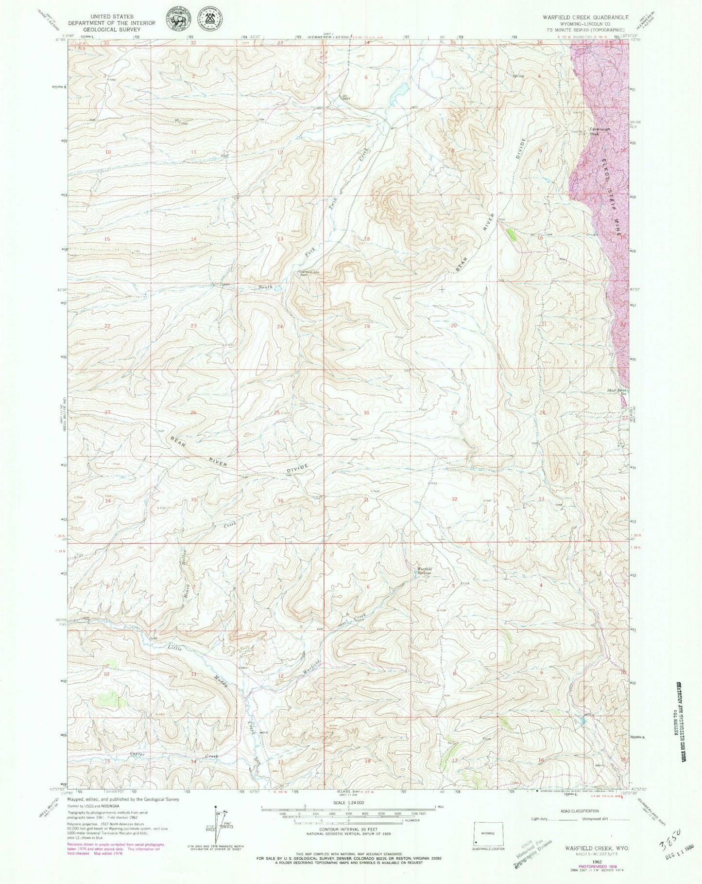
Historical USGS topographic quad map of Warfield Creek in the state of Wyoming. Map scale may vary for some years, but is generally around 1:24,000. Print size is approximately 24" x 27"
This quadrangle is in the following counties: Lincoln.
The map contains contour lines, roads, rivers, towns, and lakes. Printed on high-quality waterproof paper with UV fade-resistant inks, and shipped rolled.
Contains the following named places: Carter Creek, Cavanaugh Peak, Fmc Dam, Fmc Reservoir, Heard Hollow Creek, Old Dutch John Ranch, Richey Dam, Richey Reservoir, Skull Point Reservoir, Warfield Creek, Warfield Springs