MyTopo
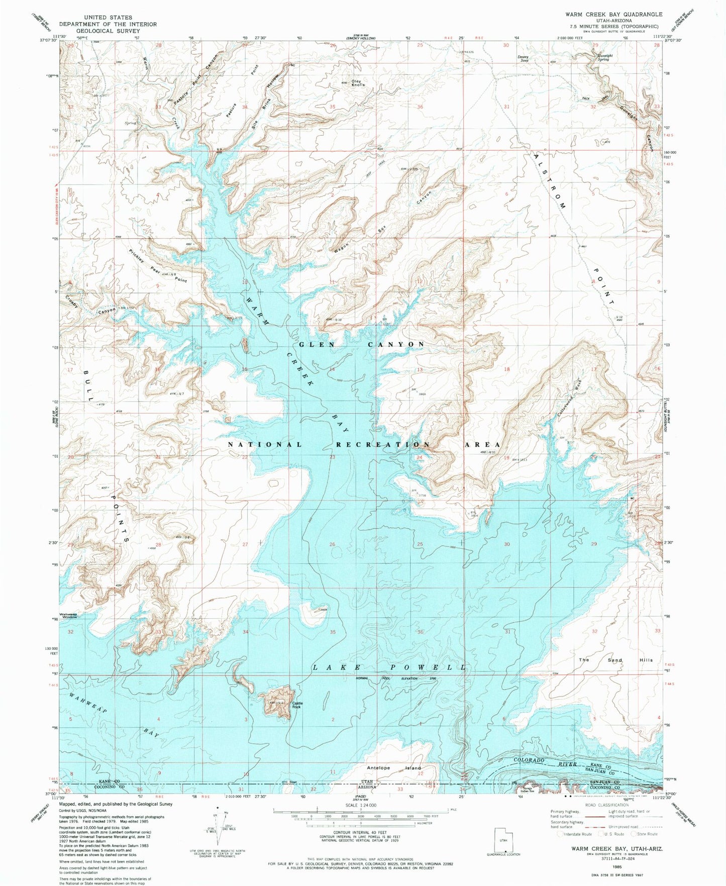
Classic USGS Warm Creek Bay Utah 7.5'x7.5' Topo Map
Couldn't load pickup availability
Historical USGS topographic quad map of Warm Creek Bay in the state of Utah. Typical map scale is 1:24,000, but may vary for certain years, if available. Print size: 24" x 27"
This quadrangle is in the following counties: Coconino, Kane, San Juan.
The map contains contour lines, roads, rivers, towns, and lakes. Printed on high-quality waterproof paper with UV fade-resistant inks, and shipped rolled.
Contains the following named places: Wahweap Bay, Romana Bench, Castle Rock, Cottonwood Wash, Warm Creek, Warm Creek Bay, Dewey Seep, Gunsight Spring, Oley Knolls, Pasture Point, Pasture Point Canyon, Prickly Pear Point, Sile Brink Hollow, Wagon Box Canyon, Wahweap Window, Crosby Canyon, Spanish Trail Crossing at Warm Creek (historical), Warm Creek Cabins (historical)