MyTopo
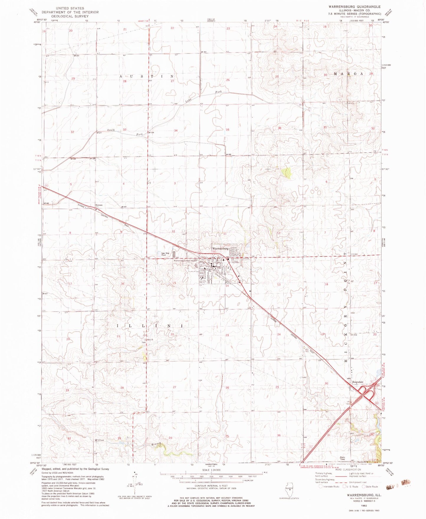
Classic USGS Warrensburg Illinois 7.5'x7.5' Topo Map
Couldn't load pickup availability
Historical USGS topographic quad map of Warrensburg in the state of Illinois. Map scale may vary for some years, but is generally around 1:24,000. Print size is approximately 24" x 27"
This quadrangle is in the following counties: Macon.
The map contains contour lines, roads, rivers, towns, and lakes. Printed on high-quality waterproof paper with UV fade-resistant inks, and shipped rolled.
Contains the following named places: Barclay Public Library, Bearsdale, Brick School, Colonel Smith Memorial Airport, Disbrow School, Heman, Illini Cemetery, Illini Congregational Church, Illini Park, PCI Heliport, Township of Illini, Village of Warrensburg, Warrensburg, Warrensburg - Latham Elementary - Middle School, Warrensburg Fire Protection District, Warrensburg Police Department, Warrensburg Post Office, Warrensburg United Methodist Church, Warrensburg-Latham School, ZIP Code: 62573