MyTopo
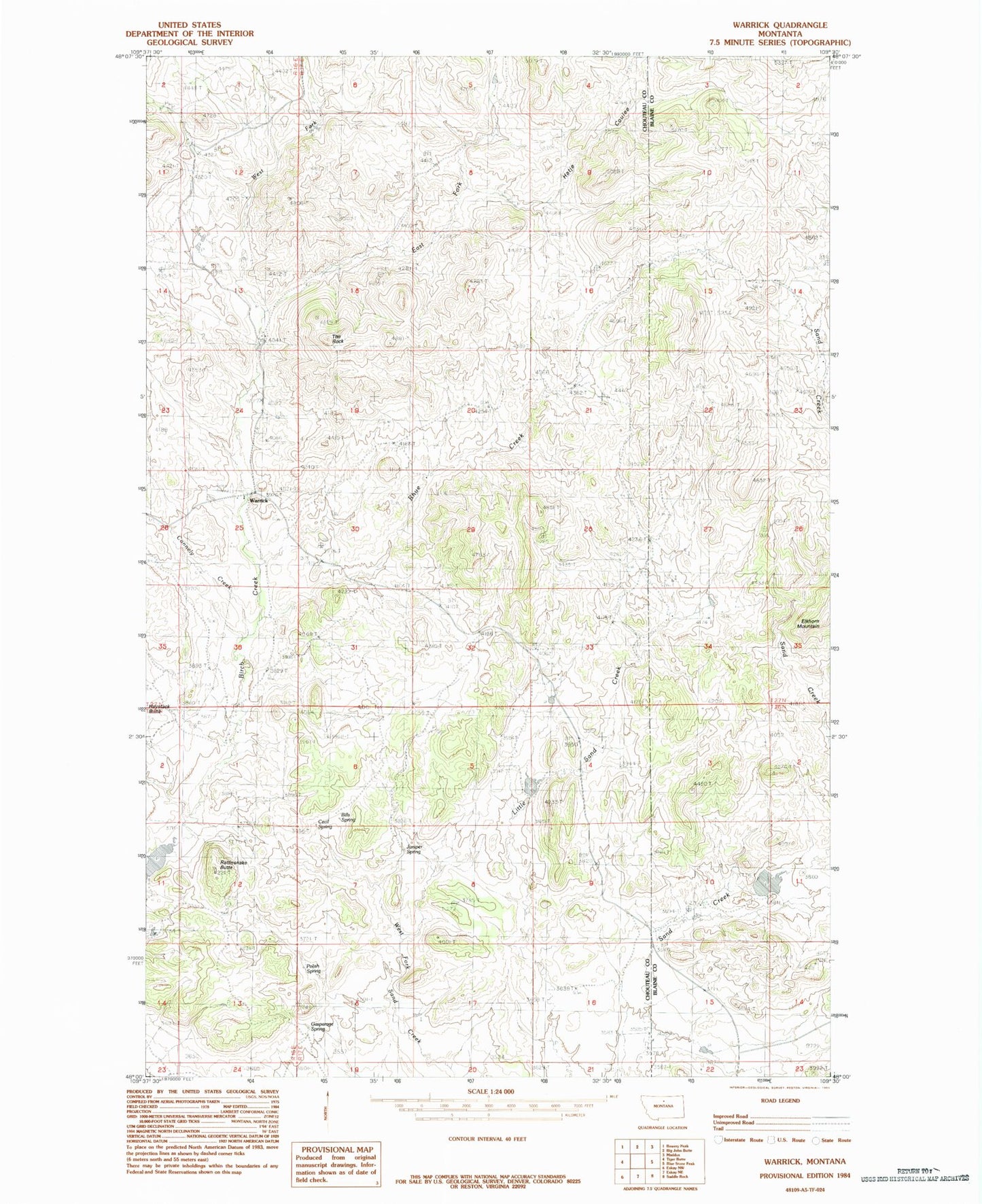
Classic USGS Warrick Montana 7.5'x7.5' Topo Map
Couldn't load pickup availability
Historical USGS topographic quad map of Warrick in the state of Montana. Map scale may vary for some years, but is generally around 1:24,000. Print size is approximately 24" x 27"
This quadrangle is in the following counties: Blaine, Chouteau.
The map contains contour lines, roads, rivers, towns, and lakes. Printed on high-quality waterproof paper with UV fade-resistant inks, and shipped rolled.
Contains the following named places: Bills Spring, Cecil Spring, Connely Creek, Dies Irae Dam, East Fork Birch Creek, Gasparage Spring, Gerald Kane Dam, Hatje Coulee, Haystack Butte, Juniper Spring, Paddle Board Dam, Polish Spring, Rattlesnake Butte, Rhue Creek, The Rock, Warrick, Warrick Post Office, Warrick School, West Fork Birch Creek