MyTopo
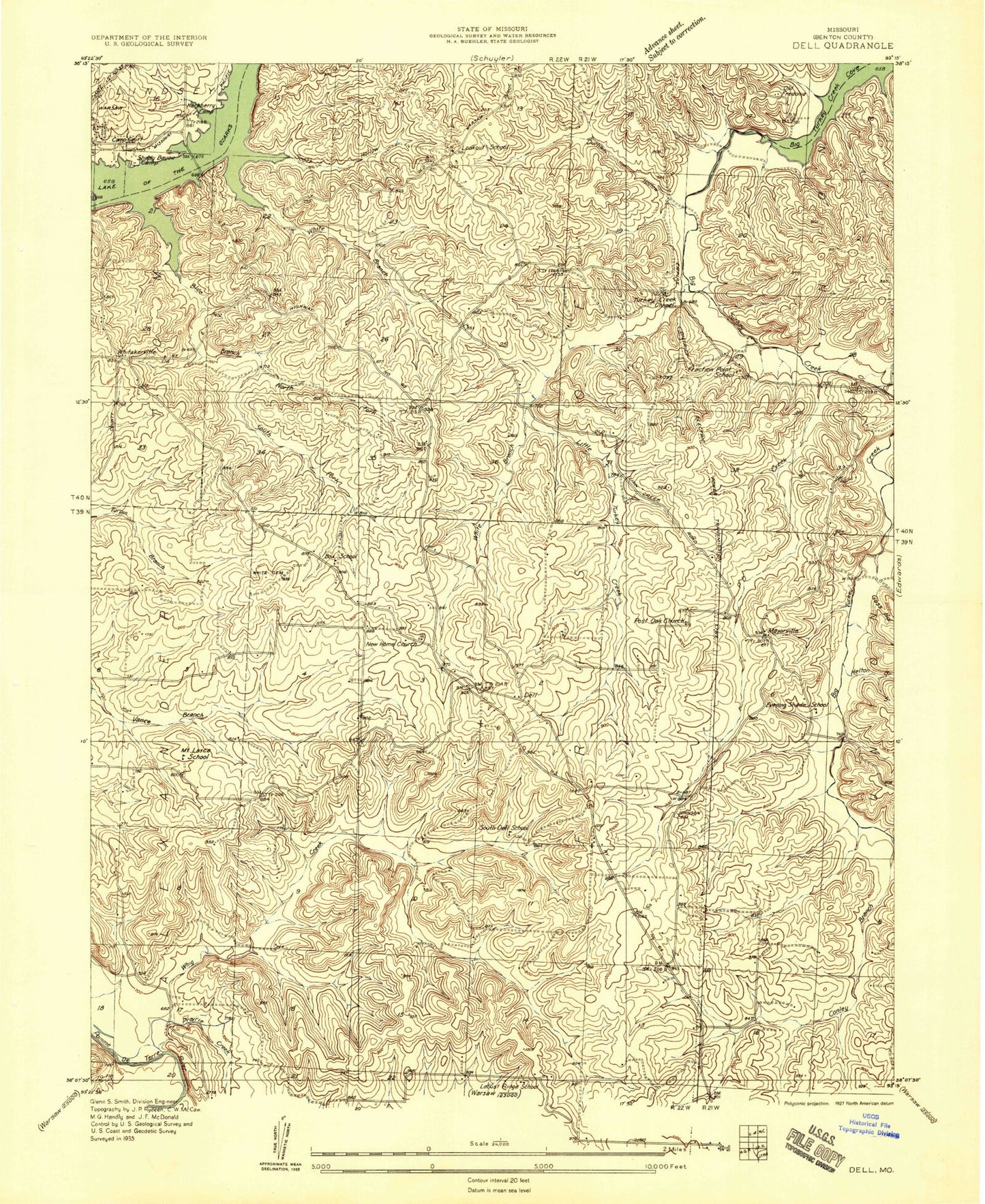
Classic USGS Warsaw East Missouri 7.5'x7.5' Topo Map
Couldn't load pickup availability
Historical USGS topographic quad map of Warsaw East in the state of Missouri. Typical map scale is 1:24,000, but may vary for certain years, if available. Print size: 24" x 27"
This quadrangle is in the following counties: Benton.
The map contains contour lines, roads, rivers, towns, and lakes. Printed on high-quality waterproof paper with UV fade-resistant inks, and shipped rolled.
Contains the following named places: Blue Branch, Blue Branch, Conley Branch, Dell Junction, Durham Hollow, Evening Shade Church, Goss Hollow, Helton Branch, Johnson Branch, Johnson Cemetery, Little Turkey Creek, New Home Church, North Fork Blue Branch, Old Fredonia, P D Creek, Pate Cemetery, Post Oak Cemetery, Prairie Creek, R 6 School, Scott Hollow, Smith Cemetery, South Fork Blue Branch, Turkey Creek Chapel, Vance Cemetery, Whig Creek, Whitakerville, White Branch, White Branch, White Cemetery, Gabriels Mills, Majorville, Postoak Church (historical), Box School (historical), South Dell School (historical), Mount Lasca School (historical), Fraction Point School, Lookout School, North Dell School (historical), Evening Shade School (historical), Dell, Tatge Lake Section 25 Dam, Gatliff Development Company Lake Dam, Township of Fristoe, City of Warsaw, Warsaw Fire and Rescue Station 4, New Home Cemetery, Turkey Creek Cemetery, White Branch Census Designated Place, Blue Branch, Blue Branch, Conley Branch, Dell Junction, Durham Hollow, Evening Shade Church, Goss Hollow, Helton Branch, Johnson Branch, Johnson Cemetery, Little Turkey Creek, New Home Church, North Fork Blue Branch, Old Fredonia, P D Creek, Pate Cemetery, Post Oak Cemetery, Prairie Creek, R 6 School, Scott Hollow, Smith Cemetery, South Fork Blue Branch, Turkey Creek Chapel, Vance Cemetery, Whig Creek, Whitakerville, White Branch, White Branch, White Cemetery, Gabriels Mills, Majorville, Postoak Church (historical), Box School (historical), South Dell School (historical), Mount Lasca School (historical), Fraction Point School, Lookout School, North Dell School (historical), Evening Shade School (historical), Dell, Tatge Lake Section 25 Dam, Gatliff Development Company Lake Dam, Township of Fristoe, City of Warsaw, Warsaw Fire and Rescue Station 4, New Home Cemetery, Turkey Creek Cemetery, White Branch Census Designated Place


