
MyTopo
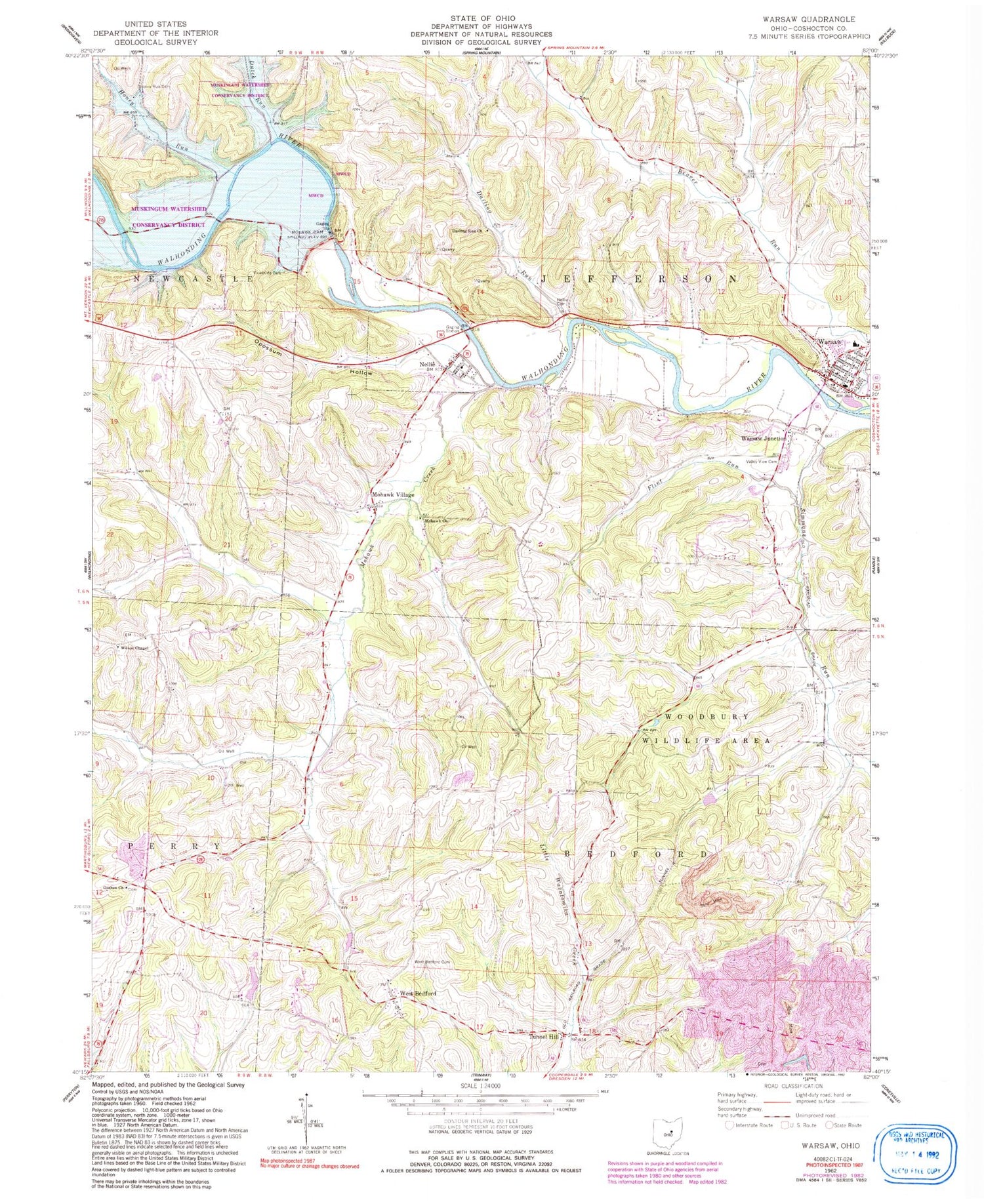
Classic USGS Warsaw Ohio 7.5'x7.5' Topo Map
Couldn't load pickup availability
Historical USGS topographic quad map of Warsaw in the state of Ohio. Typical map scale is 1:24,000, but may vary for certain years, if available. Print size: 24" x 27"
This quadrangle is in the following counties: Coshocton.
The map contains contour lines, roads, rivers, towns, and lakes. Printed on high-quality waterproof paper with UV fade-resistant inks, and shipped rolled.
Contains the following named places: Beaver Run, Darling Run Church, Dutch Run, Flint Run, Goshen Church, Honey Run, Honey Run Cemetery, Mohawk Church, Mohawk Village, Nellie Cemetery, Valley View Cemetery, West Bedford Cemetery, Wilson Chapel, Woodbury Wildlife Area, Warsaw, Goshen School (historical), Neldon School (historical), Nebo School (historical), Honey Run School (historical), Brush College School (historical), Darling Run School (historical), Donley School (historical), Jefferson School (historical), Warsaw Elementary School, Tarkiln School (historical), Tunnel Hill, West Bedford, Mohawk Creek, Nellie, Warsaw Junction, First Baptist Church of Dayton, Darling Run, Opossum Hollow, Bluff (historical), Mohawk Dam, Mohawk Reservoir, Township of Bedford, Township of Jefferson, Goshen Cemetery, Jefferson Presbyterian Cemetery, Mikesell Cemetery, Mohawk Cemetery, West Bedford Number 2 Cemetery, Wilson Chapel Cemetery, Zion Evangelical Lutheran Cemetery, Mohawk Village Post Office (historical), Nellie Post Office (historical), Tunnel Hill Post Office (historical), West Bedford Post Office (historical), Bluff Post Office (historical), Village of Nellie, Village of Warsaw, Walhonding Valley Fire Department


