MyTopo
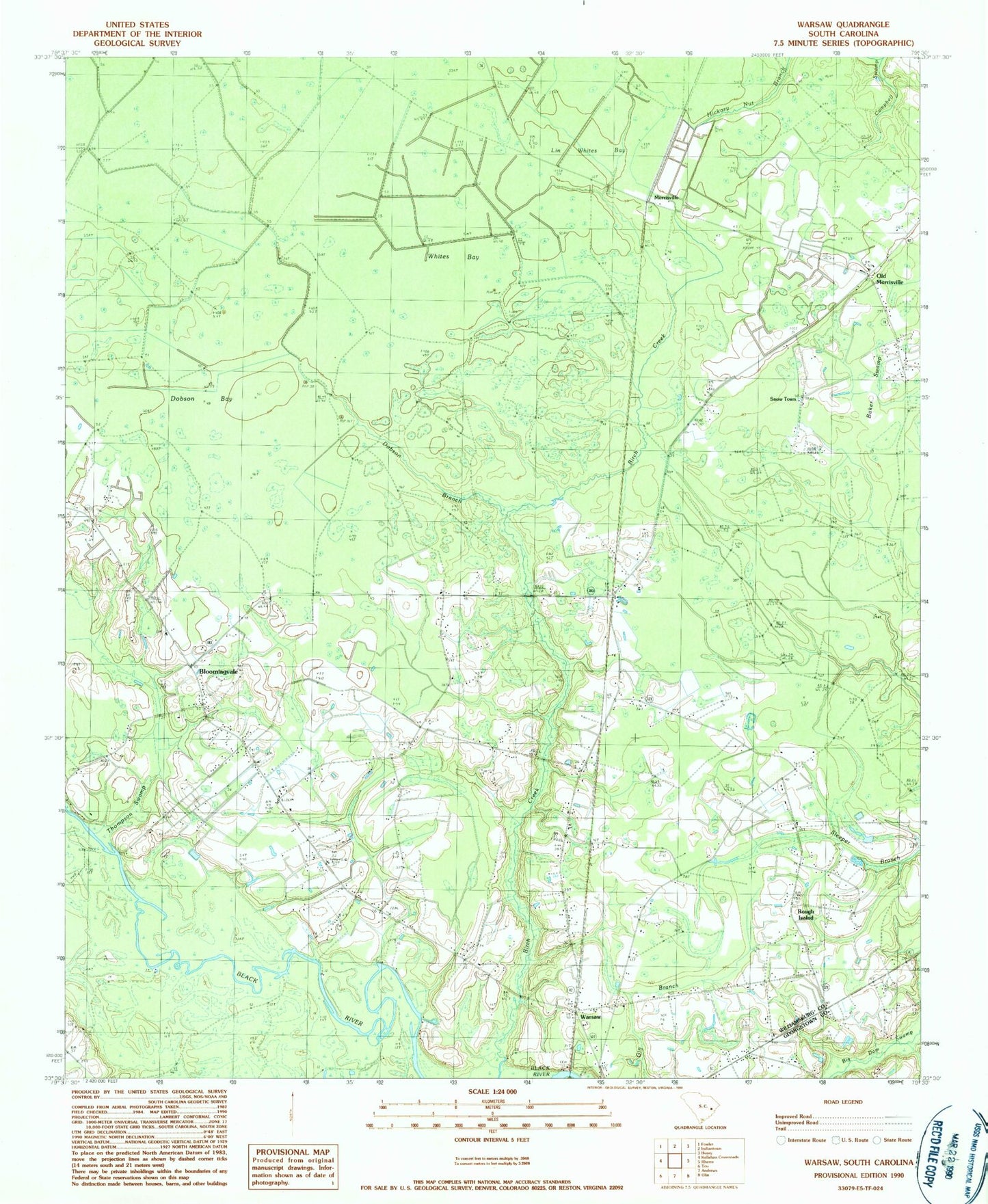
Classic USGS Warsaw South Carolina 7.5'x7.5' Topo Map
Couldn't load pickup availability
Historical USGS topographic quad map of Warsaw in the state of South Carolina. Map scale may vary for some years, but is generally around 1:24,000. Print size is approximately 24" x 27"
This quadrangle is in the following counties: Georgetown, Williamsburg.
The map contains contour lines, roads, rivers, towns, and lakes. Printed on high-quality waterproof paper with UV fade-resistant inks, and shipped rolled.
Contains the following named places: Asbury Church, Baker Swamp, Big Bay, Birch Creek Church, Birch Creek School, Black River Church, Bloomingvale, Bloomingvale Baptist Church, Bloomingvale Cemetery, Bloomingvale School, Burton Bay, Cooper, Dobson Bay, Dobson Branch, Elim Cemetery, Elim United Methodist Church, Jordan Private Airport, Lin Whites Bay, Little Star Church, Morrisville, Mount Zion Church, Mount Zion School, Nesmith Division, Old Morrisville, Piney Forest Church, Piney Forest School, Rough Island, Snow Hill Church, Snow Town, Warsaw, Warsaw School, Whites Bay, Wildcat Bay, Williamsburg County Fire Department Station 12, Williamsburg County Fire Department Station 16, Wolf Bay