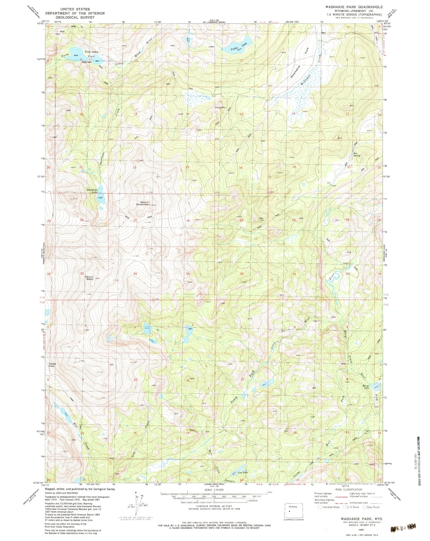
MyTopo
Classic USGS Washakie Park Wyoming 7.5'x7.5' Topo Map
Regular price
$16.95
Regular price
Sale price
$16.95
Unit price
per
Couldn't load pickup availability
Historical USGS topographic quad map of Washakie Park in the state of Wyoming. Typical map scale is 1:24,000, but may vary for certain years, if available. Print size: 24" x 27"
This quadrangle is in the following counties: Fremont.
The map contains contour lines, roads, rivers, towns, and lakes. Printed on high-quality waterproof paper with UV fade-resistant inks, and shipped rolled.
Contains the following named places: Mount Baldy, Box Spring, East Fork Marys Creek, Lost Creek, Lost Lake, Marys Creek, Marys Lake, Shoshone Creek, Shoshone Lake, Mount Shoshone, Twin Lakes, Washakie Park, West Fork Marys Creek, Yahtic Lake, Gaylord Creek, Moss Creek