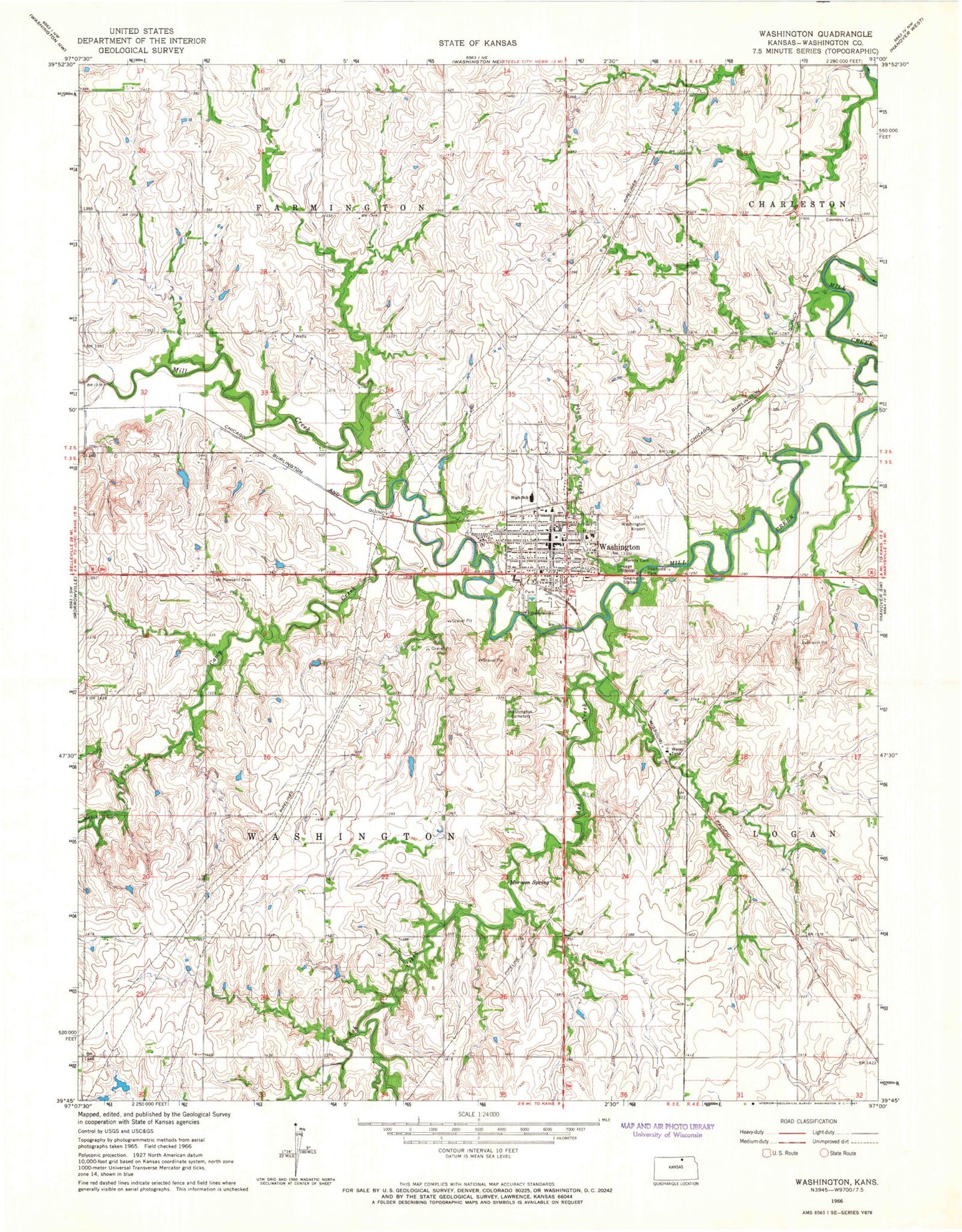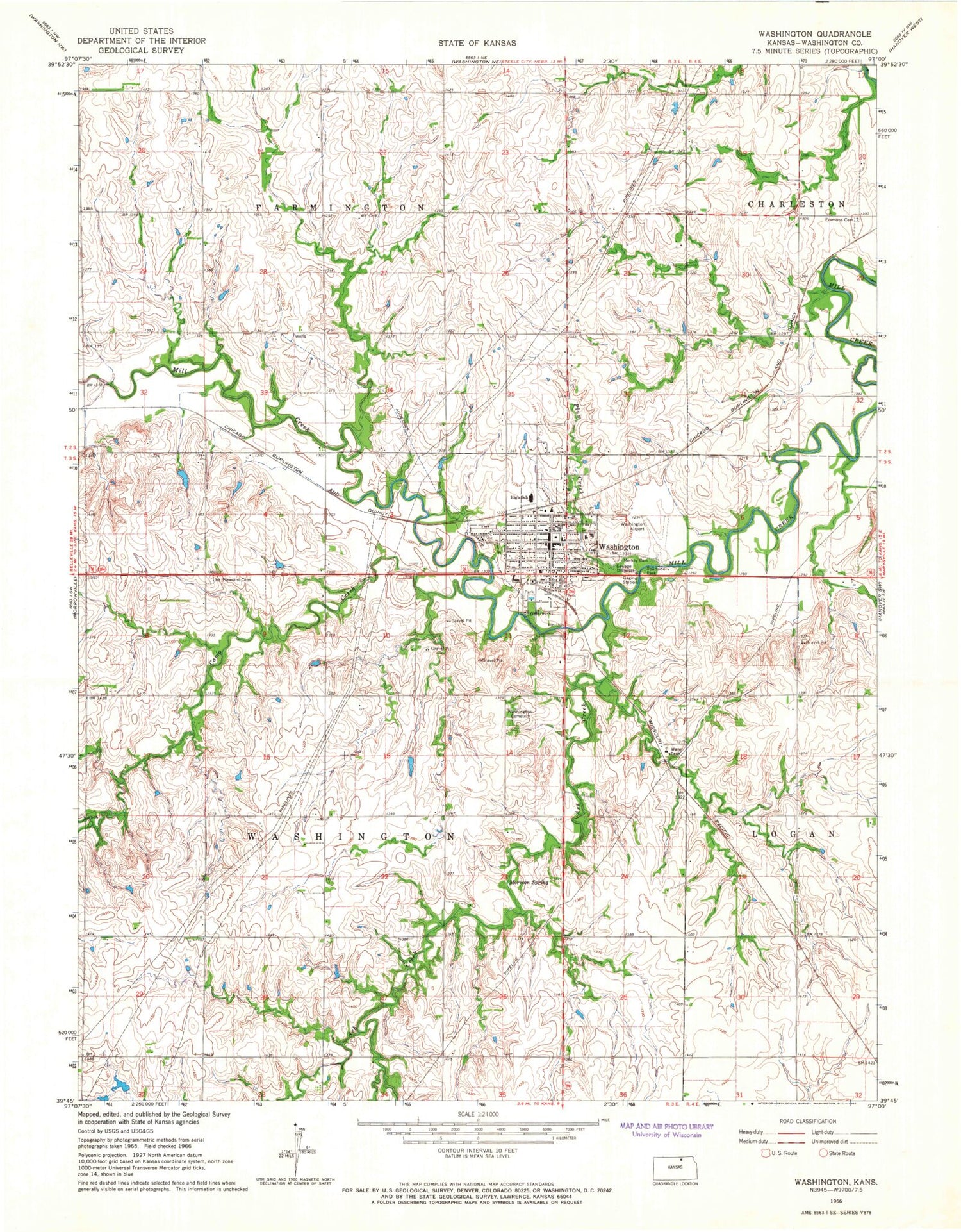
MyTopo
Classic USGS Washington Kansas 7.5'x7.5' Topo Map
Couldn't load pickup availability
Historical USGS topographic quad map of Washington in the state of Kansas. Map scale may vary for some years, but is generally around 1:24,000. Print size is approximately 24" x 27"
This quadrangle is in the following counties: Washington.
The map contains contour lines, roads, rivers, towns, and lakes. Printed on high-quality waterproof paper with UV fade-resistant inks, and shipped rolled.
Contains the following named places: Ash Creek, Brethern Merkey Cemetery, Camp Creek, Cedar Hills Golf Course, City of Washington, Emmons, Emmons Cemetery, First United Presbyterian Church, Good Shepherd Evangelical Lutheran Church, Grace Baptist Church, Linn United Methodist Church, Mormon Spring, Mount Pleasant Cemetery, Plum Creek, Saint Augustine Catholic Church, Township of Farmington, Township of Washington, Washington, Washington Cemetery, Washington Christian Church, Washington Church of the Brethren, Washington City Hall, Washington County, Washington County Courthouse, Washington County Fairgrounds, Washington County Health Department, Washington County Hospital, Washington County Junior / Senior High School, Washington County Landfill, Washington County Museum, Washington County Public Works, Washington County Sheriff's Office, Washington Elementary School, Washington Emergency Medical Services, Washington Fire District 9, Washington First Baptist Church, Washington Municipal Airport, Washington Post Office, Washington Public Library, Washington Speedway, Washington Wastewater Treatment Facility, Washington Water Reservoir Dam, ZIP Code: 66968