
MyTopo
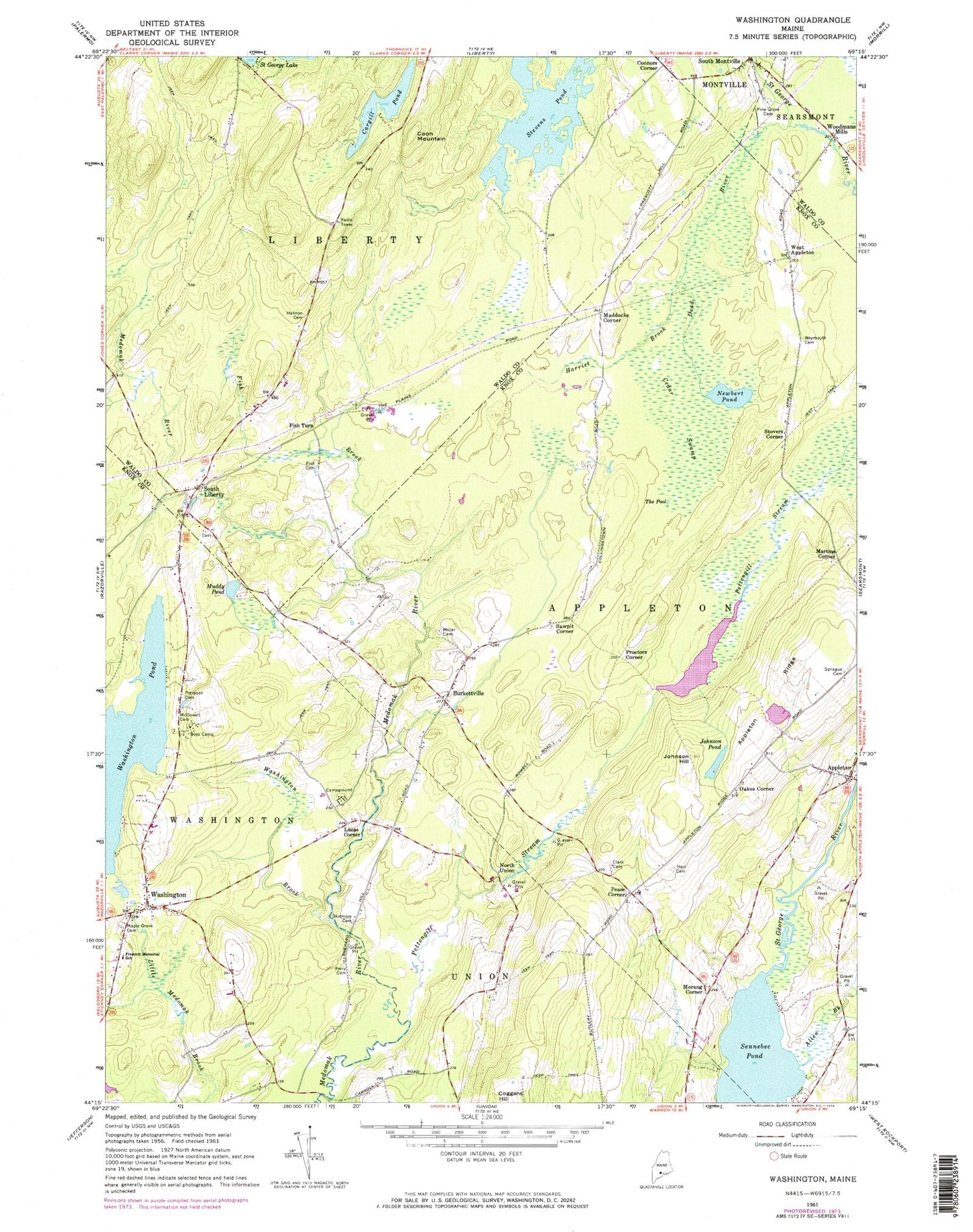
Classic USGS Washington Maine 7.5'x7.5' Topo Map
Couldn't load pickup availability
Historical USGS topographic quad map of Washington in the state of Maine. Typical map scale is 1:24,000, but may vary for certain years, if available. Print size: 24" x 27"
This quadrangle is in the following counties: Knox, Waldo.
The map contains contour lines, roads, rivers, towns, and lakes. Printed on high-quality waterproof paper with UV fade-resistant inks, and shipped rolled.
Contains the following named places: Allen Brook, Appleton, Appleton Ridge, Burkettville, Cargill Pond, Cedar Swamp, Clark Cemetery, Connors Corner, Coon Mountain, Dead River, Fish Brook, Fish Cemetery, Fish Turn, Hannon Cemetery, Harriet Brook, Hart Cemetery, Johnson Hill, Johnson Pond, Lucas Corner, Maple Grove Cemetery, McDowell Cemetery, Miller Cemetery, Muddy Pond, Newbert Pond, Perry Cemetery, Pettengill Stream, Pierpont Cemetery, Pine Grove Cemetery, Prescott Memorial School, Sennebec Pond, Skidmore Cemetery, South Liberty, South Montville, Sprague Cemetery, Stevens Pond, The Pool, Washington, Washington Brook, Washington Pond, Weymouth Cemetery, Maddocks Corner, Martins Corner, Morang Corner, North Union, Oakes Corner, Pease Corner, Proctors Corner, Sawpit Corner, Stovers Corner, West Appleton, Woodmans Mills, Town of Appleton, Town of Liberty, Washington Pond Dam, Pettengill Marsh Dam, Pettengill Marsh, Appleton Ridge Pond Dam, Appleton Ridge Pond, Appleton Baptist Church, Appleton Village School, Sennebec Lake Campground, Washington Post Office, Washington Village Baptist Church, Washington Fire Station, South Liberty Baptist Church School, Gibbs Library


