MyTopo
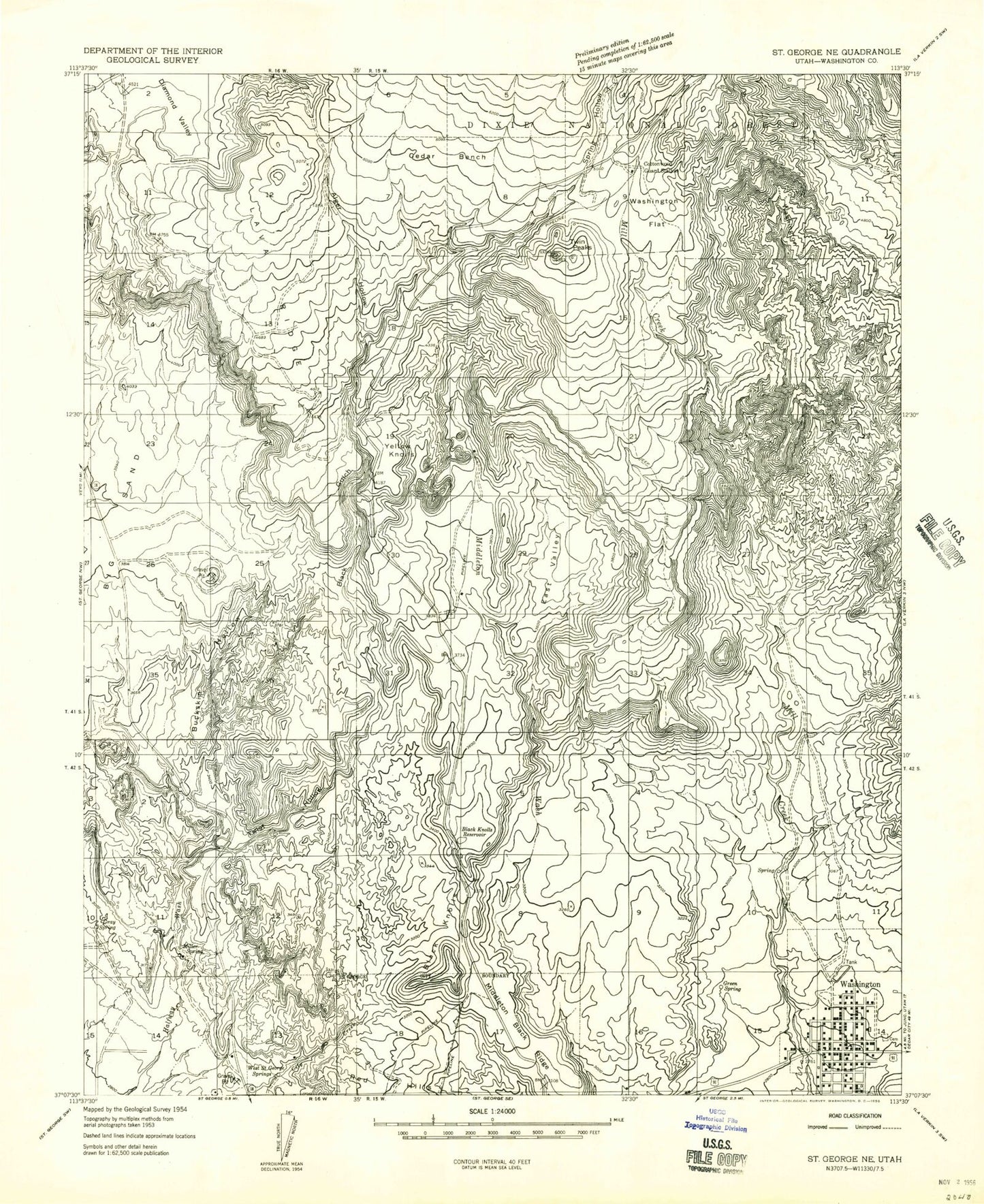
Classic USGS Washington Utah 7.5'x7.5' Topo Map
Couldn't load pickup availability
Historical USGS topographic quad map of Washington in the state of Utah. Map scale may vary for some years, but is generally around 1:24,000. Print size is approximately 24" x 27"
This quadrangle is in the following counties: Washington.
The map contains contour lines, roads, rivers, towns, and lakes. Printed on high-quality waterproof paper with UV fade-resistant inks, and shipped rolled.
Contains the following named places: Alger Hollow, Big Sand, Black Gulch, Black Knolls, Black Knolls Reservoir, Buckskin Hollow, Cedar Bench, Cottonwood Guard Station, Diamond Valley Volunteer Fire Department, East Valley, Gold Cross Ambulance, Grace Baptist Church, Gray Spring, Green Spring, KCLG-AM (Washington), Lava Ridge, Middleton Black Ridge, Miller Spring, Old Alexander Cemetery, Redlands RV Parks, Saint George Fire Department Station 7, Sait George City Dam, Santa Clara Dam, Santa Clara Reservoir, Spring Hollow, T-Bone Hill, The Church of Jesus Christ of Latter Day Saints, Twin Peaks, Twist Hollow, Washington, Washington City Cemetery, Washington City Fire Department - Station 61, Washington City Police Department, Washington Elementary School, Washington Flat, Washington Hollow, Washington Post Office, West Saint George Spring, Winchester Hills Volunteer Fire Department, Yellow Knolls, ZIP Code: 84770