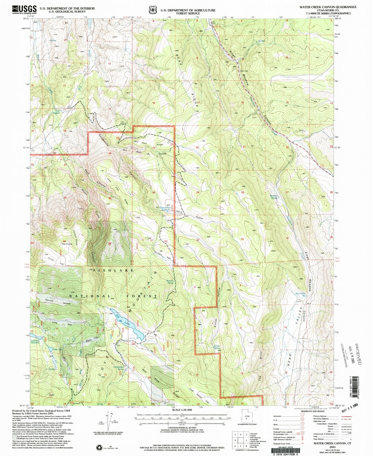
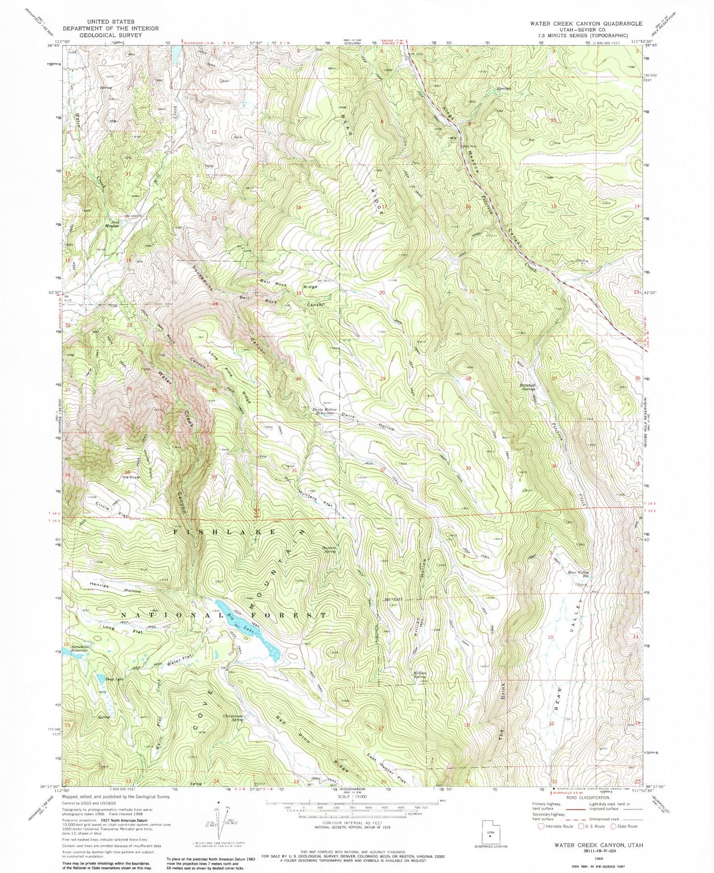
MyTopo
Classic USGS Water Creek Canyon Utah 7.5'x7.5' Topo Map
Couldn't load pickup availability
Historical USGS topographic quad map of Water Creek Canyon in the state of Utah. Typical map scale is 1:24,000, but may vary for certain years, if available. Print size: 24" x 27"
This quadrangle is in the following counties: Sevier.
The map contains contour lines, roads, rivers, towns, and lakes. Printed on high-quality waterproof paper with UV fade-resistant inks, and shipped rolled.
Contains the following named places: Sand Ledges Recreation Area, Bear Valley, Bear Valley Reservoir, Bell Rock Canyon, Bell Rock Ridge, Big Lake, Brimhall Springs, Chicken Gulch, Christensen Spring, Circle Flat, Davis Hollow, Davis Hollow Reservoir, Deep Lake, East Hunter Flat, Henries Hollow, Hunters Flat, Hunters Spring, Killian Hollow, Killian Spring, Lone Pine Ridge, Long Flat, Red Pine Ridge, Rock Canyon, Saul Meadow, Squeedunk Canyon, The Brink, The Circle, Water Creek, Water Creek Canyon, Water Flat, White Pine Creek, Deep Lake Dam, Big Lake Reservoir Dam