MyTopo
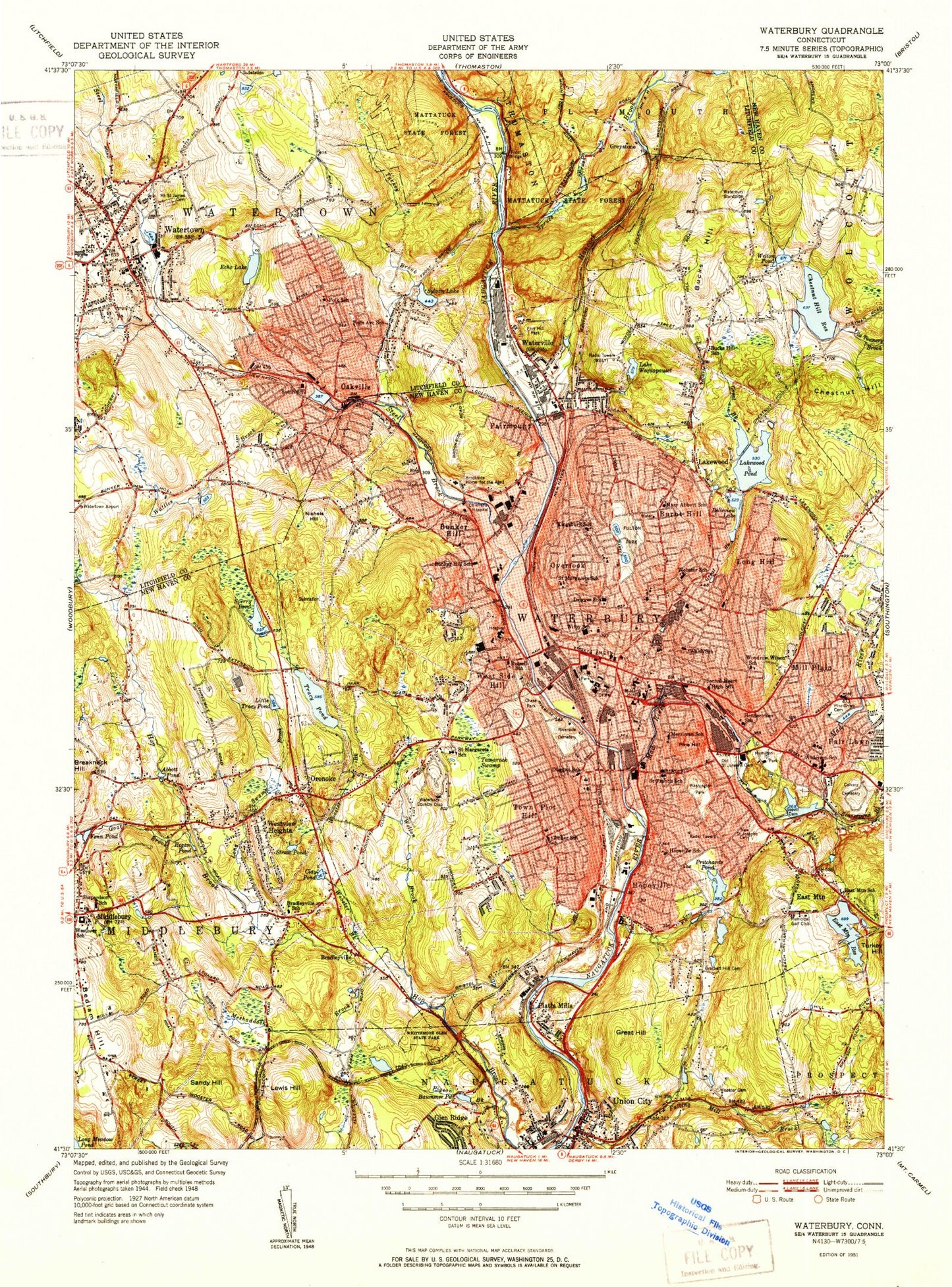
Classic USGS Waterbury Connecticut 7.5'x7.5' Topo Map
Couldn't load pickup availability
Historical USGS topographic quad map of Waterbury in the state of Connecticut. Map scale may vary for some years, but is generally around 1:24,000. Print size is approximately 24" x 27"
This quadrangle is in the following counties: Litchfield, New Haven.
The map contains contour lines, roads, rivers, towns, and lakes. Printed on high-quality waterproof paper with UV fade-resistant inks, and shipped rolled.
Contains the following named places: A J Oster Company Heliport, Abbotts Pond, Aldorizo Park, All Saints Cemetery, American Italian Civic Club Park, Anderson School, Atwood Pond, Baldwin Elementary School, Balmoral Farm Pond, Bank Street Historic District, Barbers Pond, Barnard School, Baummer Pond, Beaver Pond Brook, Bedlam Hill, Beer Pond, Beetle Bung Pond, Belleview Lake, Belleview Lake Dam, Beth David Academy, Beth El Synagogue Cemetery, Bishop School, Blessed Sacrament School, Bradleyville, Brass City Lodge Cemetery, Bronson Meadows Playground, Brook Glen Park, Brookside Industrial Park, Buck Meadow, Bucks Hill, Bucks Hill Cemetery, Bucks Hill Park, Bucks Hill School, Buell Flats, Bunker Hill, Bunker Hill School, Burnt Hill, Calvary Cemetery, Center Square, Chase Brook, Chase Park, Chestnut Hill, Chestnut Hill Dam, Chestnut Hill Reservoir, City Mills Ponds, City of Waterbury, Clay Pond, Clinton Hill, Clough Brook, Cold Spring Brook, Colonial Plaza Shopping Center, Commerce Campus Industrial Park, Cooke Homestead, Crosby High School, Delano Field, Driggs School, Duggan School, East Brass Mill Dam, East Mountain, East Mountain Brook, East Mountain Municipal Golf Course, East Mountain Reservoir, East Mountain Reservoir Dam, Easter Seals Rehabilitation Center, Echo Lake, Echo Lake Brook, Echo Lake Dam, Echo Lake Park, Ecole Saint Anne School, Evergreen Cemetery, F J Kingsbury School, Fair Lawn, Fairmount, Falls Avenue School, Fenn Pond, Fort Hill Park, Four Corners, Frost Bridge, Fulling Mill Brook, Fulton Park, Garrington School, Gilmartin School, Glen Ridge, Goat Brook, Great Brook, Great Brook Reservoir, Great Brook Reservoir Dam, Great Hill, Greystone, Greystone Pond, H S Chase School, Hamilton Park, Hancock Brook, Hancock Brook Dam, Hancock Pond, Heminway Park School, Heminway Pond, Hendricken School, Hillcrest, Hills Pond Number 1, Hills Pond Number 2, Hillside Historic District, Holy Land Cemetery, Holy Land Monument, Hop Brook Dam, Hop Brook Lake, Hop Brook Municipal Golf Course, Hopeville, Hopeville Pond Brook, Joes Rock, John A Coe Park, John Dees Pond, John Dees Pond Dam, Johnson Brothers Pond, Lake Wequapauset, Lakewood, Lakewood Park, Larkin Pond, Lewis Hill, Library Park, Lithuanian Cemetery, Little Tracys Pond, Long Hill, Long Swamp Brook, Lower Fulton Park Pond, Mad River, Mad River Dam, Mattatuck Plaza Shopping Center, Michael F Wallace Middle School, Middlebury Center Historic District, Middlebury Green, Middlebury Land Conservation Association, Mill Plain, Miry Dam Heliport, Miry Dam Pond, Mount Fair, Mount Saint James Cemetery, Murray Park, Naugatuck Industrial Park, Naugatuck Valley Mall Shopping Center, New Saint Josephs Cemetery, Nichols Hill, Nova Scotia Hill Park, Oakville, Oakville Census Designated Place, Old Saint Josephs Cemetery, Old Watertown Cemetery, Oronoke, Overlook, Overlook Historic District, Pakovitch Ponds Number 1, Pathmark Shopping Center, Pigeon Brook, Pilgrim Memorial, Pin Shop Pond, Pin Shop Pond Dam, Pine Grove Cemetery, Pine Hill, Platts Mills, Pritchards Pond, Pritchards Pond Dam, Rifle Range Pond, Risdon Pond, Risdon Pond Dam, Riverside Cemetery, Riverview Mobile Home Estates, Rondo Heliport, Rowland Park, Saint Marys Heliport, Saint Marys Hospital, Saint Marys Russian Orthodox Greek Catholic Cemetery, Salem Health Care Center, Sandy Hill, Schildgen Pond, Settlers Village, Shattuck Brook, Sled Haul Brook, Smith Pond Brook, South Commons Industrial Park, Sperry Pond, Sperry Pond Dam, Spruce Brook, Stanley Park, Steele Brook, Straw Pond, Sylvan Lake, Tamarack Swamp, Timex Heliport, Town of Middlebury, Town of Waterbury, Town of Watertown, Town Plot, Town Plot Hill, Tracys Pond, Turkey Brook, Turkey Hill Brook, Turtle Pond, Union Ice Company Pond, Upper Fulton Park Pond, Washington Park, Water Company Pond Number 1, Waterbury, Waterbury Country Club, Waterbury Green, Waterbury Hospital, Waterbury Municipal Stadium, Waterbury Plaza Shopping Center, Waterbury Union Station, Watertown, Watertown Census Designated Place, Waterville, Waterville Green, WATR-AM (Waterbury), Wattles Brook, Welton Brook, Welton Pond, Wendell L Cross School, West Side Hill, Western Hills Municipal Golf Course, Westside Hill, Westview Heights, Westwood Shopping Center, WFNW-AM (Naugatuck), Whittemore Glen State Park, Wooster Brook, WQQW-AM (Waterbury), WTXX-TV (Waterbury), WWCO-AM (Waterbury), ZIP Codes: 06702, 06704, 06706, 06708, 06710, 06762, 06779


