MyTopo
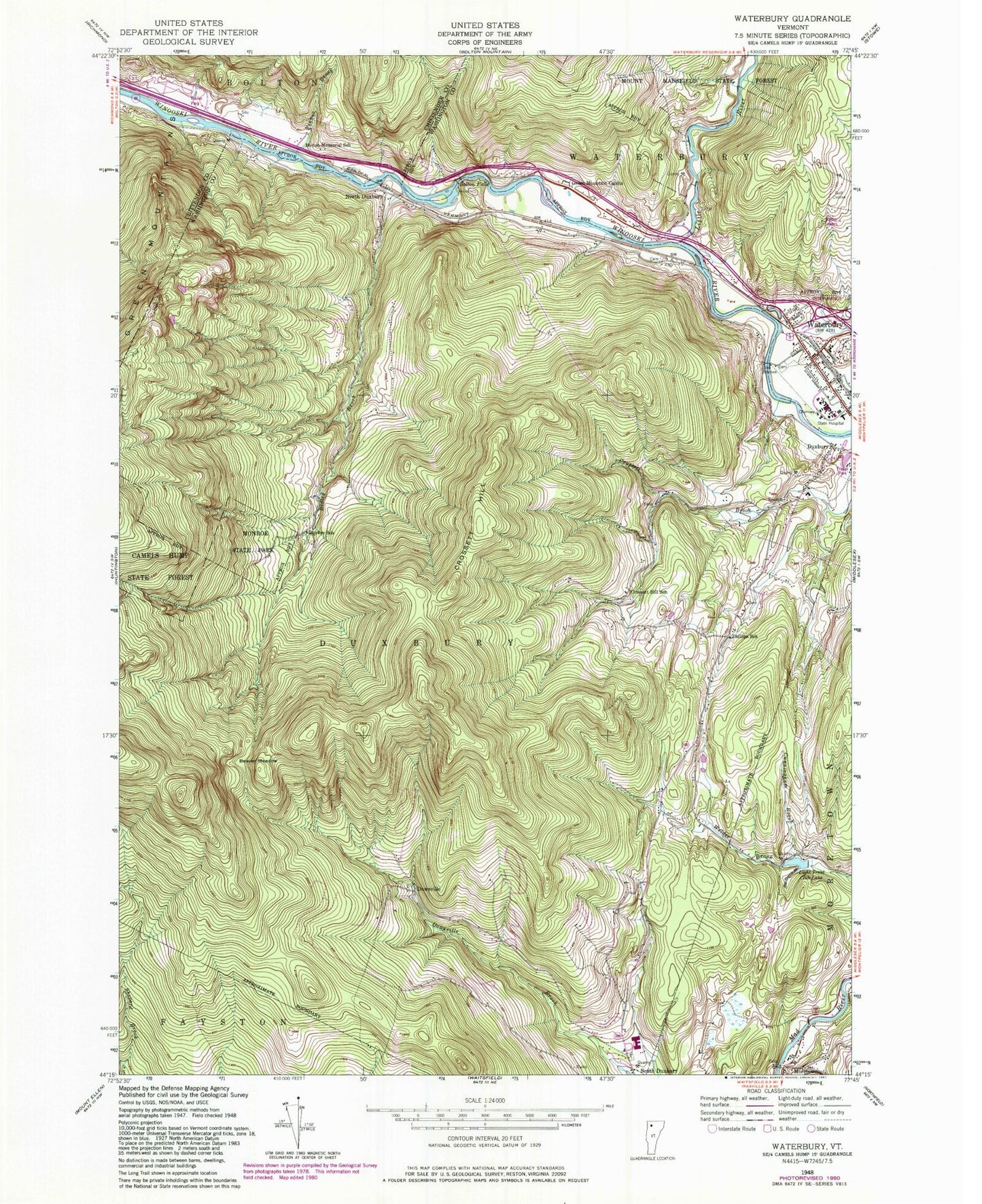
Classic USGS Waterbury Vermont 7.5'x7.5' Topo Map
Couldn't load pickup availability
Historical USGS topographic quad map of Waterbury in the state of Vermont. Typical map scale is 1:24,000, but may vary for certain years, if available. Print size: 24" x 27"
This quadrangle is in the following counties: Chittenden, Washington.
The map contains contour lines, roads, rivers, towns, and lakes. Printed on high-quality waterproof paper with UV fade-resistant inks, and shipped rolled.
Contains the following named places: Bat Harris Brook, Beaver Meadow, Bolton Falls, Bolton Memorial School, Crossett Hill, Crossett Hill School, Cunningham Brook, Durkee School, Duxbury, Graves Brook, Green Mountain Cabins, Light Trout Club Lake, Little River, Monroe State Park, North Duxbury, Phillips School, Pinneo Brook, Ridley Brook, Waterbury, Dowsville, Moretown, WDEV-AM (Waterbury), WGLY-FM (Waterbury), Town of Duxbury, Eight Trout Club Dam, Bolton Falls Number 1 Dam, Blush Hill Country Club, Butler Pond, Crossett Hill Cemetery, Graves Cemetery, Landon - Hayden Cemetery, Monroe Ranger Cabin, Moretown Falls, Moretown Post Office, Phillips - Duxbury Hill Cemetery, Saw Mill Mall Shopping Center, Thatcher Brook Primary School, Vermont State Hospital, Waterbury Congregational Church, Waterbury Post Office, Waterbury Village Historic District, Waterbury Villge Public Library, Wesley United Methodist Church, Dale Women's Facility, Waterbury Fire Department, Crossett Brook Middle School, Harwood Union Middle and High School, Waterbury Children's Space, Waterbury Police Department, South Duxbury Cemetery, Holy Cross Cemetery, Duxbury Corner Cemetery, Waterbury Census Designated Place