MyTopo
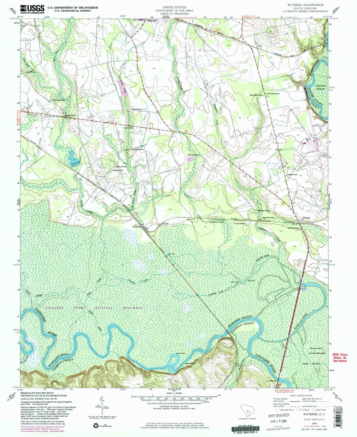
Classic USGS Wateree South Carolina 7.5'x7.5' Topo Map
Couldn't load pickup availability
Historical USGS topographic quad map of Wateree in the state of South Carolina. Map scale may vary for some years, but is generally around 1:24,000. Print size is approximately 24" x 27"
This quadrangle is in the following counties: Calhoun, Richland, Sumter.
The map contains contour lines, roads, rivers, towns, and lakes. Printed on high-quality waterproof paper with UV fade-resistant inks, and shipped rolled.
Contains the following named places: Bates Ferry, Bates Ferry Bridge, Bates Mill Creek, Bates Old River, Big Lake, Blue Hole, Buckhead Creek, Cedar Creek, Congaree Church, Congaree National Park, Cope Williams School, Devils Elbow, Drafts Pond, Fork Swamp Hunting Club, Fort Motte Bridge, Goodin Cemetery, Griffins Creek, Joyner Cemetery, Kingville, Little Lake, McKenzie Creek, Mount Nebo Church, Mount Olive Church, Pleasant Grove Church, Ray Branch, Red Hill Church, Red Hill School, Richland Church, Running Creek, Running Lake, Saint James Church, Saint Lukes Church, Saint Phillips Church, Saint Phillips School, Sampson Island, Sanctified Church, Singleton Creek, Stoney Hill Church, Stoney Hill School, Tom Seay Cemetery, Toms Creek, Wateree, Weber School, ZIP Code: 29052