MyTopo
Classic USGS Waterloo South Carolina 7.5'x7.5' Topo Map
Couldn't load pickup availability
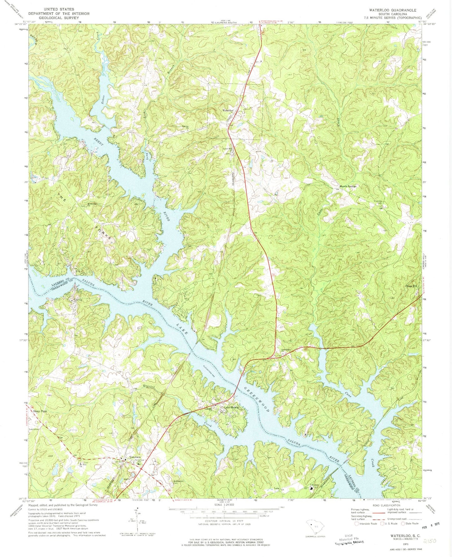
Historical USGS topographic quad map of Waterloo in the state of South Carolina. Typical map scale is 1:24,000, but may vary for certain years, if available. Print size: 24" x 27"
This quadrangle is in the following counties: Greenwood, Laurens.
The map contains contour lines, roads, rivers, towns, and lakes. Printed on high-quality waterproof paper with UV fade-resistant inks, and shipped rolled.
Contains the following named places: Bethlehem Cemetery, Bethlehem Church, Cane Creek, Franklin Cemetery, Lakeside Church, Lakeview Church, Long Lick Branch, Quarter Creek, Reedy River, The Forks, Harris Springs, Lake Shores, Waterloo, Boyds Mill, Coronaca Baptist Church, Mount Zion School (historical), Andersons Mill (historical), Balls Mill (historical), Bethlehem Church, Collins Lakeside Village, Isle of Pines, Neilus Ferry (historical), Niswongers Mill (historical), Pine Land Shores, Rosemont School (historical), Smyrna Cemetery, Waterloo United Methodist Church, Youngs Ferry (historical), Lake Greenwood, South Carolina Noname 24008 D-1264 Dam, Good Hope Church, Laurel Hill Church, Lota, Bethlehem Church, Camp Branch, Coronaca, Mount Zion Church, Rabon Creek, Smyrna Church, Boyds Bridge, Old Puckett Ferry (historical), Lake Greenwood, Coronaca Census Designated Place, Town of Waterloo, Laurens County Fire Department Waterloo Station 2, Laurens County Fire Department Waterloo, Coronaca Volunteer Fire Department Station 50, Laurens County Fire Department Cross Hill Station 4, Ridgewood Air